Elevation Bands Offline Map Layer: Seeing the Terrain like They Do
The Scout To Hunt team has been anxious to get this key layer into your hands. Download the latest update for the Scout To Hunt App to elevate your offline mapping experience.
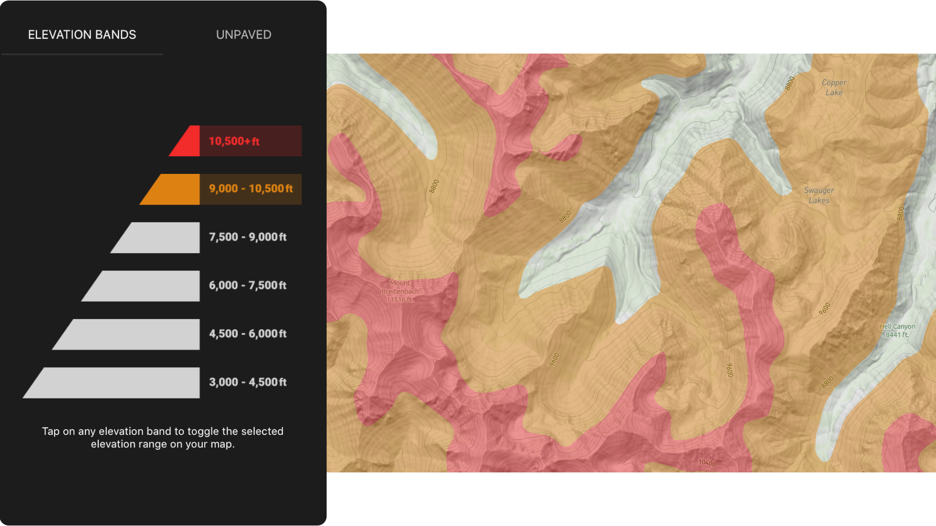
Elevation Bands
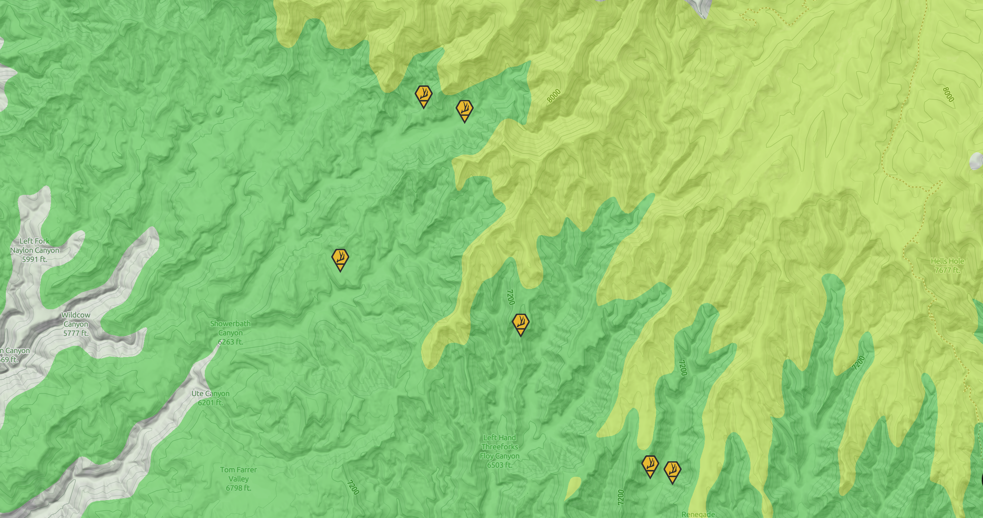
A map is full of critical data that shows us where we need to be to get on an animal or pick up monster sheds. But sometimes, it's difficult to see. The Elevation Bands offline map layer helps make sense of it all. By segmenting filterable elevation ranges, you can take control of your map to see the big picture.
Patterns, Trends and (R)elevations
Elevation plays a significant role in finding animals at different times of the year. The Elevation Bands simplify how you determine your target areas to scout and hunt based on the relevant elevations you expect to find the game you're chasing.
More importantly, the Elevation Bands organize your own data. Adding a powerfully visual perspective, patterns and trends of your own Markers and observations from the field stand out with eye-opening insights. Scout To Hunt's Elevation Bands layer brings science and simplicity together to make your decision-making a breeze.
Applying the Elevation Bands Layer
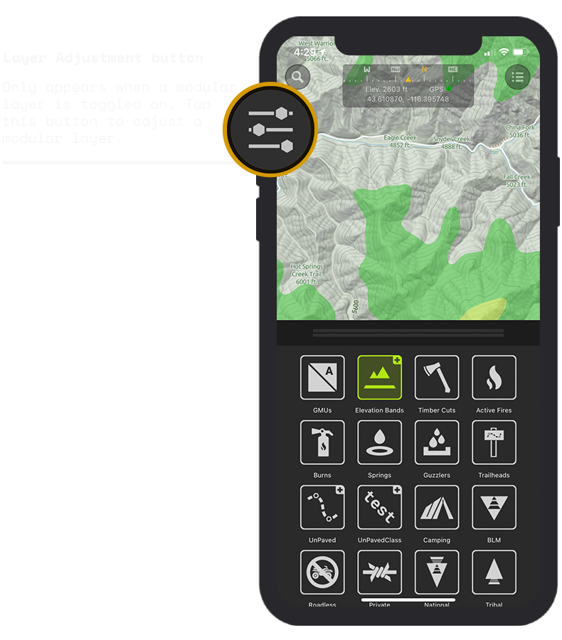
We like to keep things very simple, so you don't waste valuable hunt time trying to figure out how to apply a map layer. We thoughtfully designed the Layer Adjustment button to maintain that simplicity, so you can quickly control and filter the elevation ranges you want or do not want to be displayed on your map without forcing you to leave your map screen.
The Layer Adjustment button appears on the upper left corner of your main map screen only when a modular layer, such as the Elevation Bands or UnPaved layers, is toggled on from the Layers Menu. If all modular-type layers are toggled off from the Layers Menu, the Layer Adjustment button will automatically be removed from your map screen to keep visual interference to a minimum.
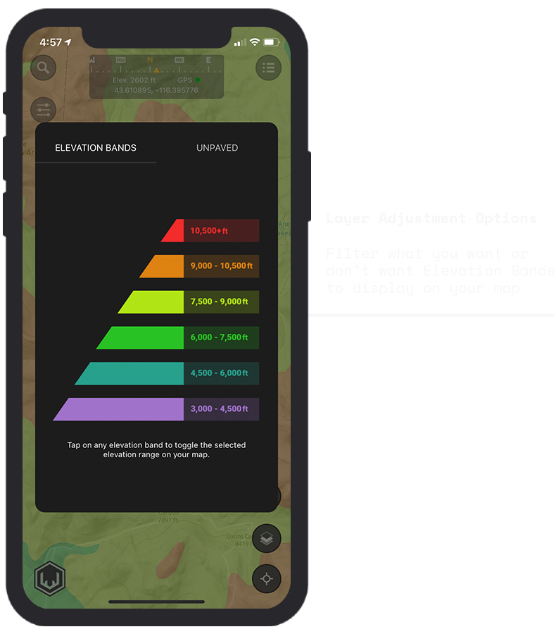
Selecting Elevation Ranges
With the adjustment menu, you can choose which ranges you want to see on the map to align with your scouting and hunting goals.
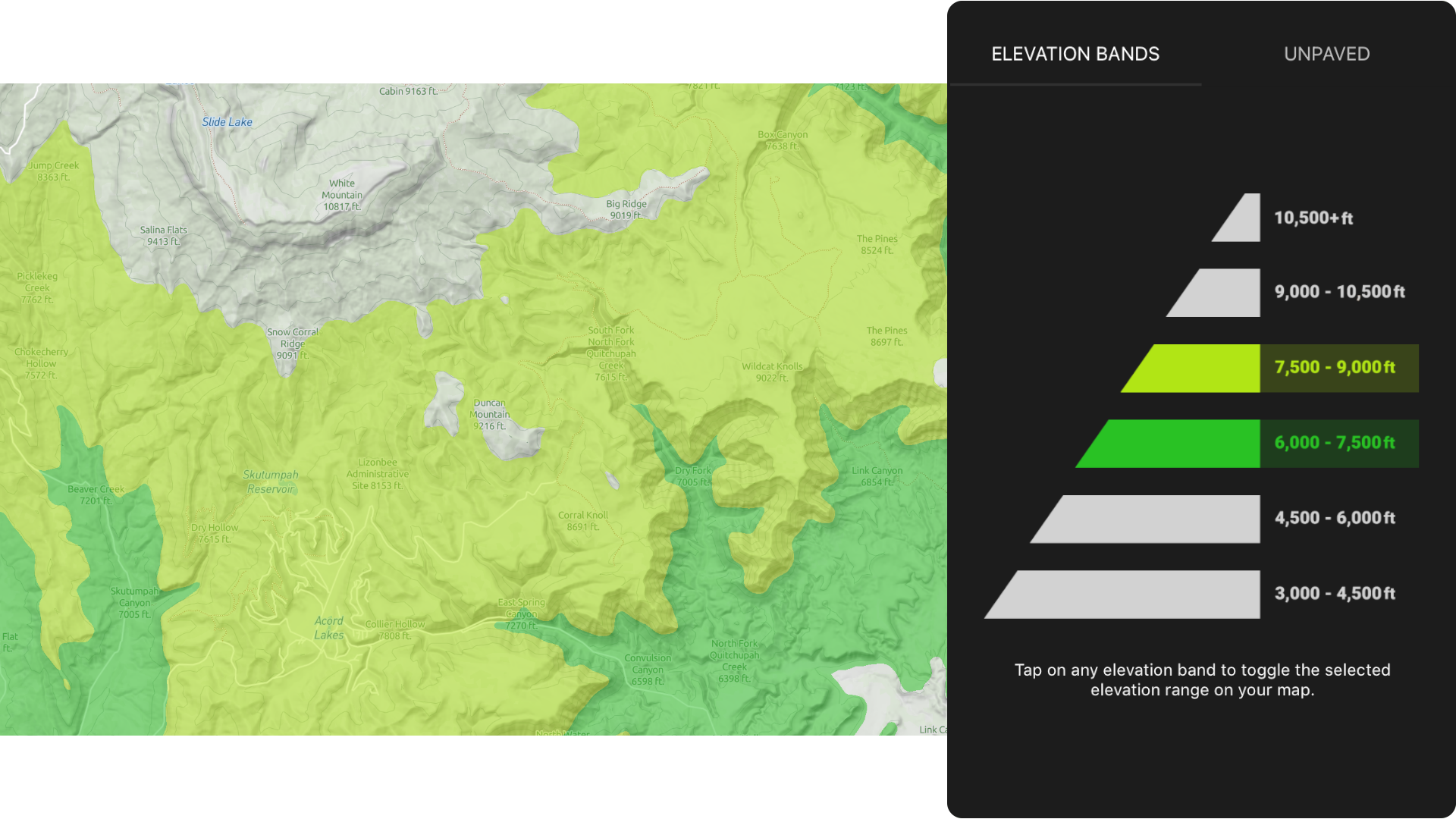
For example, you can apply the 6,000 - 7,500 ft (green) and the 7,500 - 9,000 ft (yellow) ranges to highlight potential areas to cover for antler sheds during shed season.
Chasing goats or sheep? Simply filter out the lower ranges to easily study their stomping grounds.
The Western Hunt is All Uphill
The Elevation Bands layer allows you to rapidly narrow down where to focus your scouting and hunting efforts based on the species you're after and the season you're in. This is a quintessential tool for the western big game hunter. It's one of the many tools Scout To Hunt is tenaciously engineering to Elevate Your Instincts™.

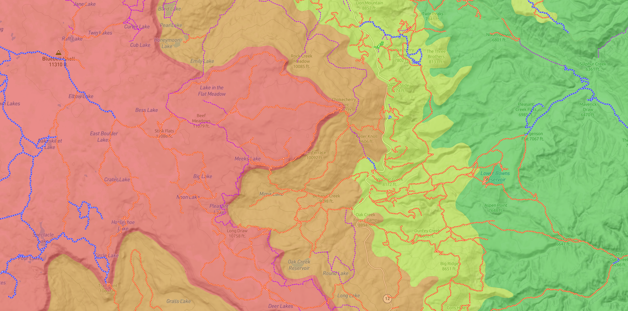
The Power Couple
When the Elevation Bands are used together with UnPaved™, Scout To Hunt's comprehensive off-road and trails layer, your route planning will be elevated to new heights of success.
Not only do you have a clear view of the elevation ranges you expect to ascend, but a robust assessment of how to navigate through them. Observe the elevation ranges your route passes through and take note of the potentially varying road conditions you might use to access your target area.
Elevate Your Instincts™ with Scout To Hunt's Elevation Bands offline map layer