2024 Utah $10K Hidden Shed Riddle Breakdown
To view the location of the Utah $10K Hidden Shed on your map copy and paste the following coordinates into the Scout To Hunt App:
Note: the solutions to the Hints will be provided once all Hidden Sheds are found.
Seek relatively efficient systems from before and more prior that intersected with the current system that is consistently identified.
Answer
Green River
Explanation:
The Old Spanish Trail trade route crossed the Green River in the area of modern-day Green River from 1829 into the 1850s.
"efficient systems" - various routes from the past
"current system" - current, as in a water current (ie., Green River)
"consistently identified" - for its notable features, the Green River has been identified as such throughout recorded history.
Find its singular relation from dusk to dawn.
Answer
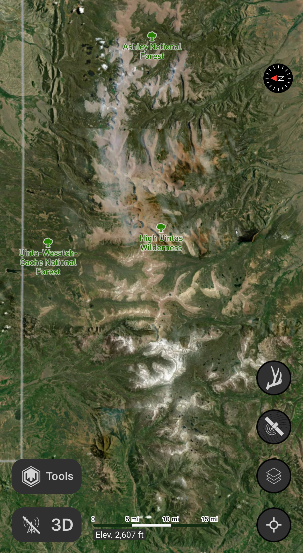
Uinta Mountain Range
Explanation:
The Uinta Mountain Range is the only major range in the contiguous United States with an east-west orientation.
Note those that networked for a complex of support.
Answer
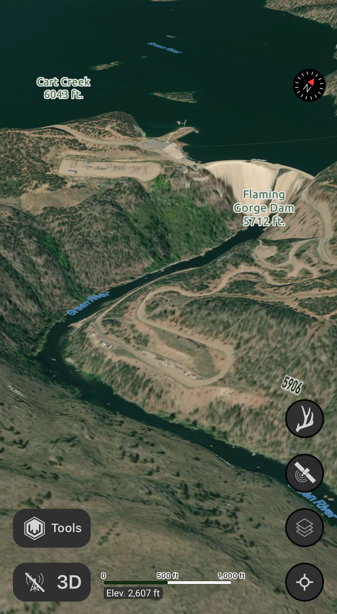
Flaming Gorge Dam
Explanation:
Flaming Gorge Dam is 1 of 6 dams in a concerted system to preserve the upper Colorado River basin, also known as the Colorado River Storage Project.
Flaming Gorge Dam is the only dam out of the six located in Utah.
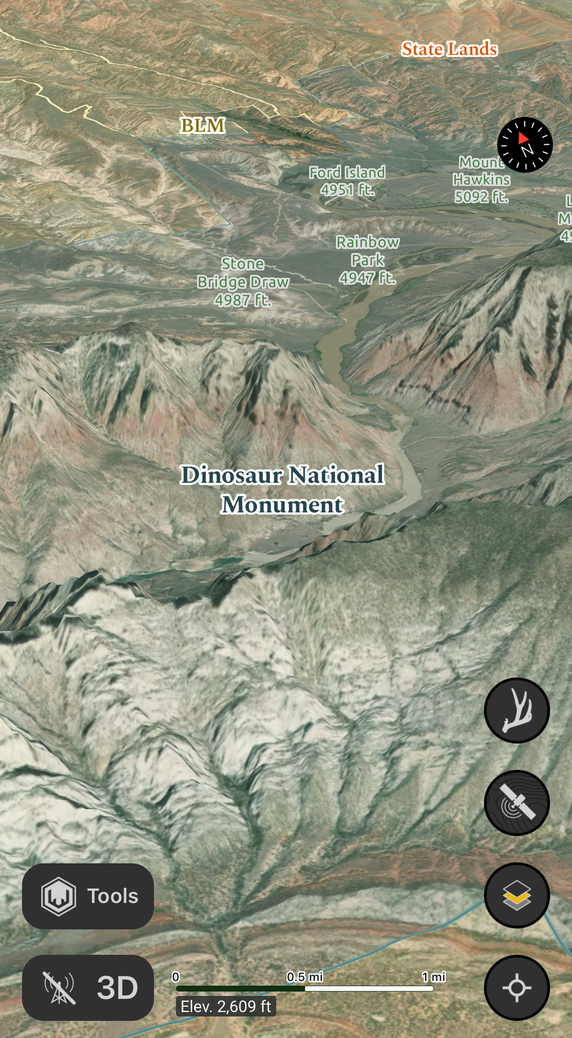
Consider the story that was marked and not forgotten.
Answer
Dinosaur National Monument
Explanation:
This relates particularly to the Fremont people and their petroglyphs and hieroglyphics, in addition the simultaneous interpretation of the dinosaur fossils that have been preserved.
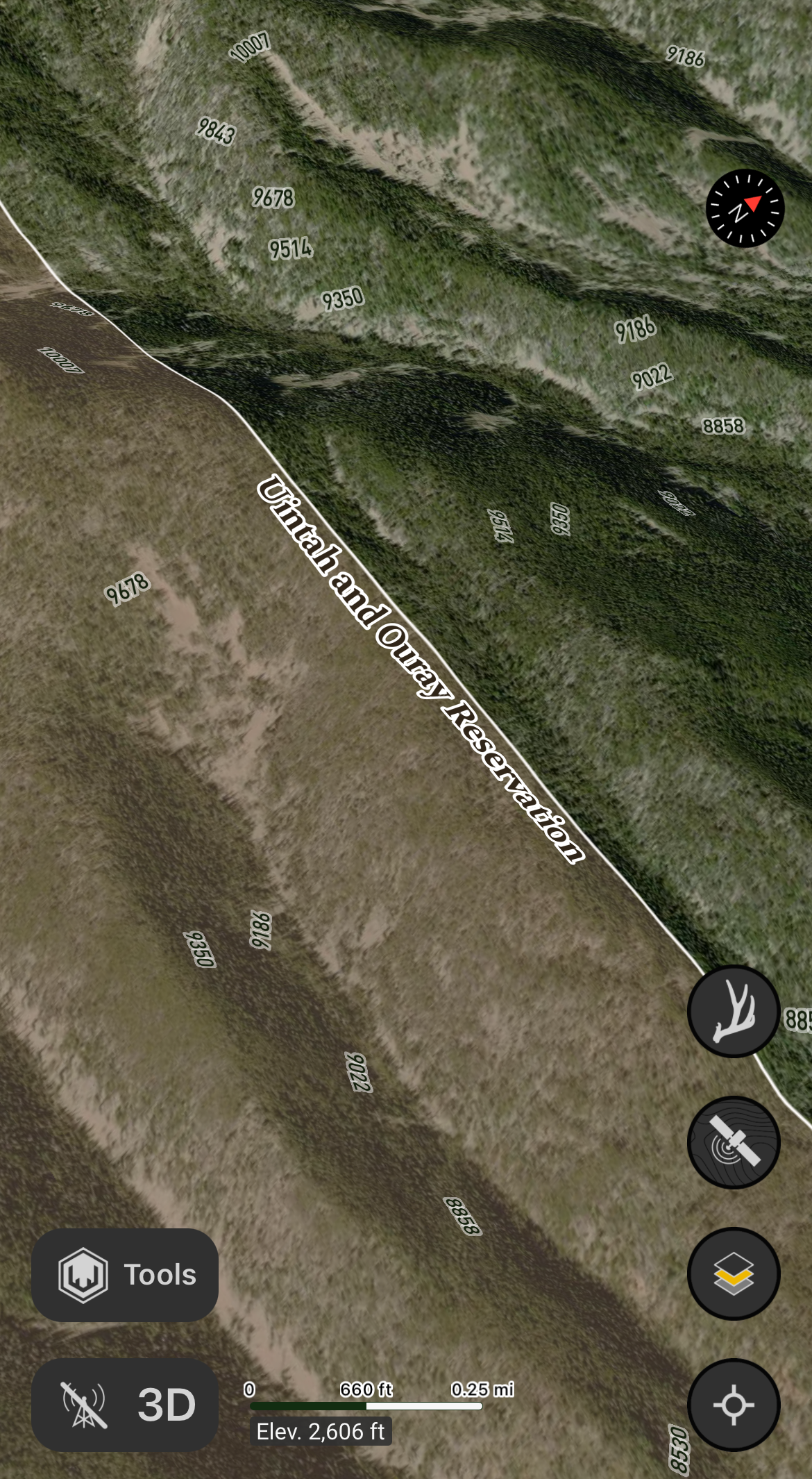
Finish fast and revere the past by moving with your future.
Answer
Uintah and Ouray Reservation; the Bear Dance
Explanation:
"Finish Fast", as in fasting from consumption - The primal ancestor of the Ute Indians are believed by themselves to be bears.[4] The reason for this dance was to help wake up the hibernating bears in winter, and the Indians from being inside during the cold season.
"revere the past" - Legends say that the songs played by the Ute Indians showed respect to the bears spirits.[8]
"by moving with your future" - Along with waking up for winter finding a new mate for the new season is another reason this dance is performed by bears, and humans.[5] During the dance women invite men to dance in order to find a mate, and dance together.[6]
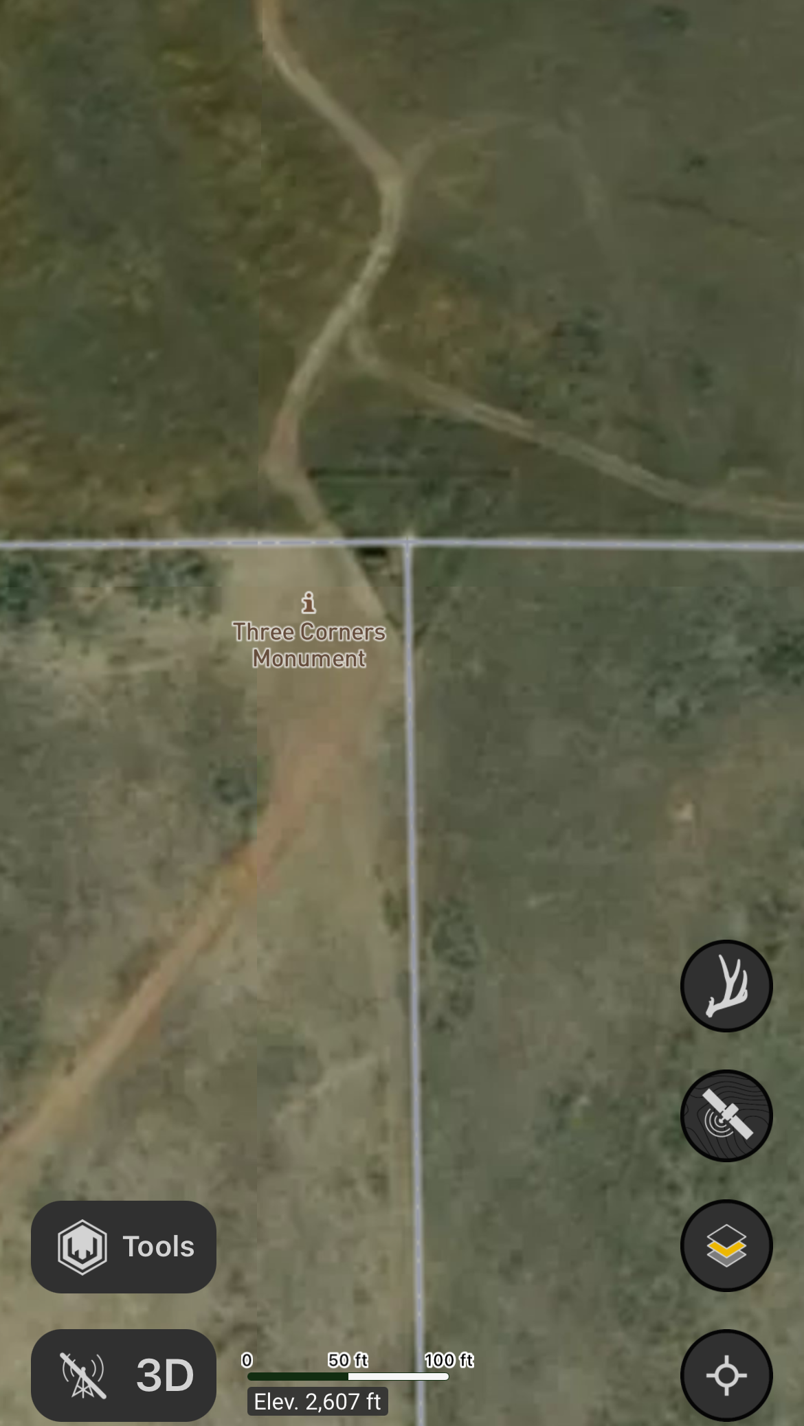
See an enduring stamp of recognition, pieces of its past remain.
Answer
Three Corners Triangle
Explanation:
The Tri-State Corner of the States of Wyoming, Utah and Colorado.
The original monument was found to be disturbed in 1931, and was remarked by US Cadastral Engineer E. V. Kimmel with a brass tablet seated in a concrete monument.
Monument:
Erected by the Kiwanis clubs of Rock Springs, WY, and Craig, CO and the Lions club of Daggett County, UT in cooperation with the Bureau of Land Management, and dedicated on August 21, 1966. Embedded in the concrete base of this monument are some of the original stones which marked the location in 1879.
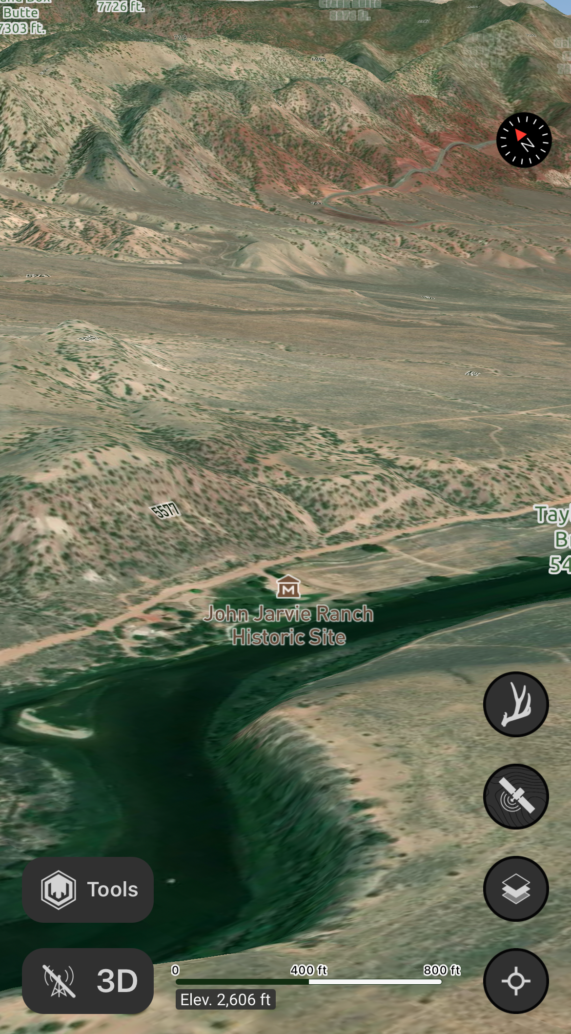
Determine where traveled by plenty, taken for granted by some. The stone set to shield from encounter.
Answer
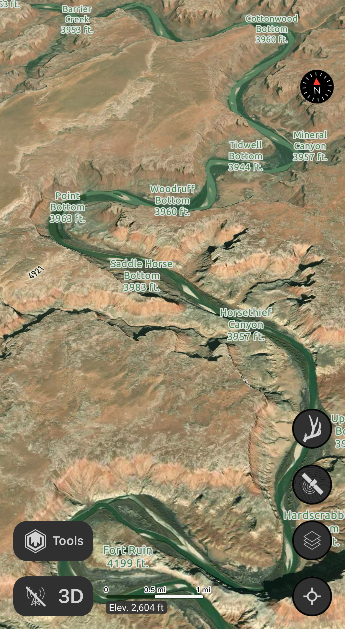
John Jarvie Historic Ranch
Explanation:
"Determine where traveled by plenty" - In 1880, John Jarvie, a Scotsman built a ranch along the Green River to offer store goods to those that lived or traveled in this wild territory. Jarvie chose this location due to a naturally occurring river crossing which was used by Indians, fur trappers, travelers, and local residents. At its height, the Jarvie ranch operation included a store, post office, river ferry, and cemetery.
"taken for granted by some" - John Jarvie was murdered while in defense of his safe during an armed robbery.
"The stone set to shield from encounter" - At the historic ranch, you’ll find the stone house, which is a one-room, rectangular building. It was built by outlaw Jack Bennett, using masonry skills he learned in prison.
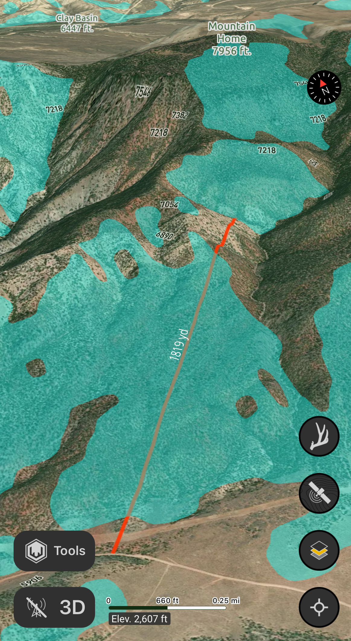
Explore the prime aspect of the ascent, spot the exposed dwelling.
Answer
South facing slopes; Mountain Home
Explanation:
"Explore the prime aspect" - South Slopes layer highlights south facing slopes on your map. A popular layer for shed hunters.
"spot the exposed dwelling" - in reference to the nearby mountain named, Mountain Home