$10K Hidden Shed Riddle Breakdown - New Mexico
To view the location of the New Mexico $10K Hidden Shed on your map tap on this link from your mobile device:
Or copy and paste the following coordinates:
Follow the flow of the earth, you'll find that which is of much worth.
Answers
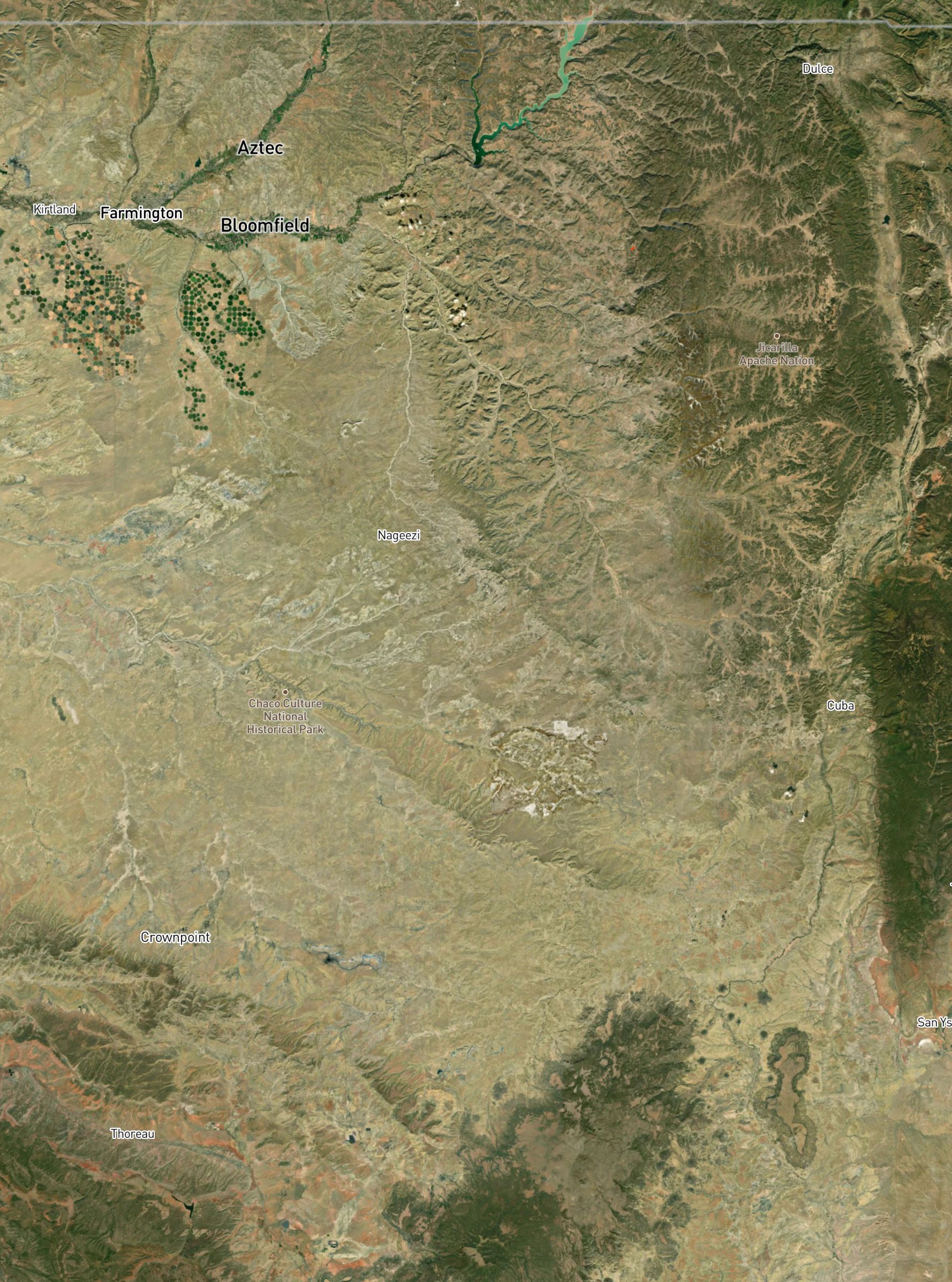
West of the Continental Divide
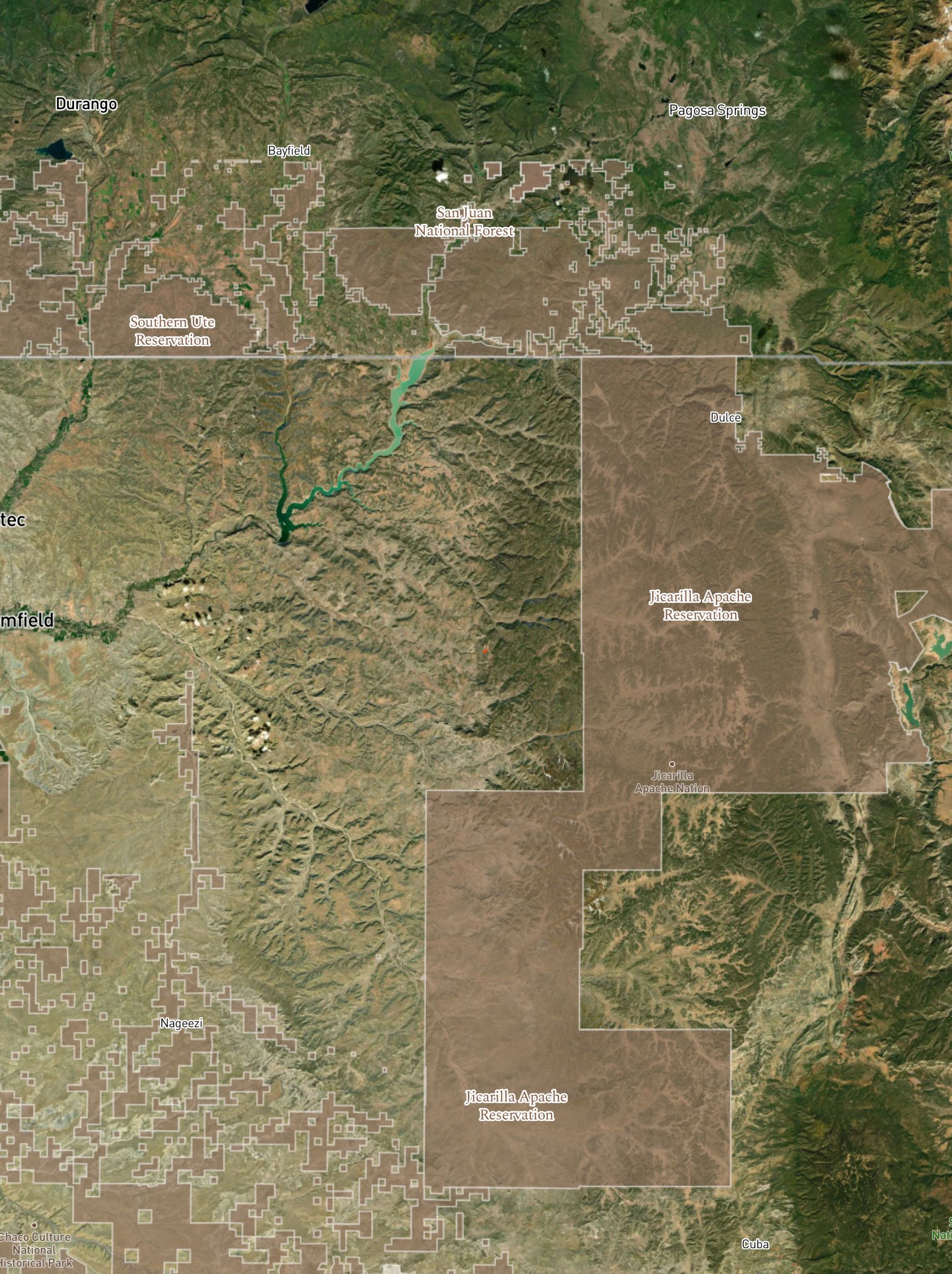
Jicarilla Apache Nation Reservation
Explanation:
Water west of the divide drains into the Pacific Ocean, indicating the side of the state to begin your search.
The Jicarilla Apache Nation Reservation is also west of the divide, as an affirmation of which side of the state to be shed hunting. Within the context of water, the Jicarilla Apache view water as sacred.
"That which is of much worth" had dual meaning as it alluded to both the focus on the flow of water and the direction of the Hidden Shed itself.
The direction you must go, you will surely know as you consider this birth from below.
Answer
Jicarilla Apache Nation Reservation
Explanation:
The Jicarilla were natively known as Haisndayin, or "people who came from below". They believed themselves to be the sole descendants of those who were born in the underworld, Ancestral Man and Ancestral Woman, from their primary diety Hascin.
This was further confirmation of the region to be focused on.
Hint:
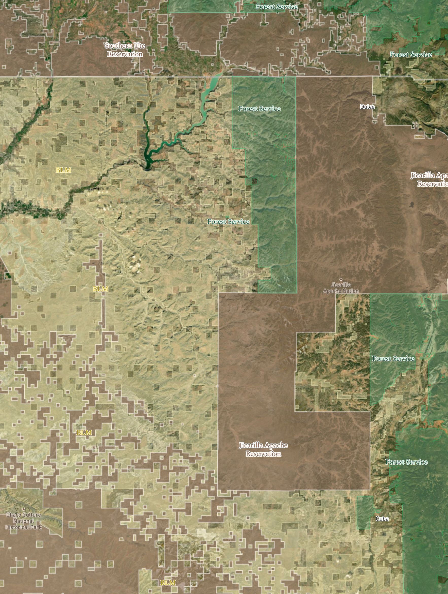
Tribal Land map layer
Take note of the River above its yellow land directs hereof, where the end of this international collector of sacred matter will meet you on the widely shared platter.
Answers
Rio Arriba County (county seat: Tierra Amarilla)
Coloardo Plateau
Rocky Mountain Range
BLM
Explanation:
"Take note of the River above its yellow land directs hereof"
This is in reference to both the Rio Arriba County and its county seat, Tierra Amarilla, as well as the color of the BLM map layer in the Scout To Hunt App (Yellow).
Both govern the people/land where the Hidden Shed is located.
"where the end of this international collector of sacred matter will meet you on the shared platter."
The Rocky Mountain range reaches from across Canada (international) down through the intermountain west of the United States where it meets the Colorado Plateau at the end of the range in the northwest region of New Mexico.
Hint:
BLM map layer
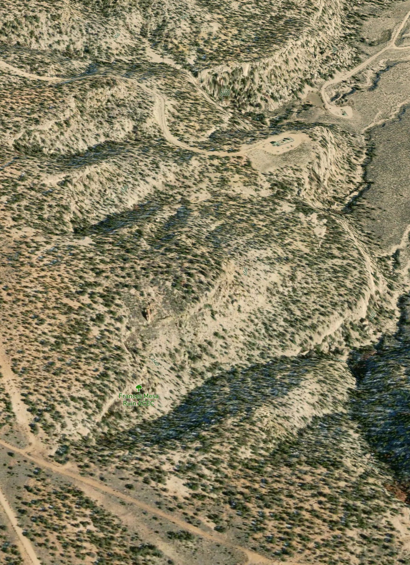
You'll find comfort in seeing a story from the past that shows you it did not last, and an avant-garde wager to grasp a mass beneath the grass.
Answers
Frances Canyon Navajo ruins
Project Gasbuggy
Explanation:
"You'll find comfort seeing a story from the past that shows you it did not last"
The Frances Canyon Navajo Ruins
"and an avant-garde wager to grasp a mass beneath the grass."
Project Gasbuggy - Gasbuggy Interpretative Site
Together these landmarks narrow down the spot of the shed.
Get Shedicated to take your 3D maps offline.
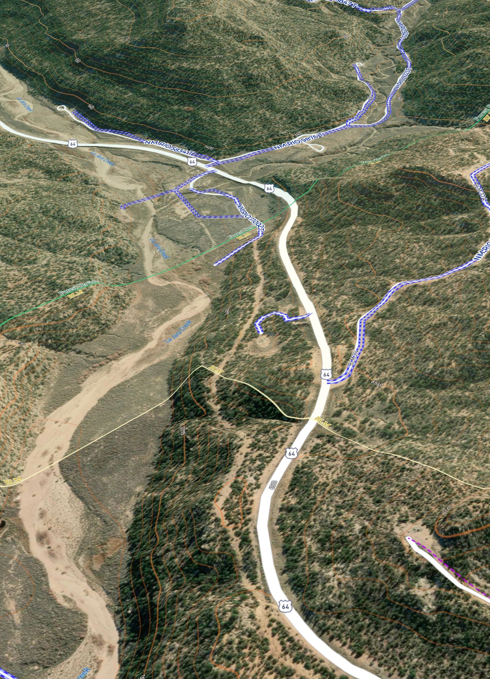
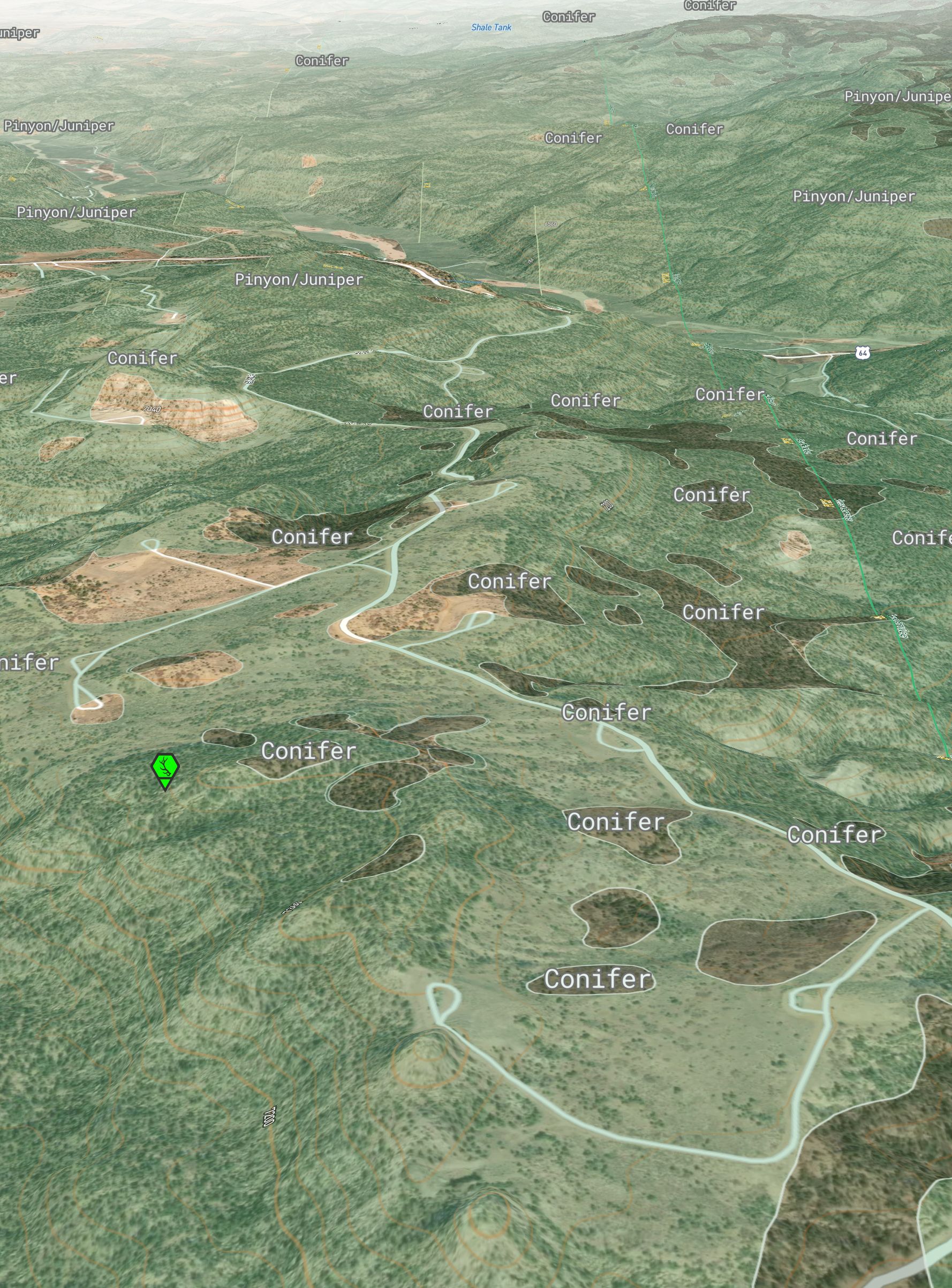
There is a creek you must seek. It is meek, but it will save you a week. It crosses the one primary road that is not unique, no matter the direction you come from to peek.
Answers
La Jara creek
Highway 64
You're not here to be watered like the wapiti wants to be foddered. Indeed you must veer off that road in the direction of the table where it's no longer offered. Choose the turn that immediately starts to elevate, and do not deviate until you've reached the path ternate.
Answers
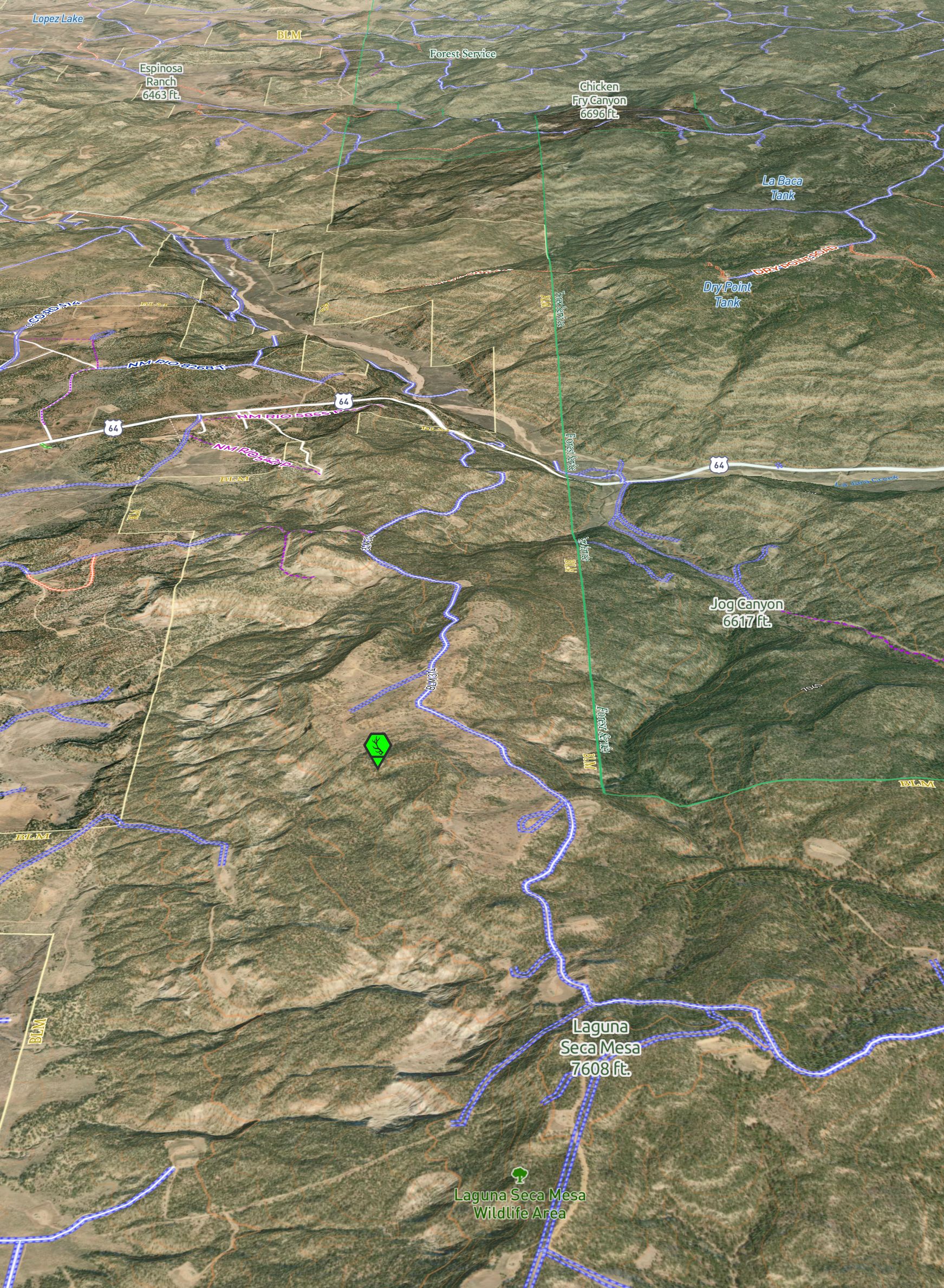
Laguna Seca Mesa
BLM Road 314
Explanation:
Confirmation that the shed hunt is for one of the Elk sheds just north of the Laguna Seca Mesa (heading south from Highway 64). The road to take is BLM 314 (NM RIO 10303 T - Unpaved layer).
This Road leads to the triangular connection of the roads visible from your map (ternate = arranged in or consisting of sets or groups of three).
Hint:
UnPaved™ Layer - Blue class
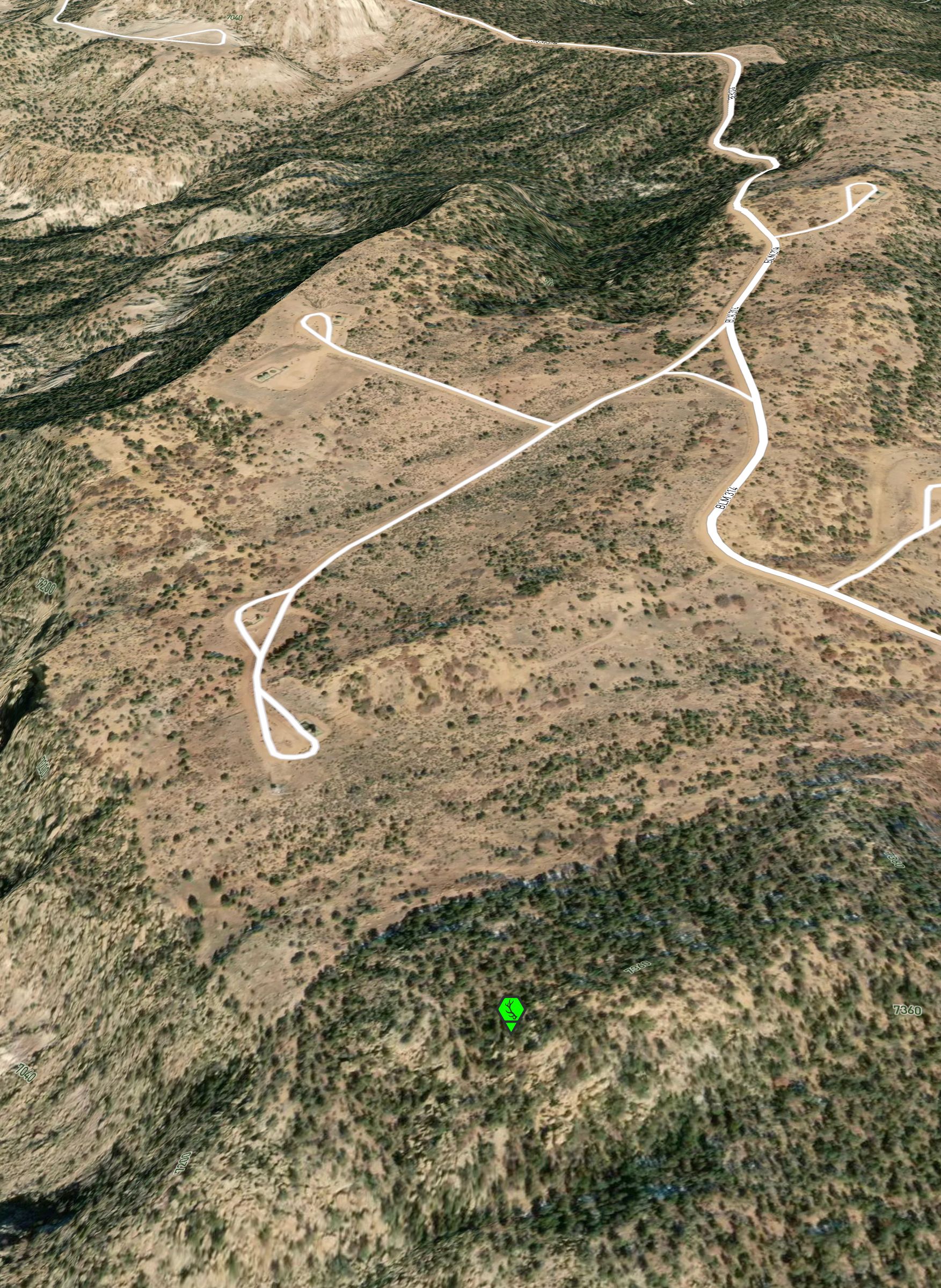
On this trichotomy, stay right and hold course until you have reached the black economy. This isn't a lottery. You're close now, it's just geology. You're at the end of the road. Put it in park, disembark, head for the bark and not the scarp so stark.
Answer
Explanation:
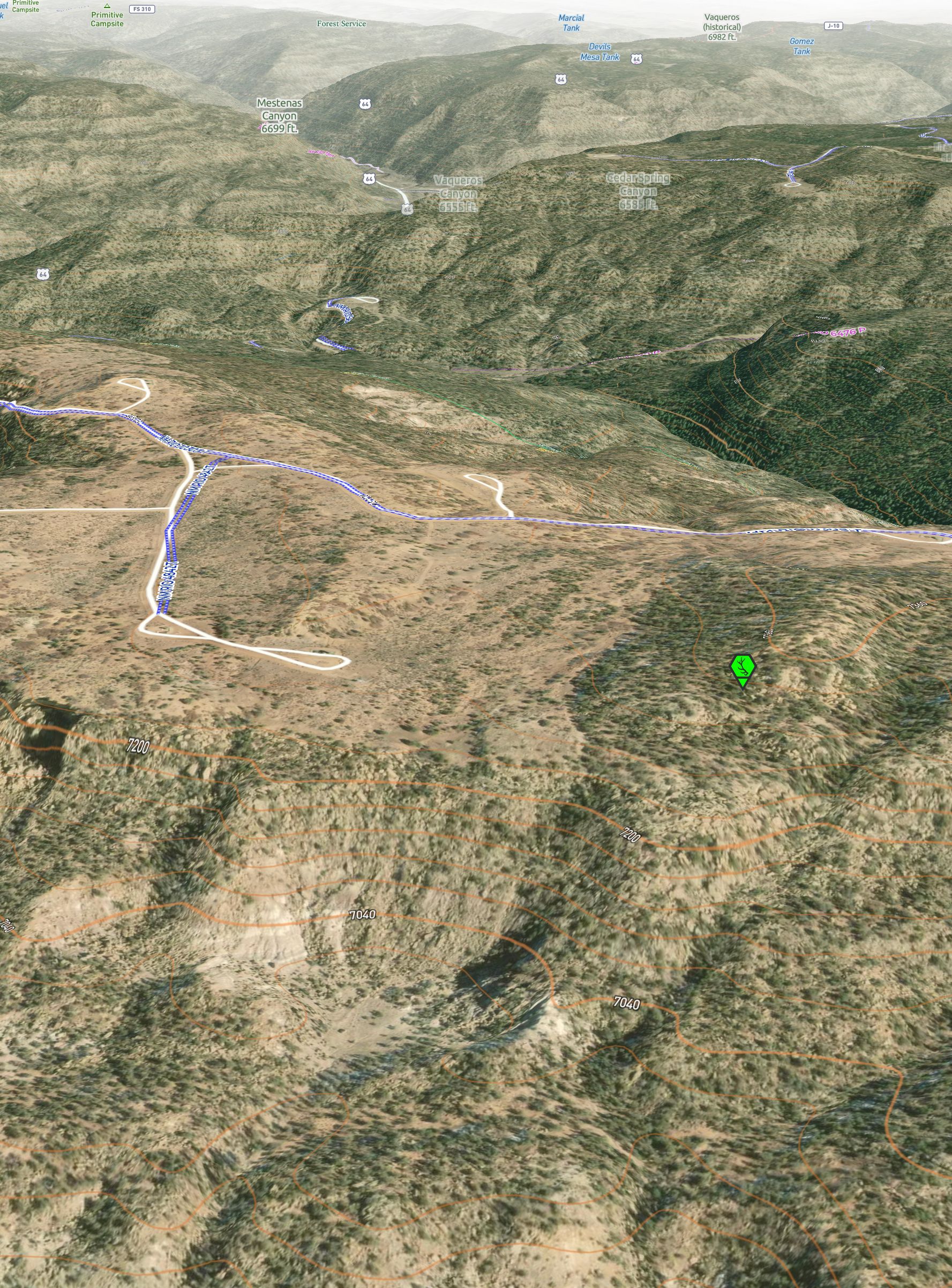
Staying right of that fork coming from Highway 64 will lead to the intended parking spot (noted in the last couple Hints) before needing to hike for the Hidden Shed.
The oil/gas sites in the immediate area where further confirmations of the correct location.
Heading towards the piñons/junipers and away from the cliff/scarp gives general direction to begin gridding south from the parking spot.
Remember, yellow is the color that directs hereof. No doubt, from here, you can see out and from above.
Answer
BLM
Elevation
Explanation:
A reminder that the Hidden Shed is on BLM and that some additional elevation would need to be gained from the parking spot to locate the shed.
Hint:
Offline 3D Maps
To not be rude, you've gone too far if you find more crude. It's also not opinion that you should be in piñon to not elude what you have pursued. To conclude, there's no need to be shrewd.
Oh, and to not be evaded or faded, the real black gold remains very shaded.
Answer
Explanation:
There are other oil/gas sites in the area. If you reached those sites it was an indication that you have gone too far.
Additionally, the general area begins to transition to a mix of pine with piñons/junipers as you move east, indicating to stay west of the national forest managed land.
The Hidden Shed was tucked under some piñons/junipers and not easily visible from afar.
Hint:
Vegetation map layer
National Forest map layer
The question ahead, where are the next two Hidden Sheds?