$10K Hidden Shed Riddle Breakdown - Nevada
To view the location of the Nevada $10K Hidden Shed on your map tap on this link from your mobile device:
Or copy and paste the following coordinates:
Look for what enters and does not exit.
Answer
Water, the Great Basin
Explanation:
Water collected by the Great Basin does not flow out, it tends to evaporate or sink (Humboldt Sink).
Remain south of this guide, relied to venture from side to side. One of its names was supplied by the bride.
Answer
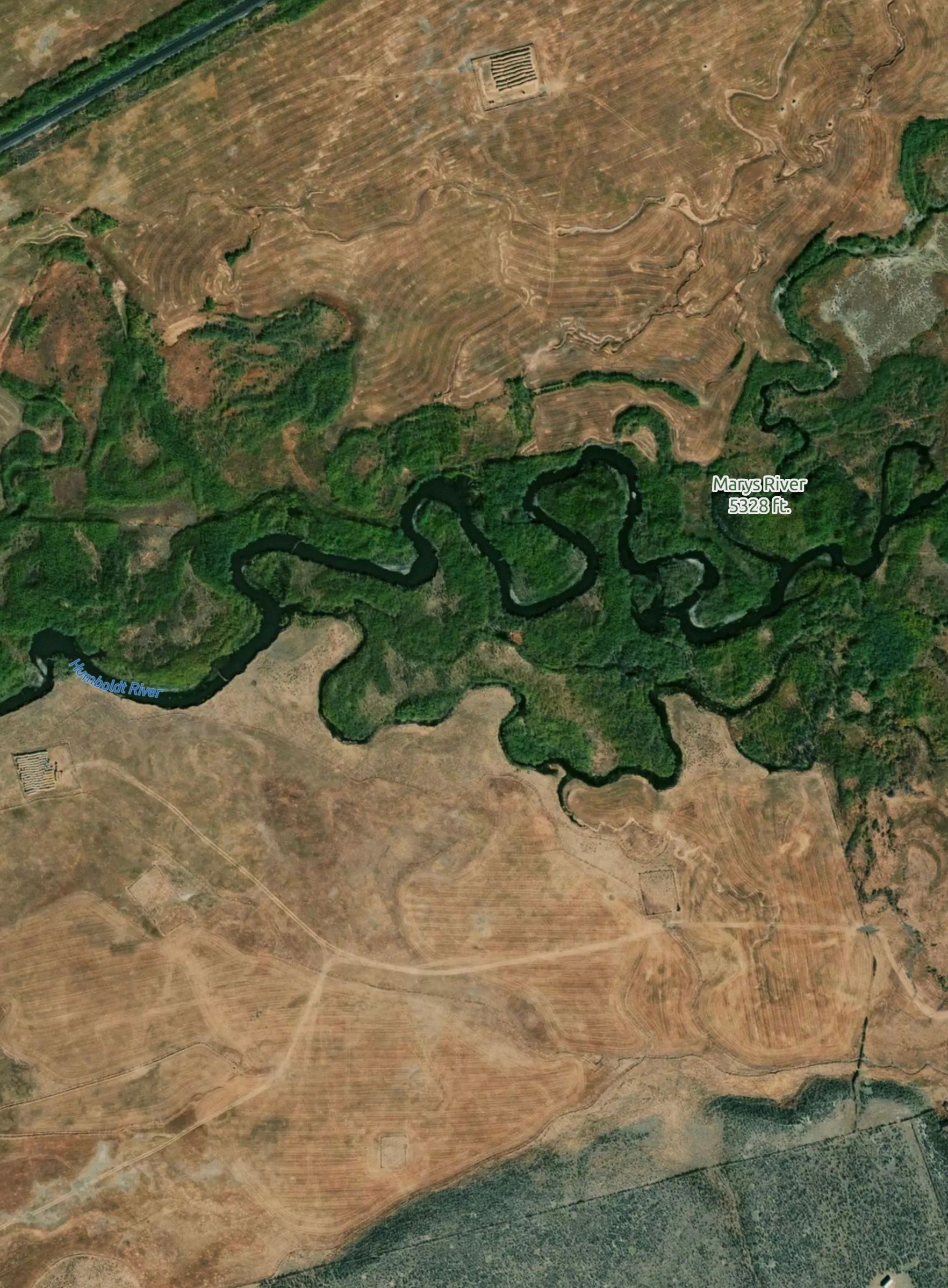
Humboldt River
Explanation:
At the time when the Humboldt River was named "Mary's River", the native American wife of a fur trapper, it was used as a main route for migrants traveling to and from California across Nevada. More recently, Interstate 80 follows along the the river across north-central Nevada.
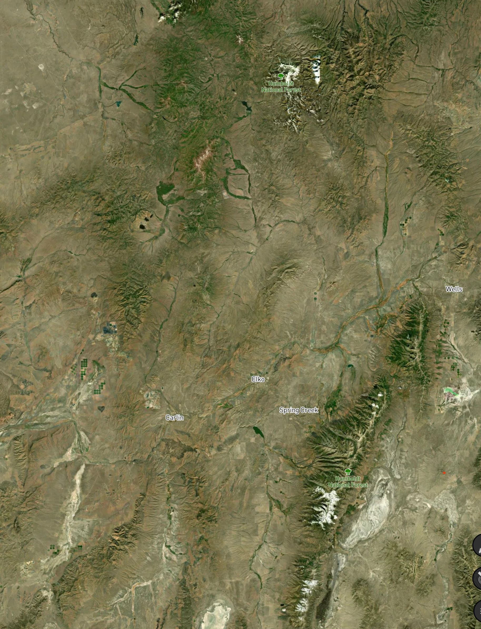
Remaining south of the Humboldt provides general direction as to where you should begin to make plans to start your shed hunt.
There are mountain ranges aplenty, but you need to first find the age-old amenity that many out of necessity found at "their extremity". Consider they who endeavored to align their prosperity in solidarity.
Answer
Wells, NV
Explanation:
Predating the settlement of Wells, for the Western Shoshone this area was known as "Toyagadzu" for the Clover Valley region. A known interpretation is "The end of the set of mountains".
The Humboldt Wells has been a source of replenishment for ages. The Central Pacific Railroad Company found such value there that they strategically established Wells, NV as they constructed towards uniting and completing the transcontinental railroad.
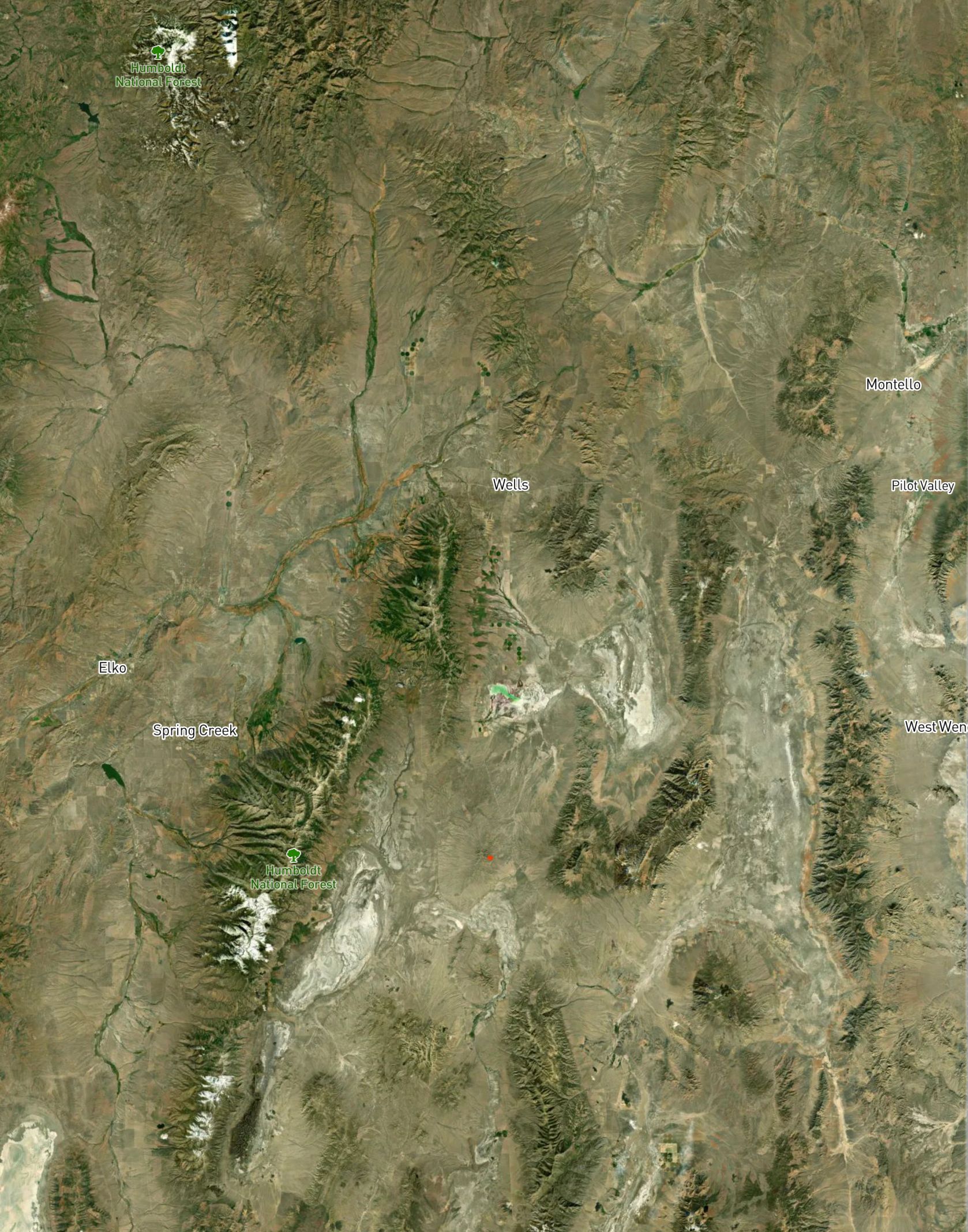
From this place of provision, take your expedition south to improve your position by way of the same name of the introduction of this exposition. At a certain distance, you may choose to follow the existence of that reminiscence in coexistence, or by your insistence remain in persistence either by deprecation or by identification of that same name in this documentation. Each lead to the same location.
Answer
Great Basin Hwy 93
Explanation:
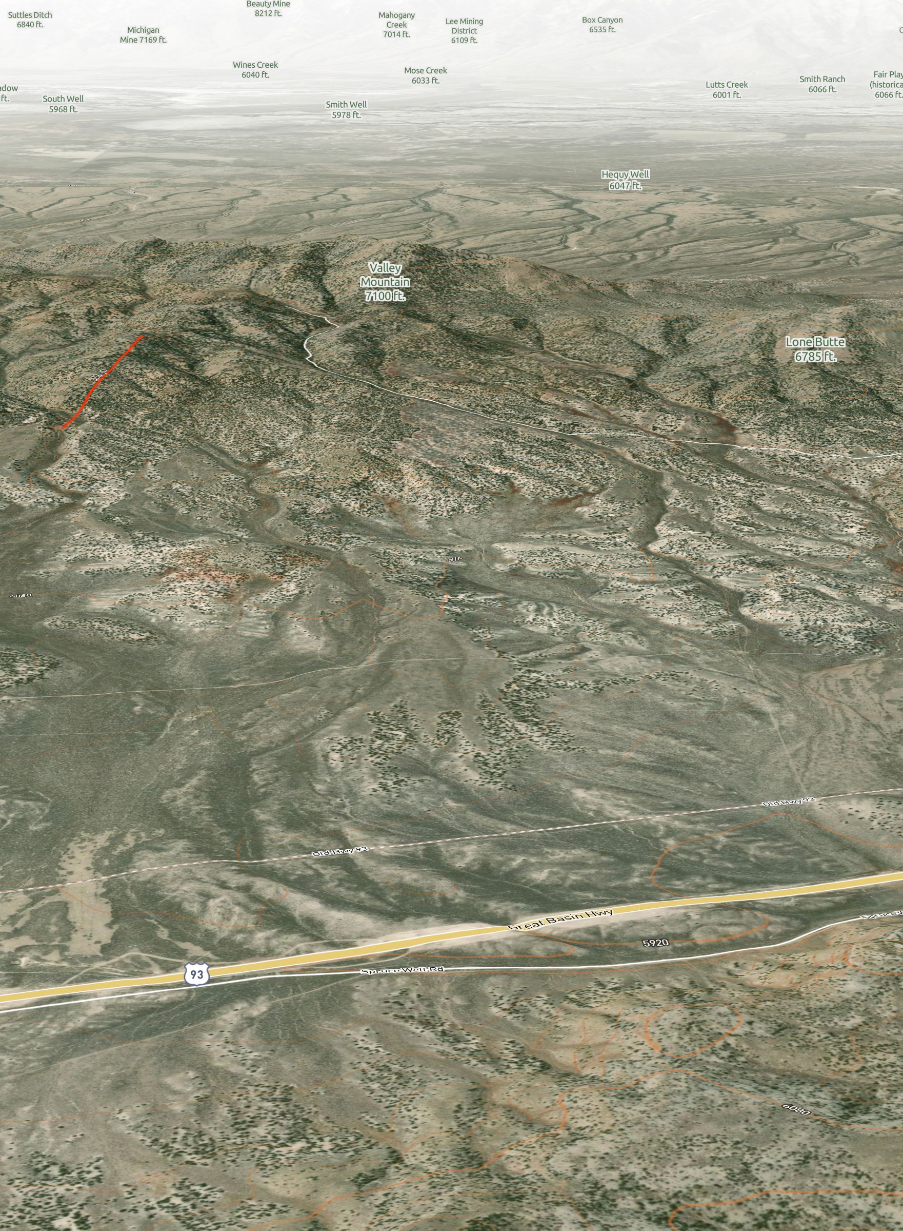
Great Basin Hwy, in relation to the first line of the Riddle (Great Basin), takes you down from Wells, NV to the Valley Mountain area.
There is a stretch of Great Basin Hwy 93 that parallels the Old Hwy 93. Taking either one of those would lead to the recommended turn towards Valley Mountain.
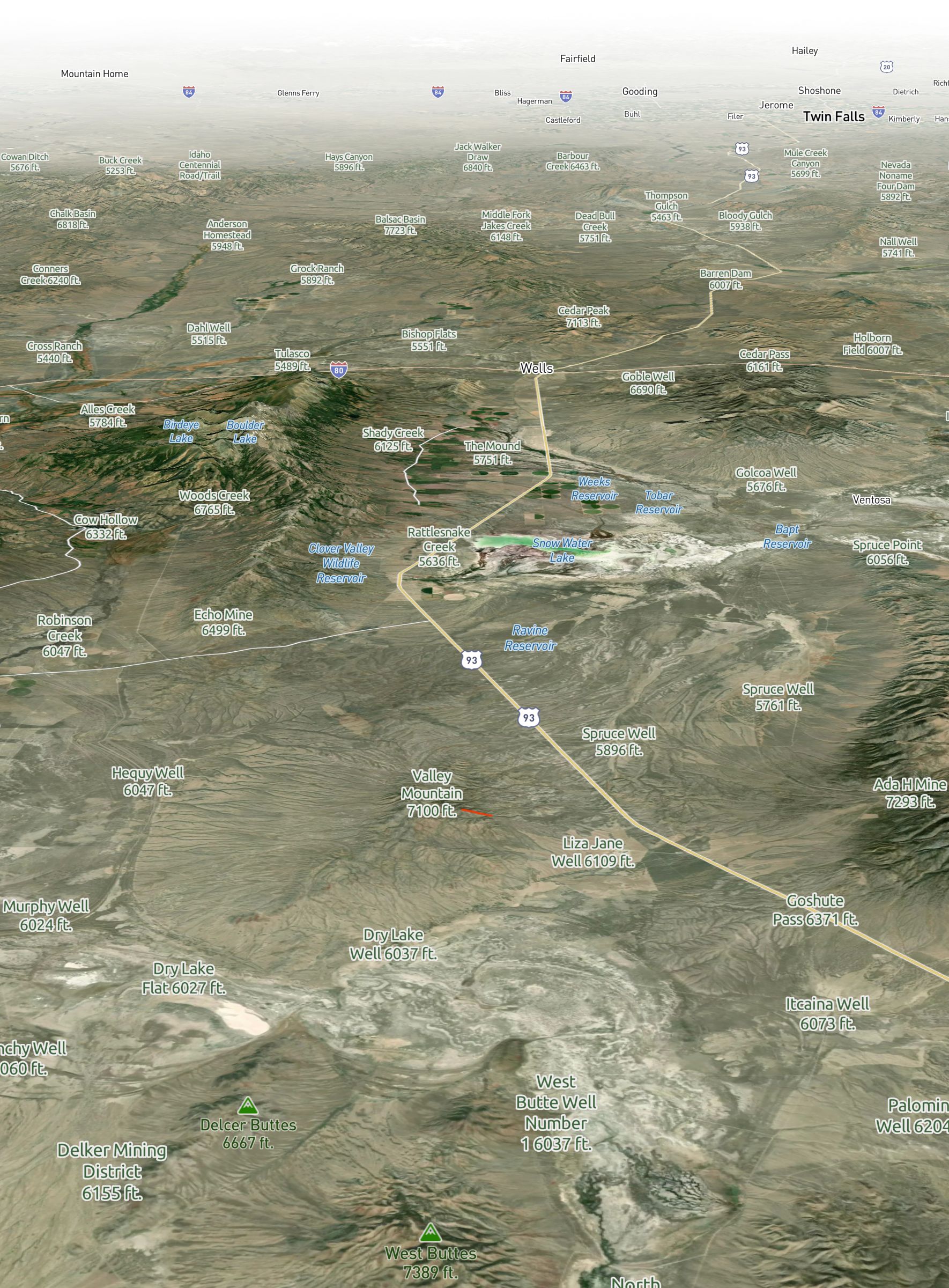
No matter the direction, there are various connections you can take to alter your trajection towards the increased elevation that occurs in isolation. For your information, your general orientation is toward the first official population.
Answer
Valley Mountain, turning west off of Hwy 93 (directionally toward Genoa, NV)
Explanation:
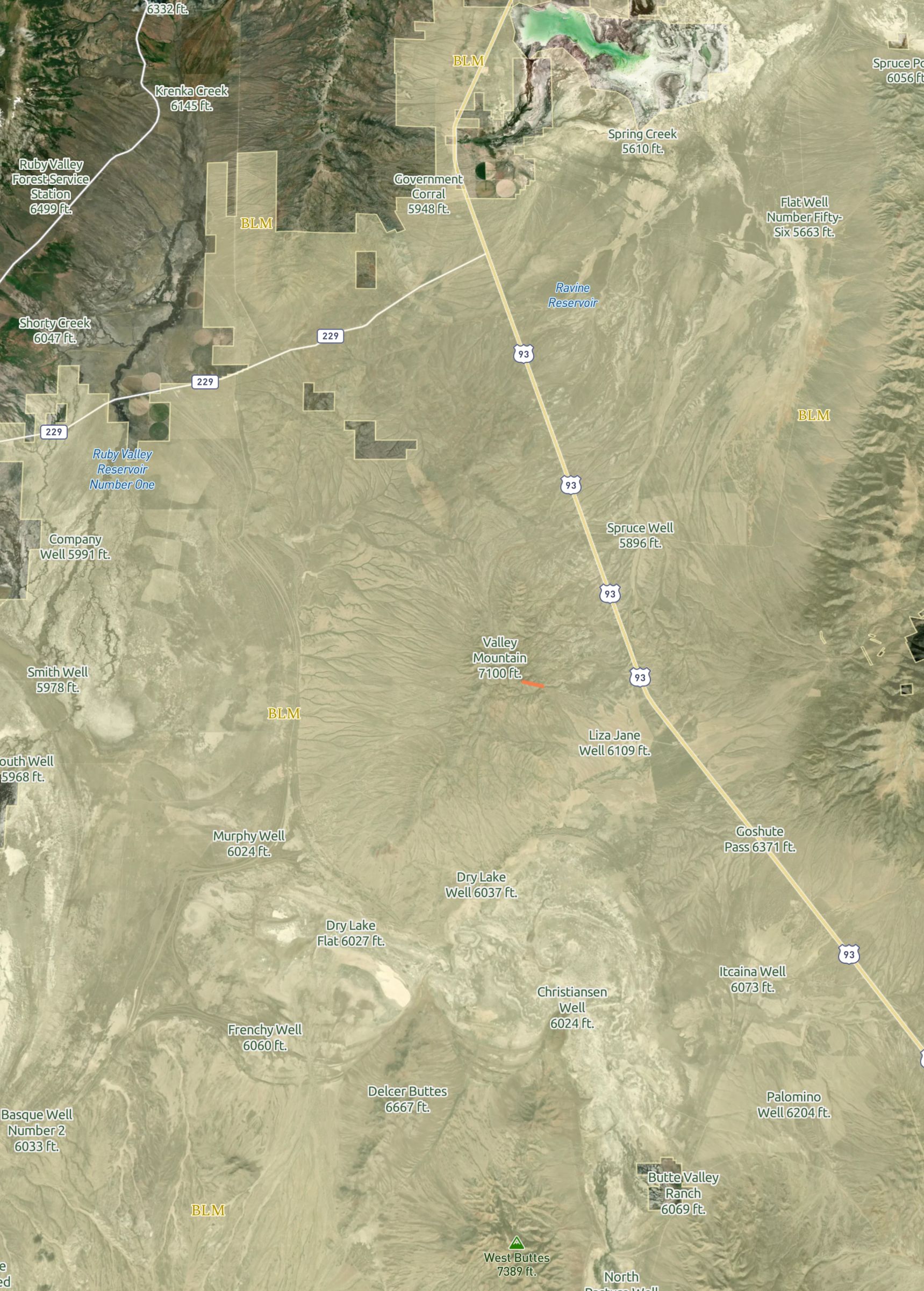
To confirm which way you must turn off of Hwy 93 (or Old Hyw 93) you have to know where Genoa, NV is relative to Hwy 93 as a general direction (west). Genoa, NV is the oldest permanent settlement in Nevada.
As a confirmation of your certainty, there's a yellow map layer that affirms this authority in the conservancy.
Answer
BLM
Explanation:
The BLM public land layer is a free layer in the Scout To Hunt App. This "yellow map layer" represents the land the BLM manages in Nevada.
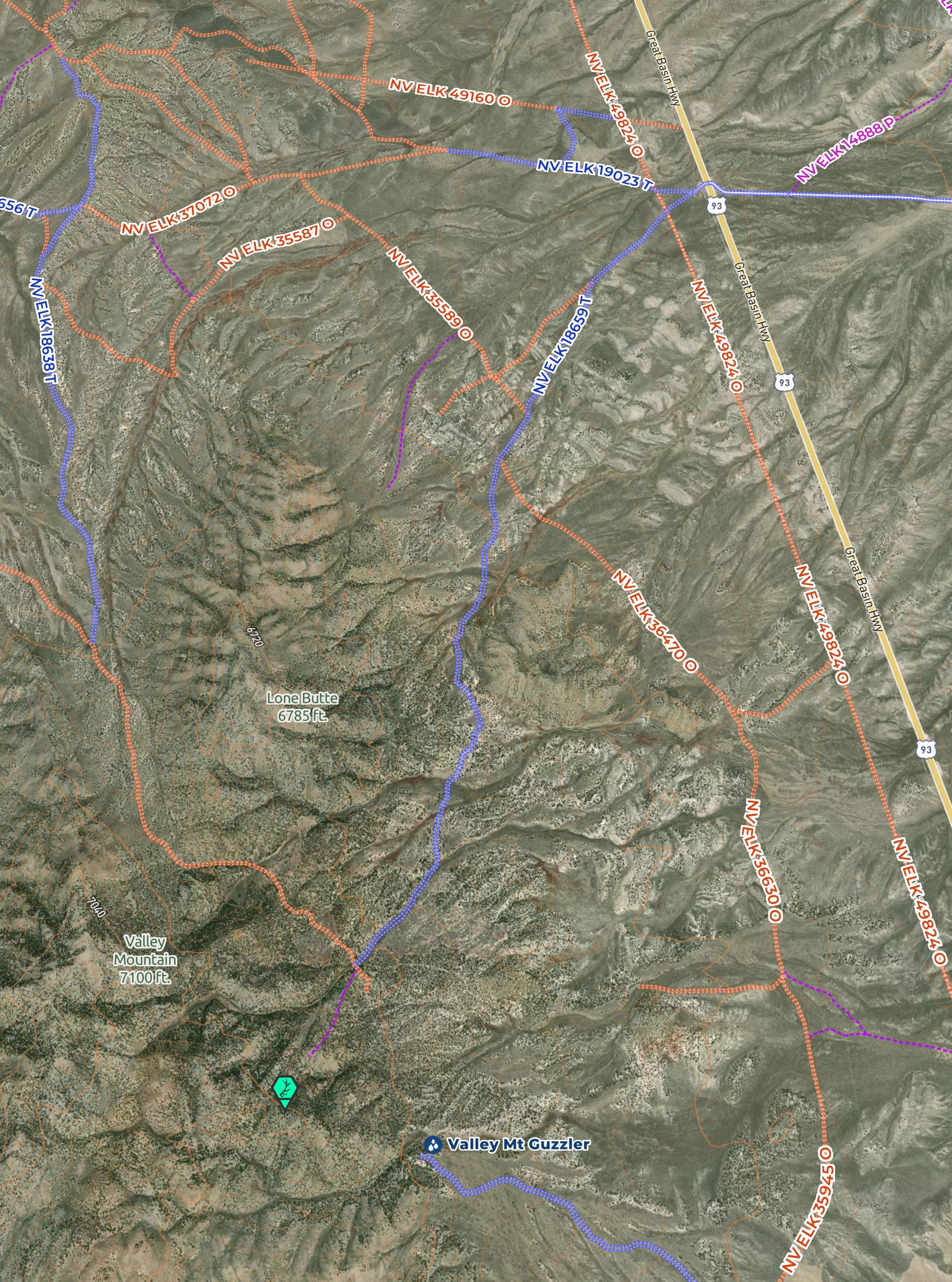
A particular path from the main route you emerge leads nearly to the cache you surely deserve. There is only one turn to take. Take the one left to reach what's at stake. Stay on this course as you climb in elevation, and stop where a sharp right curve joins your path for validation.
Answer
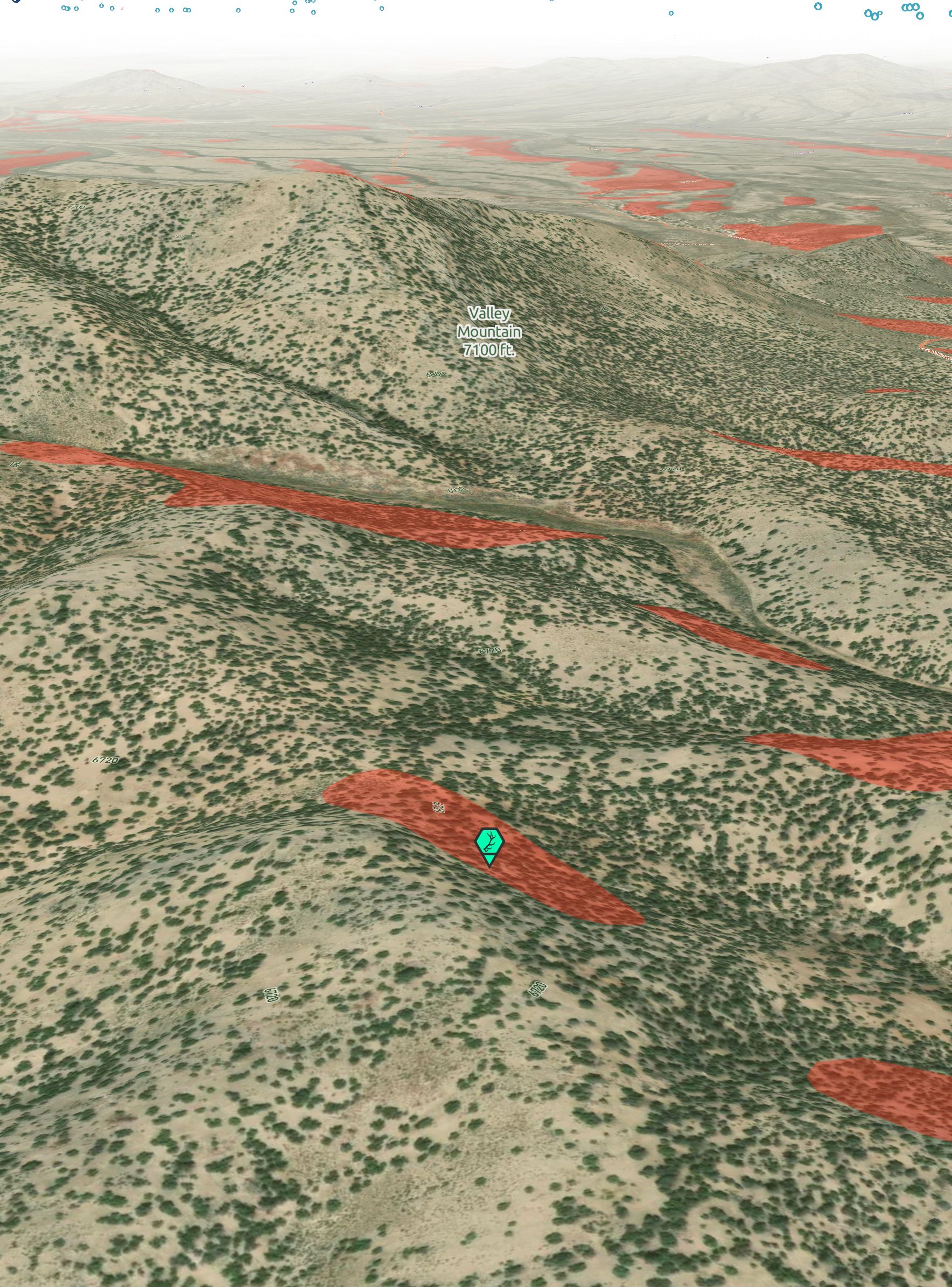
Valley Mountain
Explanation:
Valley Mountain stands alone relative to the various ranges in the region coming off of Hwy 93.
Hint:
UnPaved™ Map Layer - Blue Roads
Now by foot, head south for the sagebrush, but before you're out of the pine, look for the slope that's red like wine.
Answer
North face (red) - Slopes map layer
Explanation:
With the recommended off-road taken, it's only a short hike from where you'd park. By focusing on the north faces of the mountain, represented by red-colored areas on your map with the Slopes map layer, you'd find only a few slopes in the immediate area to start gridding for the Hidden Shed.
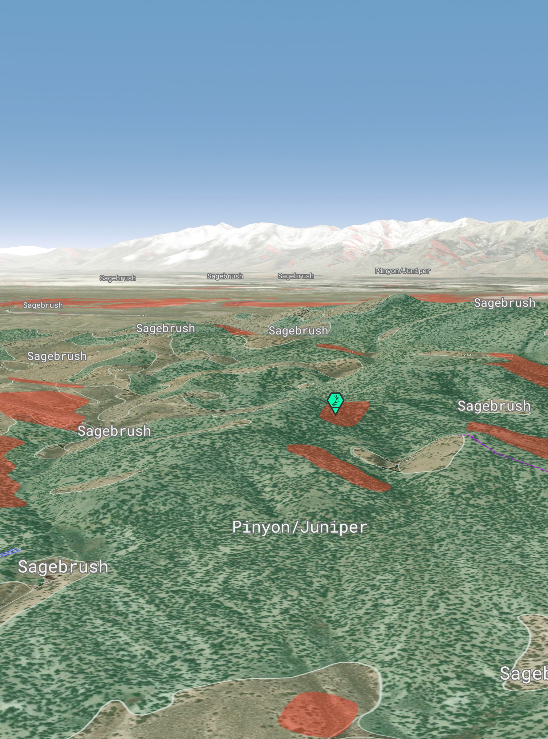
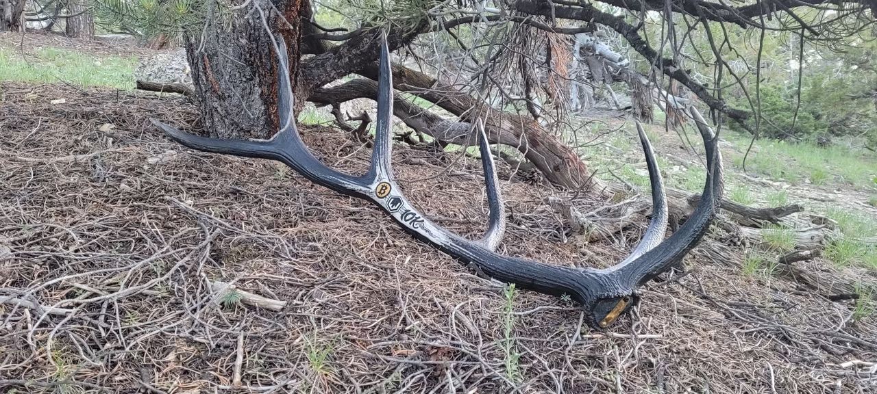
There you will find what the cervus left behind shaded by the pinyons combined.
Answer
Cervus canadensis
Explanation:
Cervus canadensis is the scientific name for Elk.
Hint:
Vegetation map layer - Pinyons/Junipers and Sagebrush
The question ahead, where is the next Hidden Shed(s)?