$10K Hidden Shed Riddle Breakdown - Idaho
To view the location of the Idaho $10K Hidden Shed on your map tap on this link from your mobile device:
Or copy and paste the following coordinates:
Begin where life followed the path after the wrath.
Answer
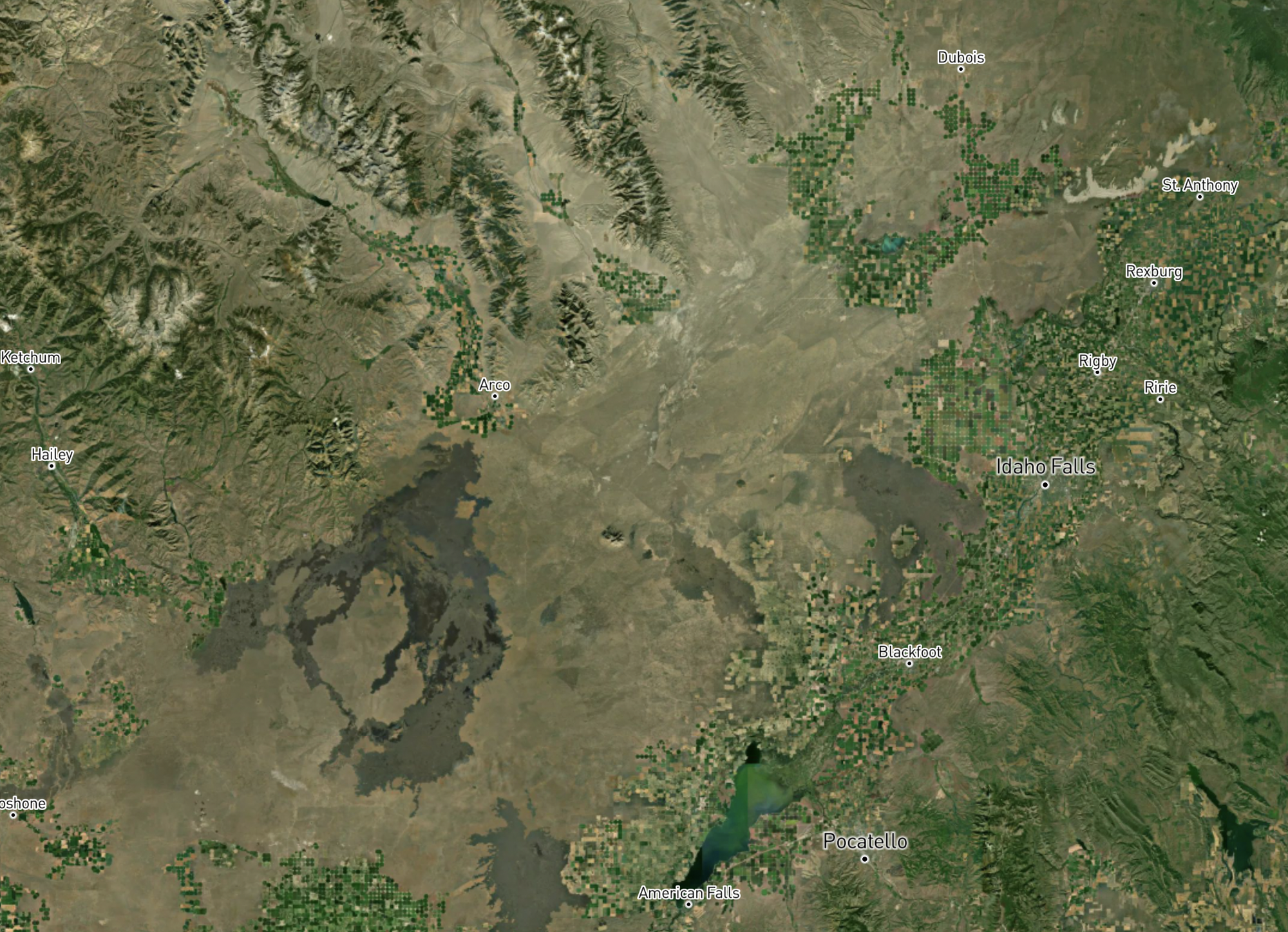
The Snake River Plain of southern Idaho
Explanation:
The Snake River followed after this natural path was created by the long lasting volcanic activity that constructed the plain as it moved over the Yellowstone hot spot.
A misnomer of those that had known her as a donor.
Answer
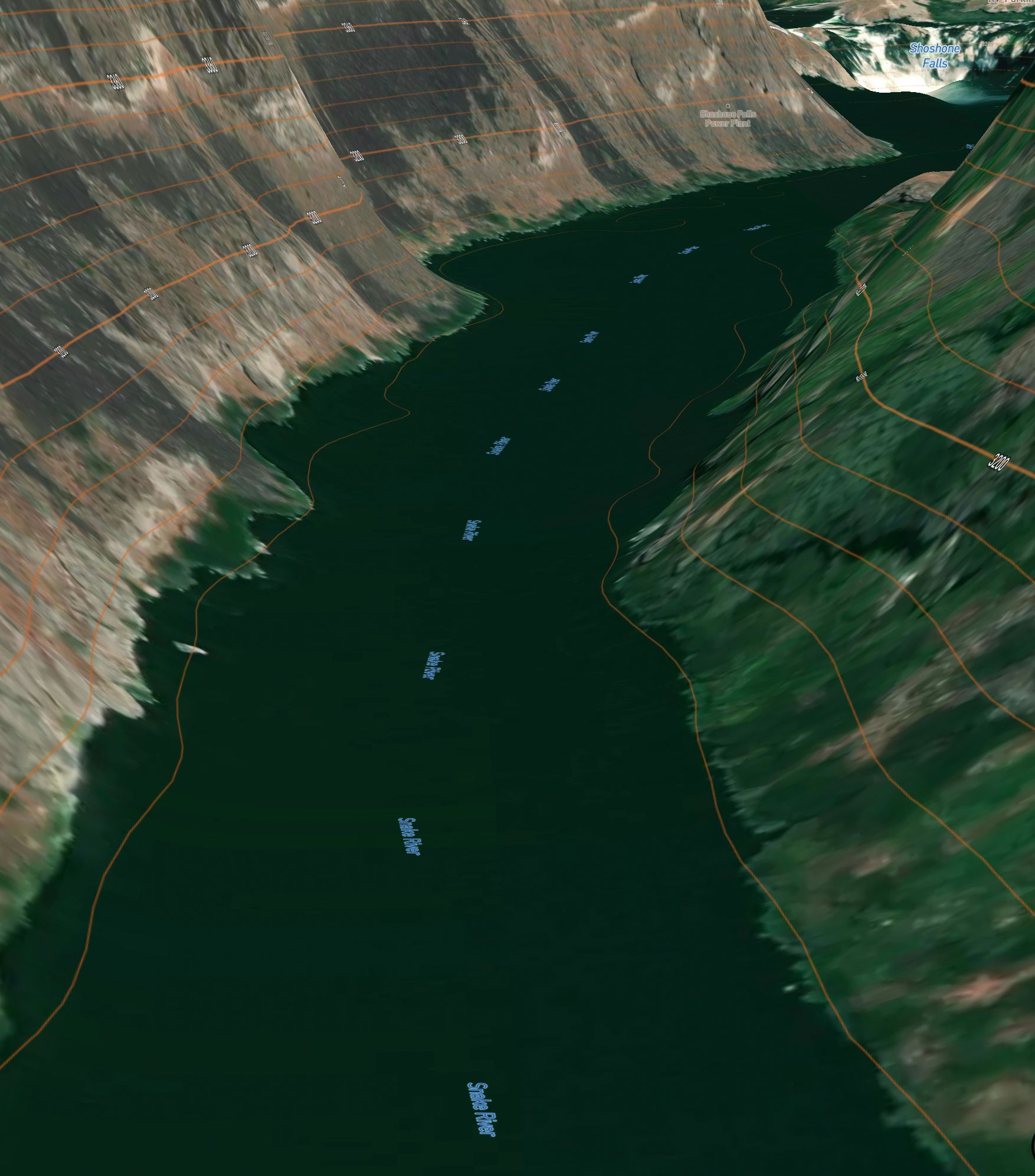
The Snake River
Explanation:
Shoshone-Bannock natives expressed their relationship to and dependence on salmon provided by the Snake River by way of sign language, which was misunderstood to represent a snake.
Both the "Snake Indians" and the Snake River where identified accordingly by explorers and neighboring people.
Misnomer: wrong or misleading name
"Those": Shoshone-Bannock native
"Her": Snake River
Far-reaching, wizards' hands began leaching and beseeching to command the lands.
Answer
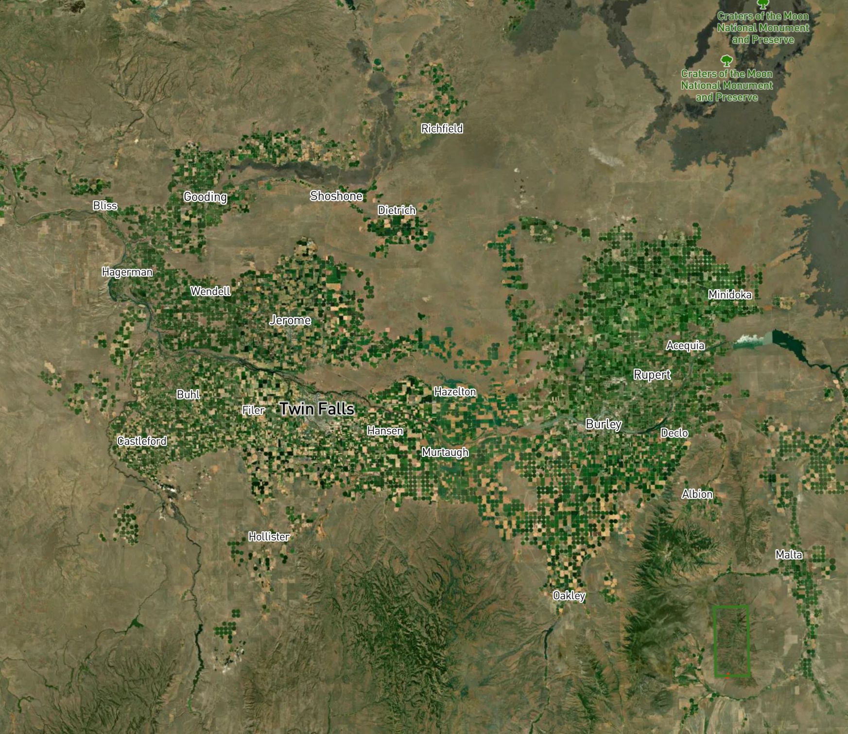
The Magic Valley
Explanation:
The construction of the Milner and Minidoka Dams on the far-reaching Snake River, in conjunction to an effective irrigation system, brought new and productive agricultural life to previously arid and barren land in south central Idaho.
This transformation was aptly referred to as magic, or the "Magic Valley".
These "wizards" worked their magic to command the land by leaching and beseeching the life sustaining water from the Snake River that flows to the north of it.
Islands once considered one are now two. The one to pursue recalls the temporary home the outcast soon bid adieu. They claim you need a Raft, so you'll be looking for a paddle too.
Answer
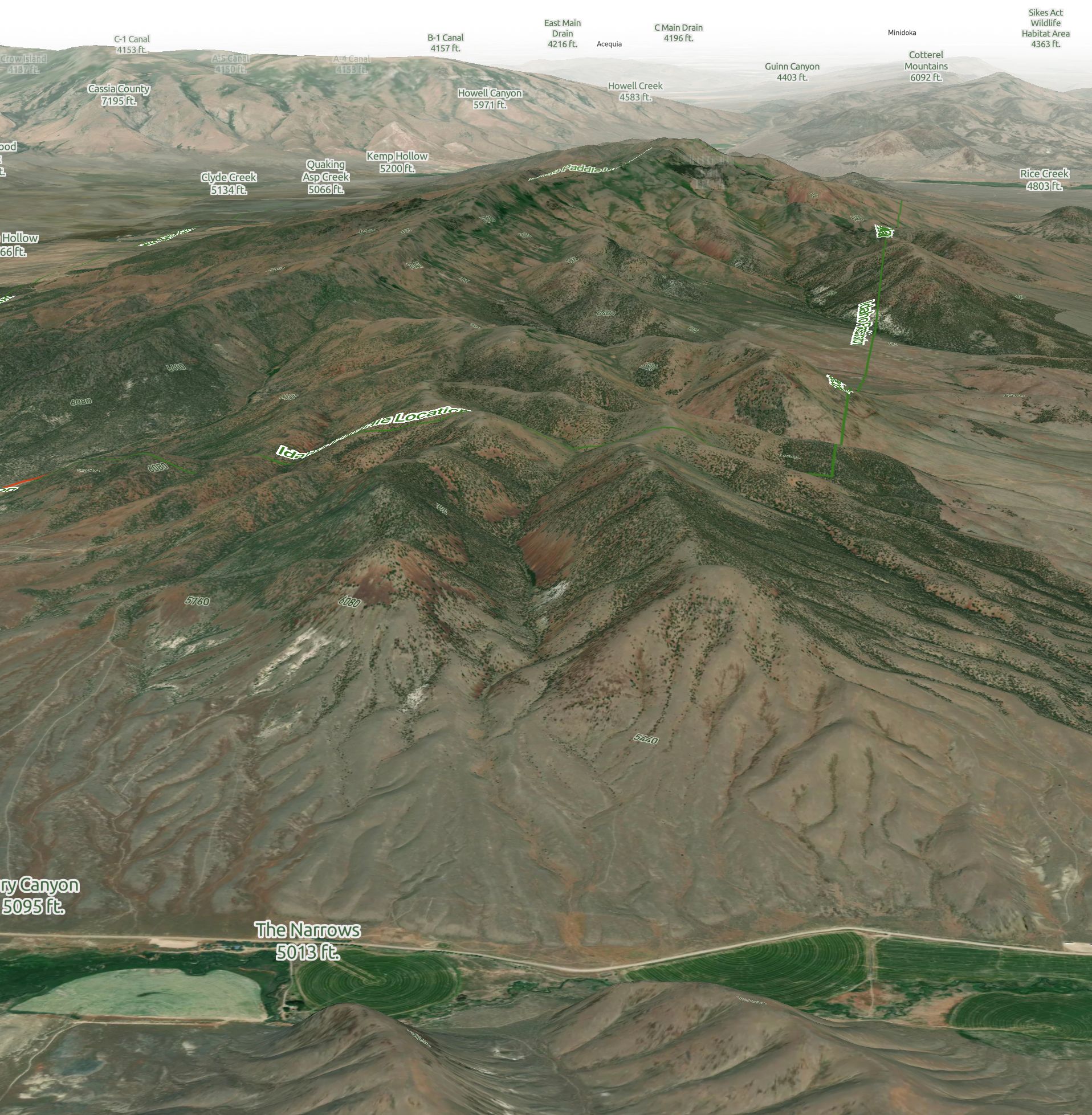
Elba Peak, Jim Sage Mountains
Explanation:
These mountain ranges and nearby towns were named after islands of the Mediterranean Sea, as they were reminiscent of the actual islands due to their basin and range formation.
The Malta range first included both the now separately identified Cotterel Mountains (north) and the Jim Sage Mountains (south).
The Jim Sage Mountains also have a peak named after the neighboring town of Elba, which again, is named after a particular island in the Mediterranean Sea. The actual island of Elba was where the French emperor Napoleon was exiled for a short time.
The southern end of the Jim Sage Mountains is corralled by the Raft River and the Raft River Valley to the east.
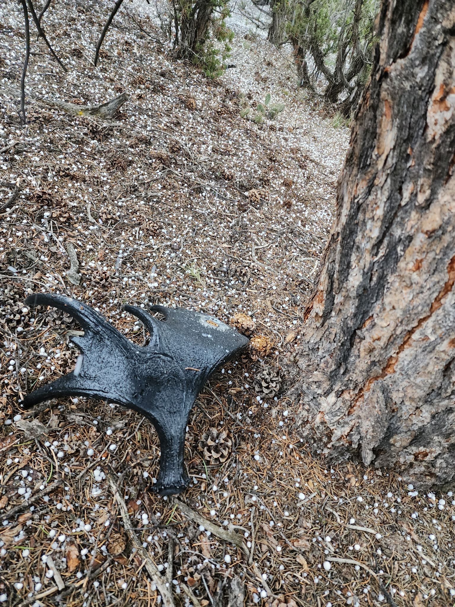
The identification of the Hidden Shed antler was subsequently provided, where one would need a "paddle" (moose shed antler) for the "Raft".
Narrow is the route you'll want take for the easiest path to the $10K cake. No matter the direction you initiate, you'll appreciate the particular canyon road north that deviates. Look for James to substantiate, he's curtate.
Answer
Narrows Rd connects to Jim Sage Cyn road
Explanation:
Once you found the Raft River to the south of the Jim Sage Moutains, you'd find the Narrows Road that follows along with it. No matter which direction you came from, you'd first end up on Narrows Rd before finding your way to the Hidden Shed via Jim Sage Cyn road.
Jim Sage Canyon leads into the Jim Sage Mountains from the south of the range heading north.
Jim is shorthand (curtate) for James.
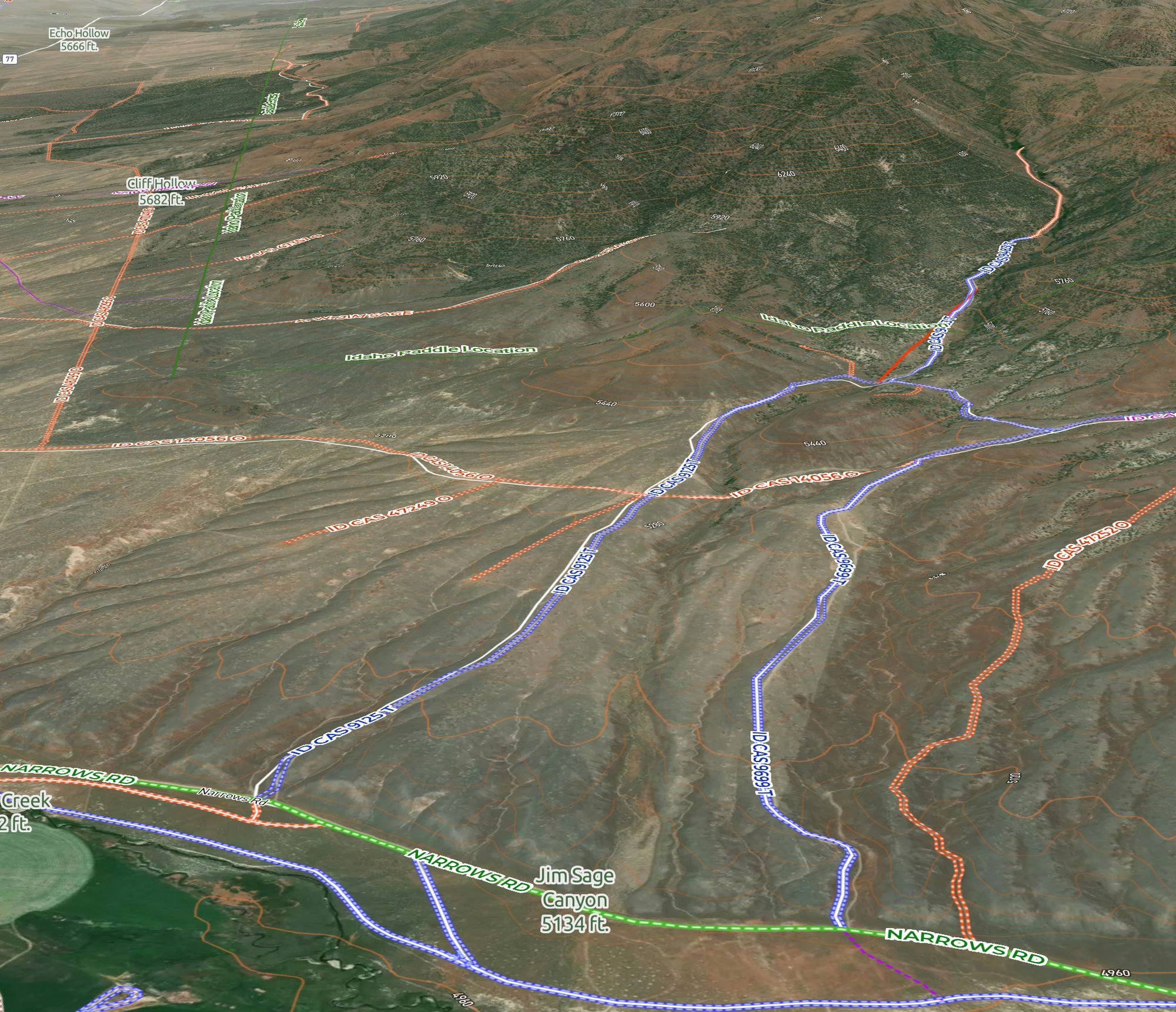
Stay on this road, do not divert. When you come to the fork, stay alert. Left will convert, right will revert. Inert your transport around three-quarters of mile from the fork, then get ready to put your feet on the dirt.
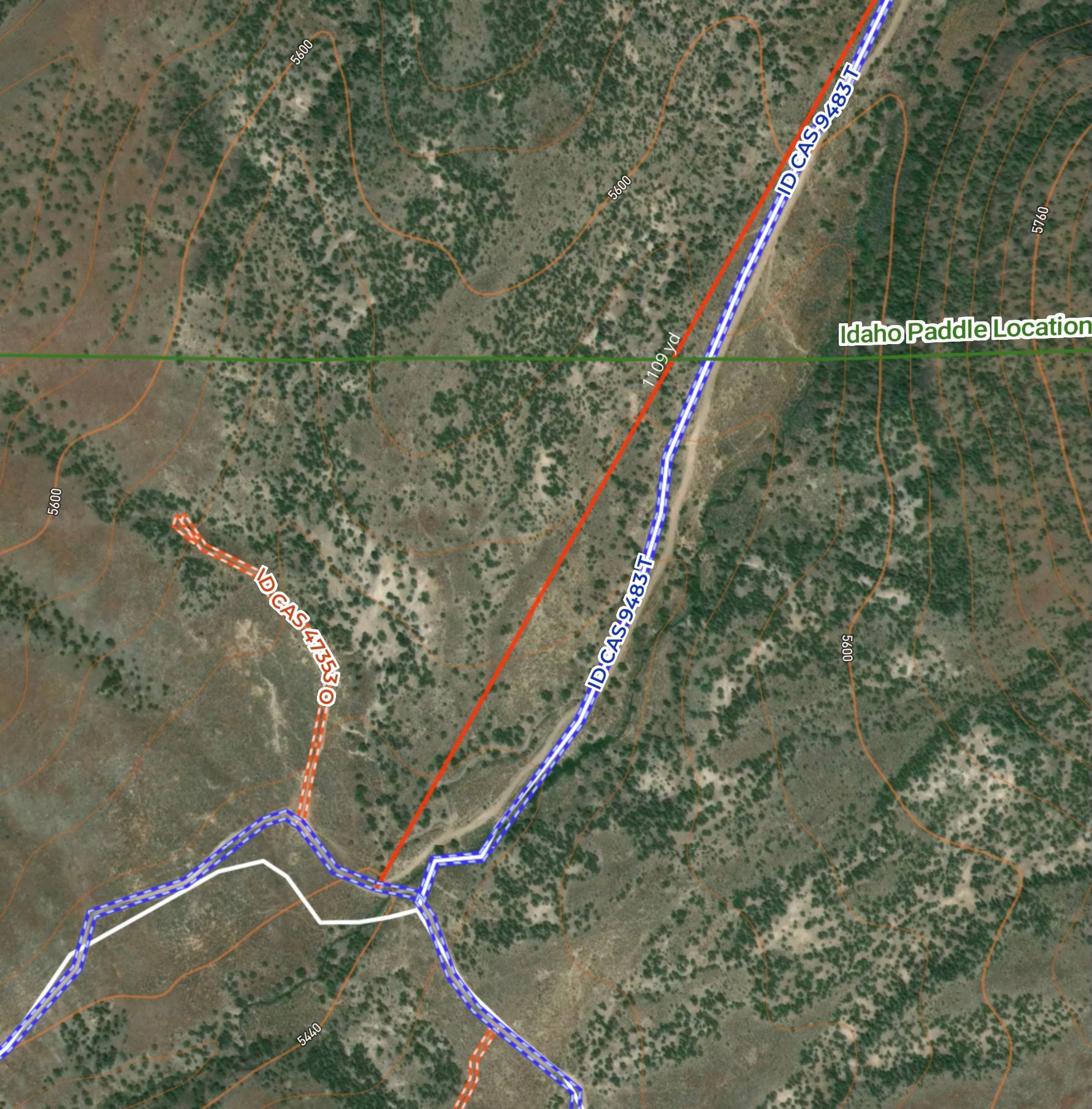
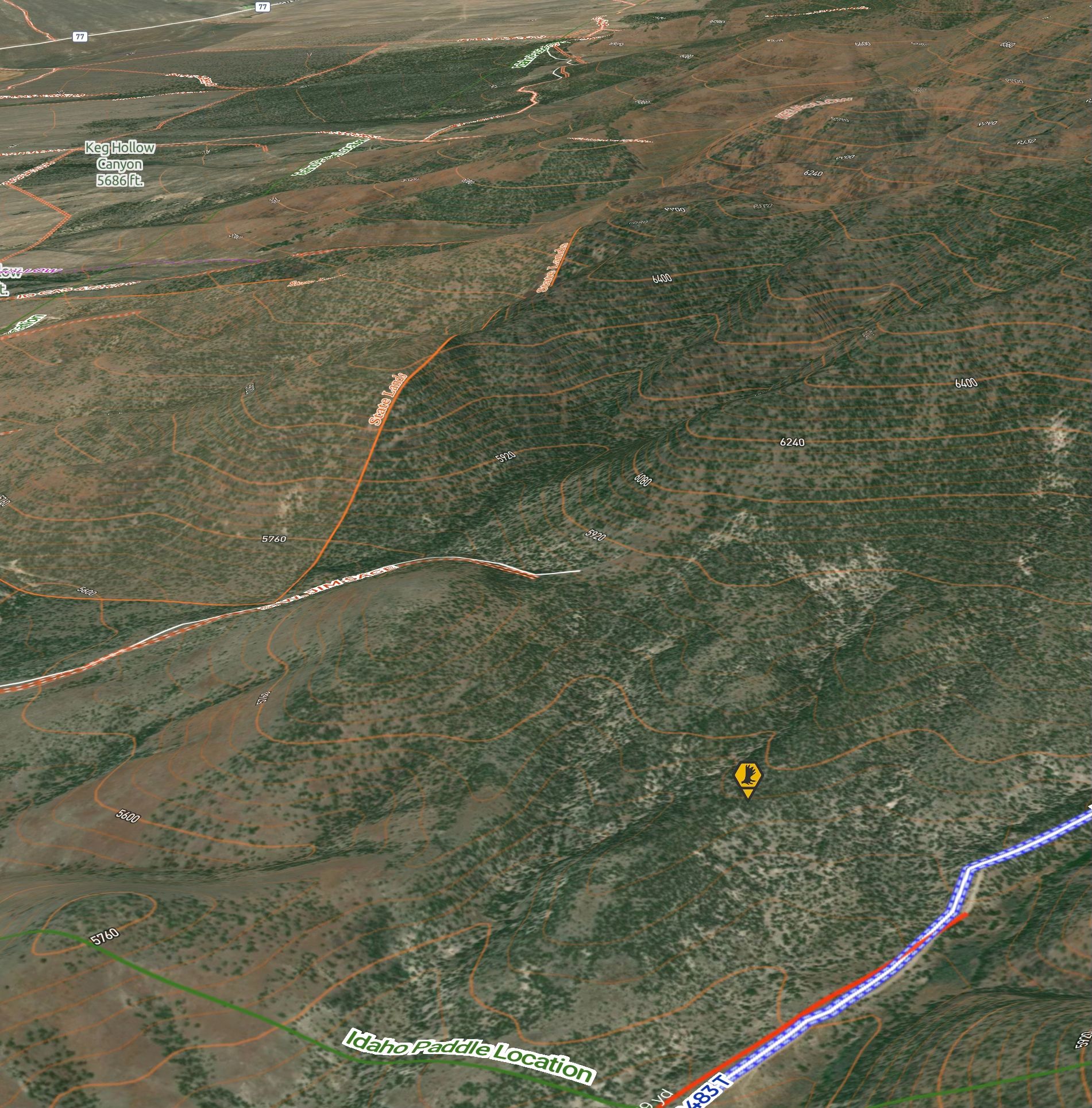
Hike in the direction of terrestrial civilization. If you're nearing the orange land in isolation, you'll feel frustration.
Answer
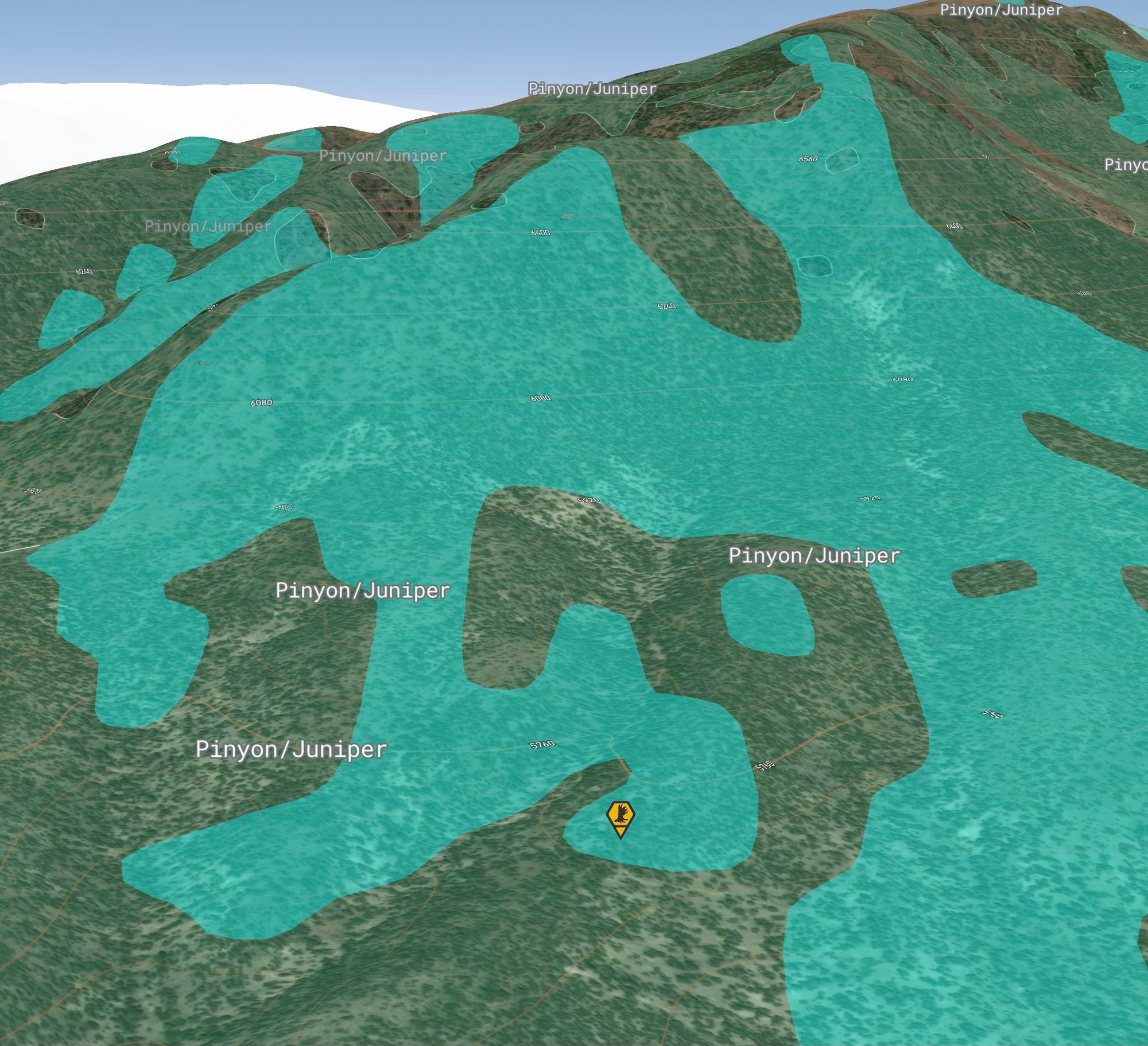
The City of Rocks is directly west from the point of the recommended parking spot. By using the State Land map layer you could identify the range to grid within.
Stay in the shed hunter's color to beat your brother to what we cannot utter.
Answer
South Slopes Map Layer
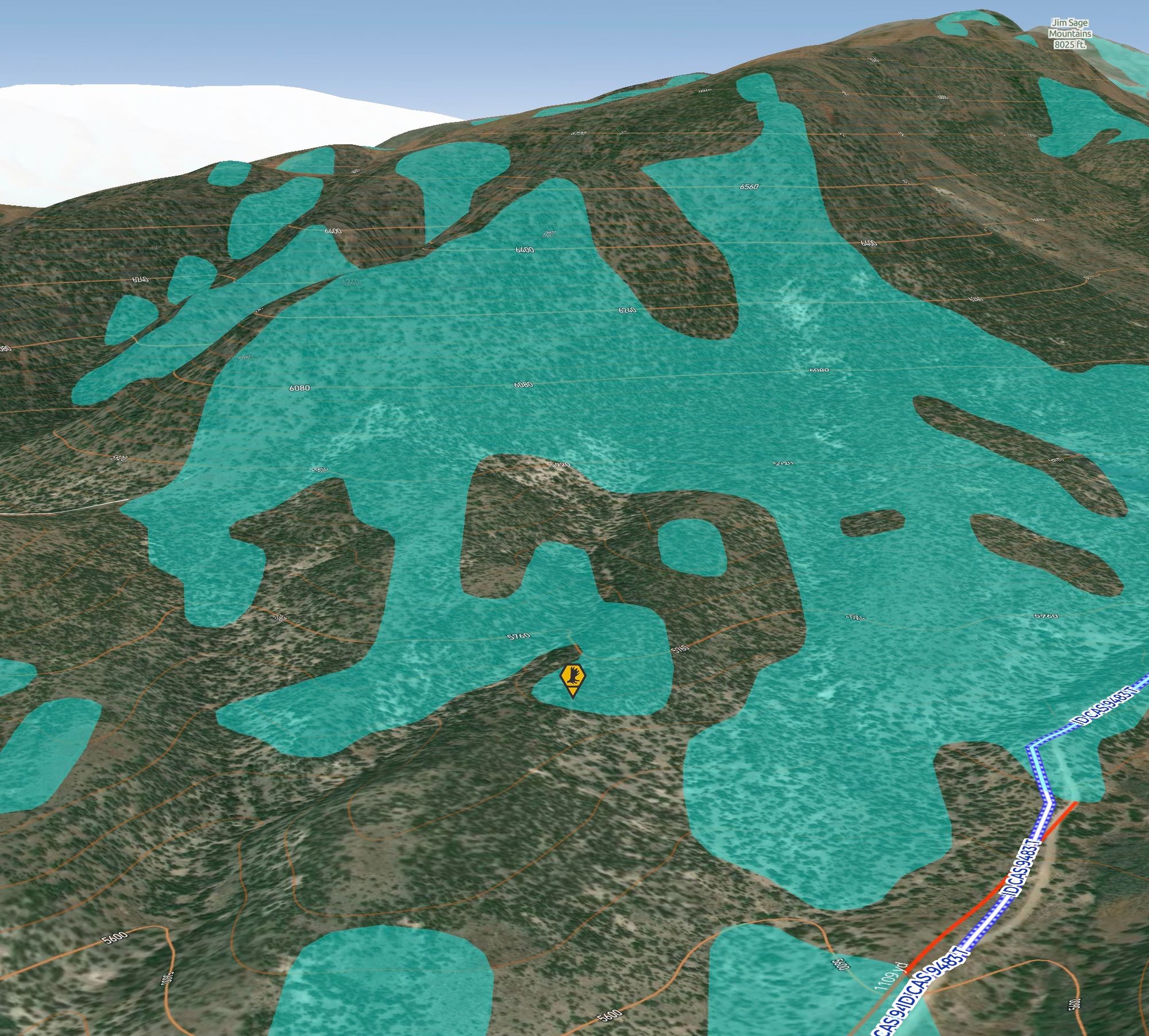
A barren pinyon covers what you seek to discover.
The question ahead, where is the next Hidden Shed(s)?