2024 Idaho $10K Hidden Shed Riddle and Hints Breakdown
To view the location of the Idaho $10K Hidden Shed on your map copy and paste the following coordinates into the Scout To Hunt App:
Remember your abdication by their indication and acknowledge these three for active mitigation and the last one for manual regulation.
Answer
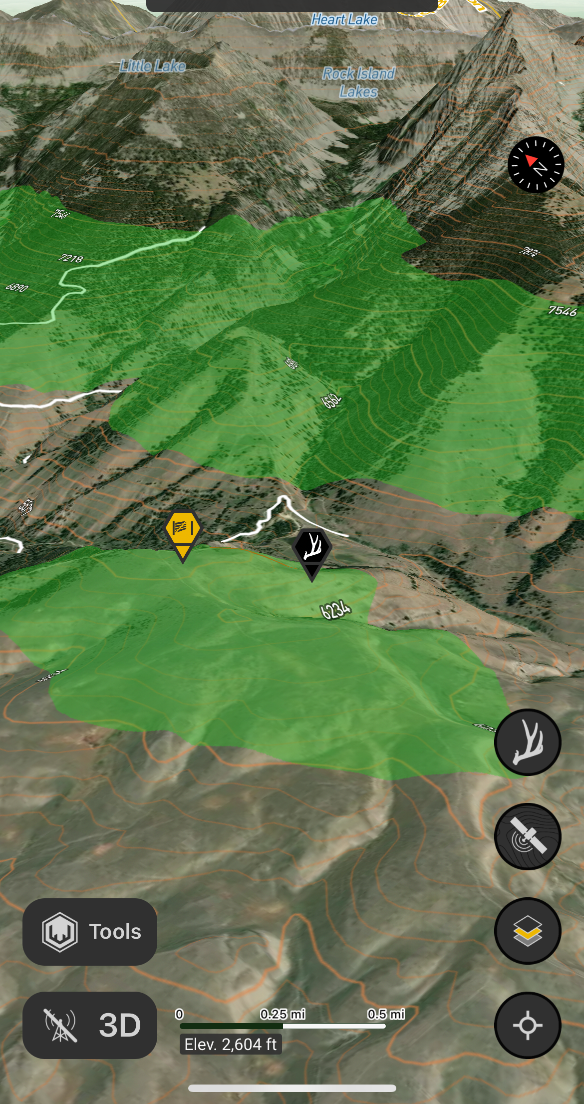
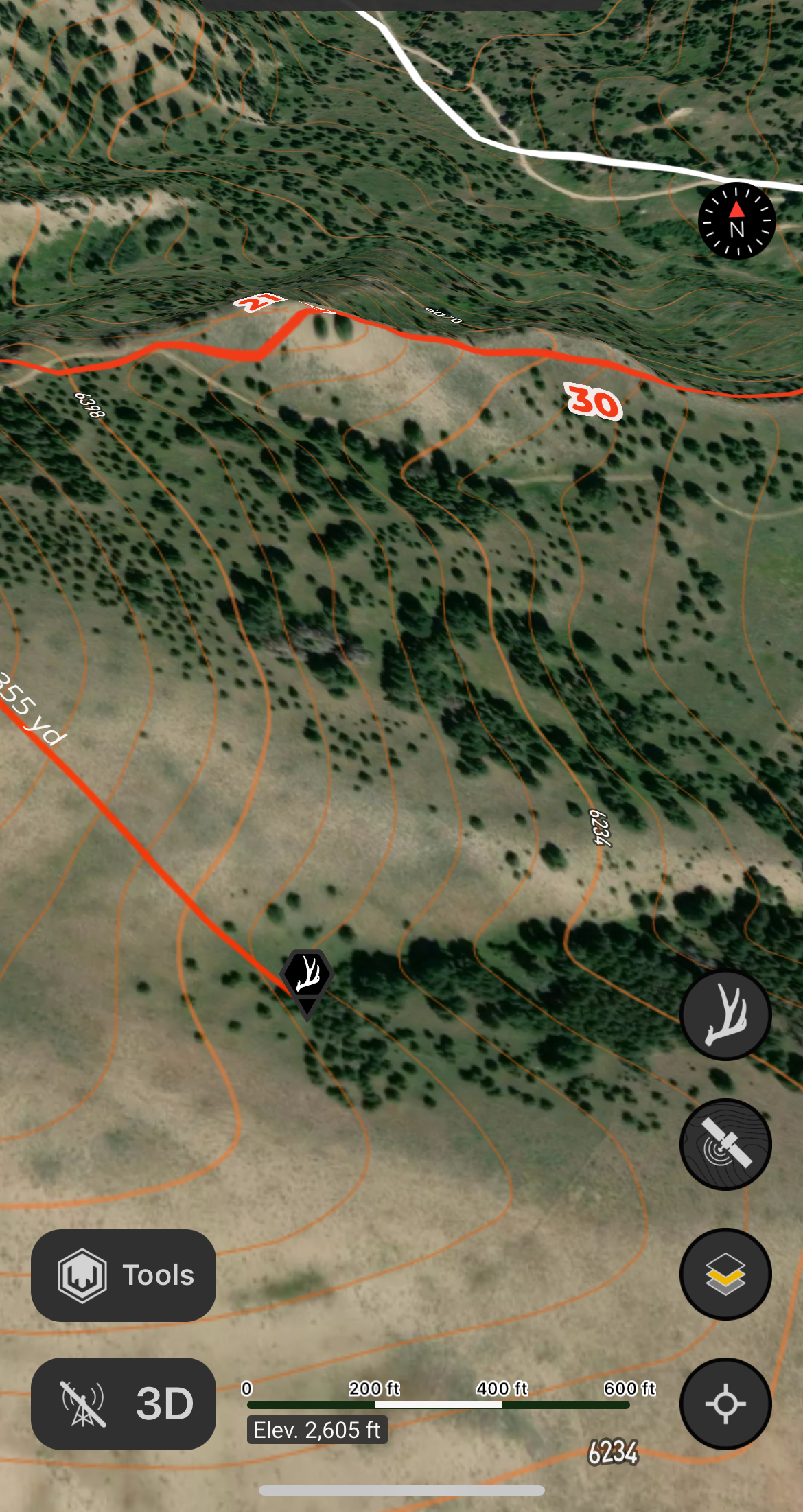
The three BLM Cattle guards found along Sagehen Flat road up to Trail 138, and the cattle gate on Trail 138 as you cross into Unit 30.
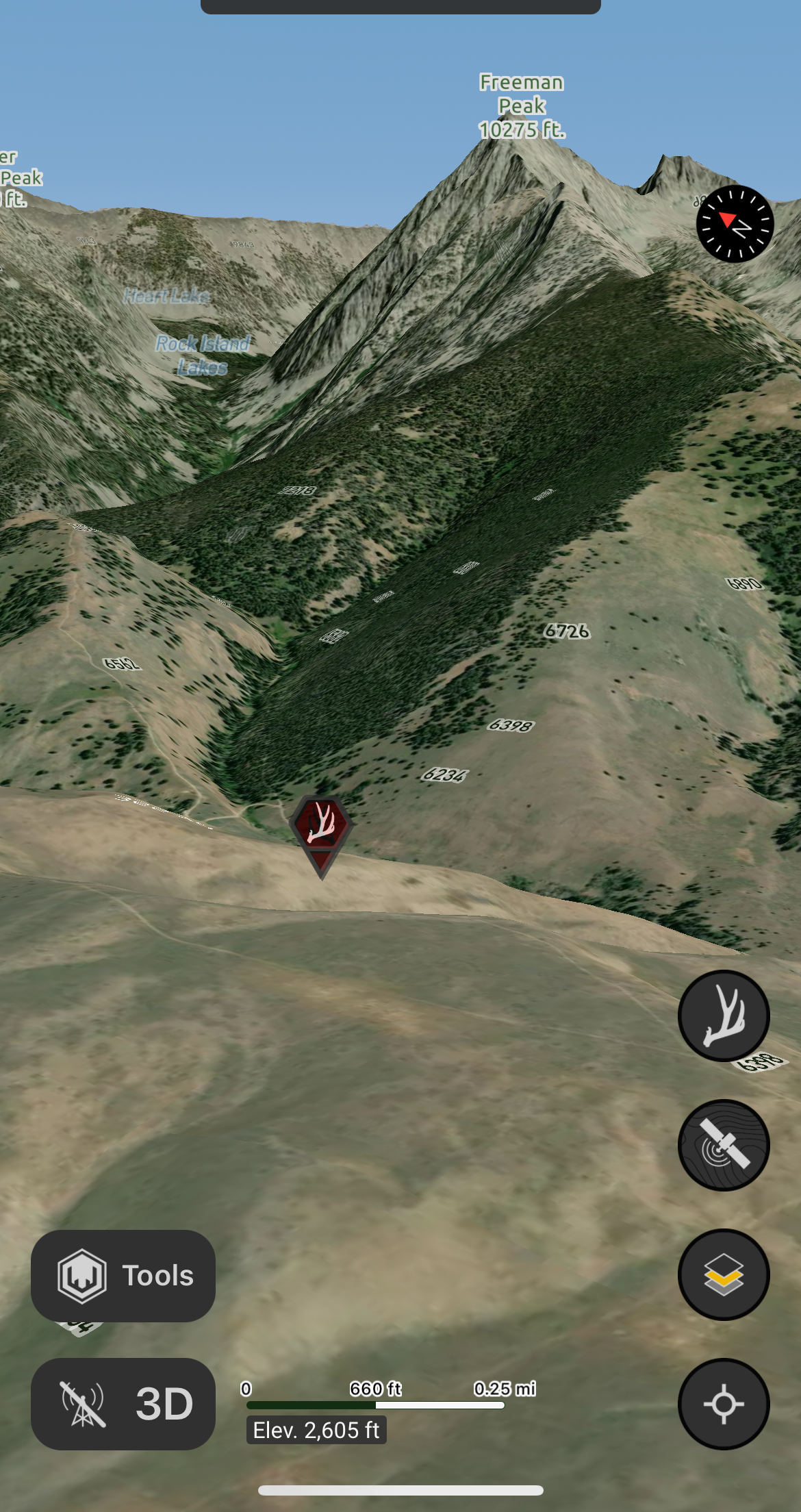
Descend by foot to face the Natural notion above. A motion against the rule whereof.
Answer
Freeman Peak; descending into the draw near the location of the Hidden Shed faces you towards Freeman Peak.
Explanation:
Playing on the word "Free man", the natural (Natural Law) notion of liberty/inalienable rights.
Diplomatic dispute, loot, and pursuit, and reuse to fruit is the root of this pervasive repute.
Answer
Fort Lemhi; Lemhi County
Explanation:
The attack on the fort as a result of tensions with natives, and later the reoccupation of Fort Lemhi by miners that utilized it to grow and sell food.
The experimental fusion in place of confusion, notable profusion is the conclusion at the hand of the institution.
Answer
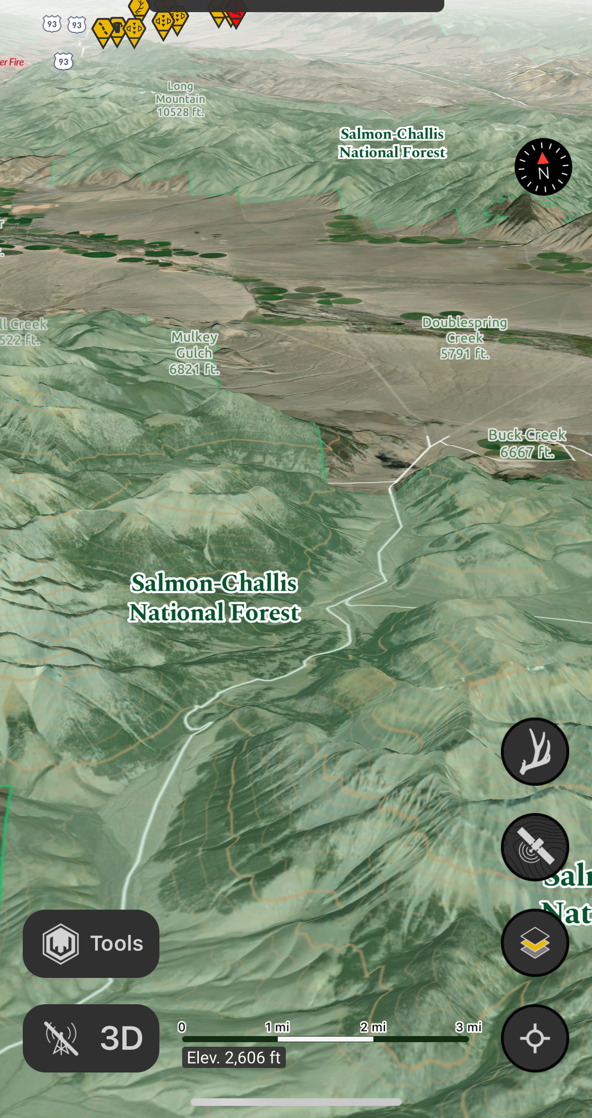
Salmon-Challis National Forest
Explanation:
With a slight red herring with the use of 'fusion' (Arco), the real answer was the the merger of Challis and Salmon national forests to improve bureaucratic administration of the forest service. Although, either answer would have put you in the general area.
Least resistance, reminiscence of persistence and assistance for a distance.
Answer
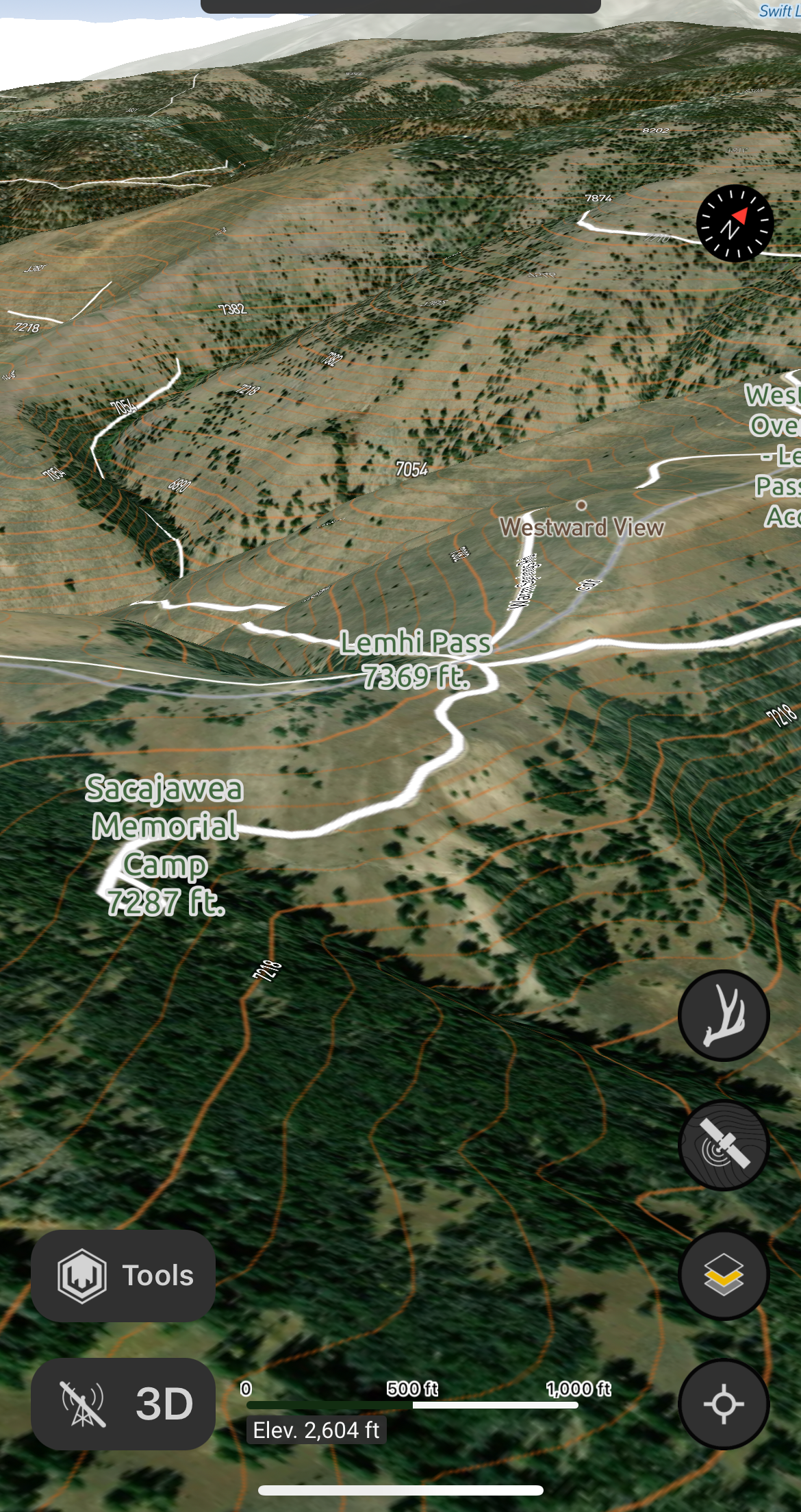
Beaverhead mountains/Lehmi Pass
Explanation:
A pivotal point of progress on the Lewis & Clark expedition, where with the guidance of the Shoshone natives they were able to continue forward.
The prime passage for advantage, warned of damage complete. But old friends would meet to eat.
Answer
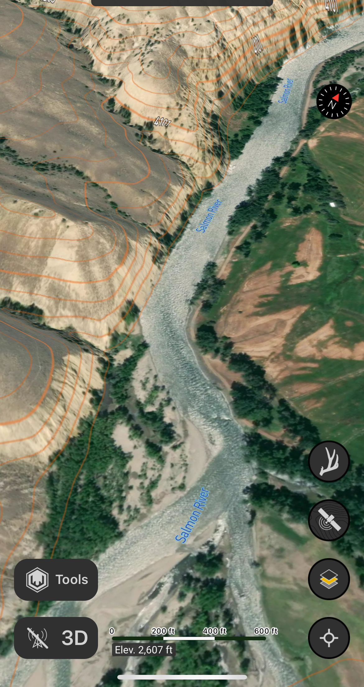
Salmon River
Explanation:
"But Cameahwait and the other Shoshones ruled out the Salmon as a way to the Pacific because of its rapids and canyons, which eliminated travel either by boat or on horseback. A better, but still difficult, route was the one taken by the Nez Perce Indians over the Lolo Trail, whose eastern approach was reached via the Bitterroot Valley.
Yet, being determined to see the ruthless river for himself, William Clark hired a Shoshone guide known as Old Toby and they left the party on August 21, 1805. That first night camping near the Salmon, Clark was impressed with the size and beauty of the river. But two days later, he came to the conclusion the river was truly impassable."
The Mountain Shoshone (sheepeaters), Nez Perce, and Flathead indians fished and traded on the Salmon river for many years.
This family of five, but by one some contrived the point of inflection with their connection.
Answer
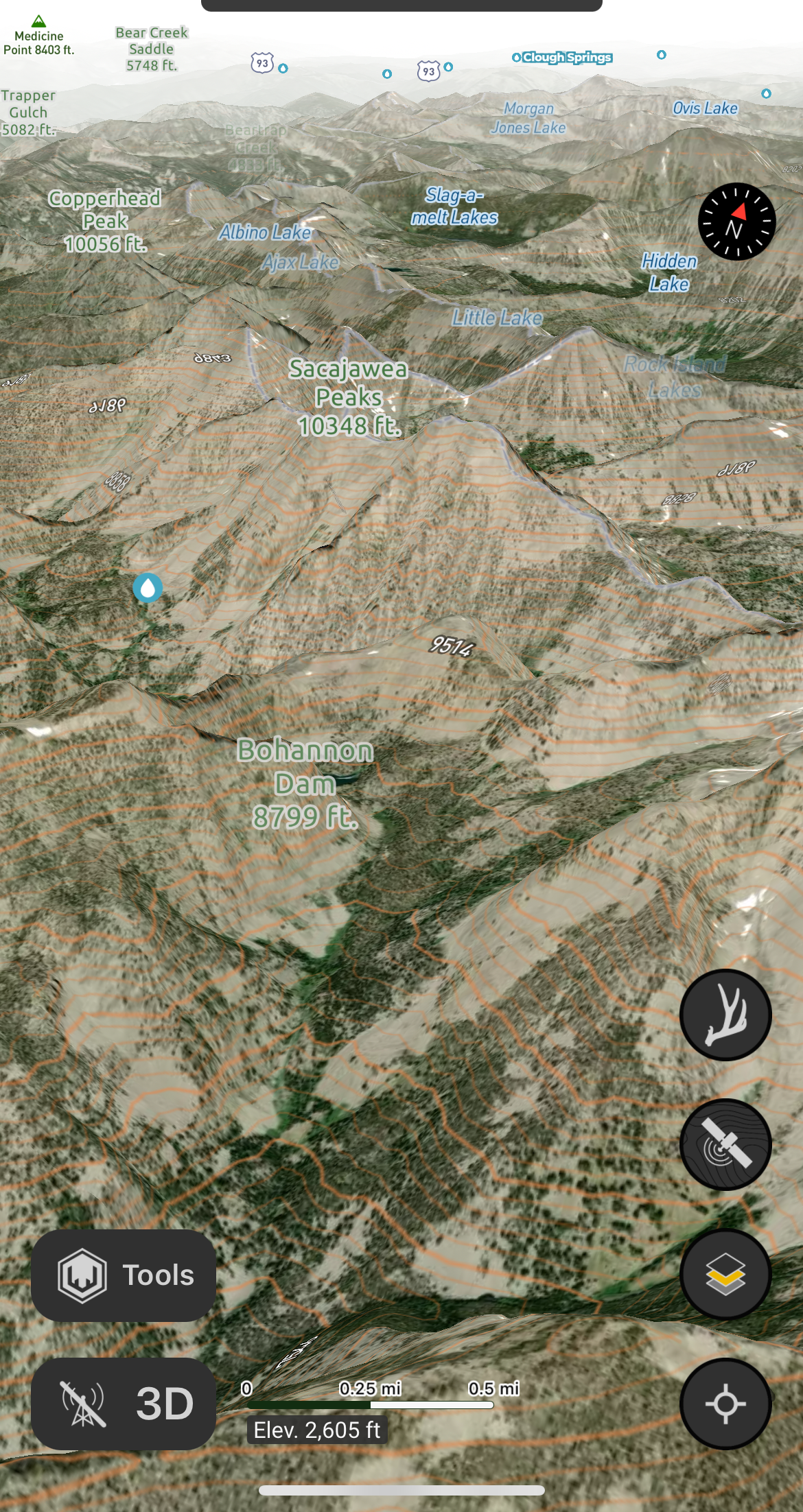
Bitterroot range: Beaverhead mountains
Explanation:
The Bitterroot Range includes five subranges:
Coeur d'Alène Mountains
Saint Joe Mountains
Bitterroot Mountains
Beaverhead Mountains
Centennial Mountains
The Beaverhead Mountains is home to Lemhi Pass, an additional reference to Line 5 of the Riddle, where Lewis & Clark made connection to the west of the continental divide through Sacajawea's connection to her family.
Some call this all a big bluff, but we really do hope you discover more than just stuff.
Answer
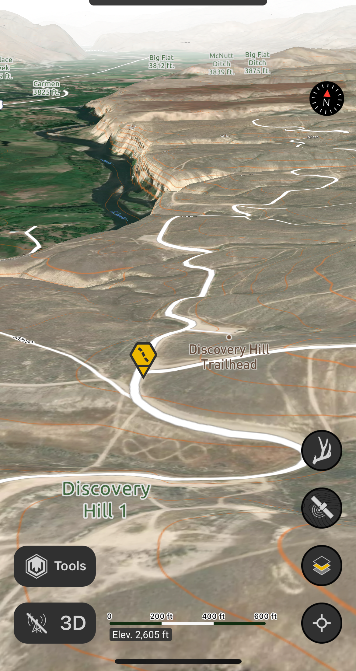
Discovery Hill
Explanation:
"Bluff" is another word for hill. By being out there we also hoped you'd find more than just the $10K Hidden Shed, but everything else the beautiful country has to offer, including real sheds 😎.
Hints Key: Shed Hunts
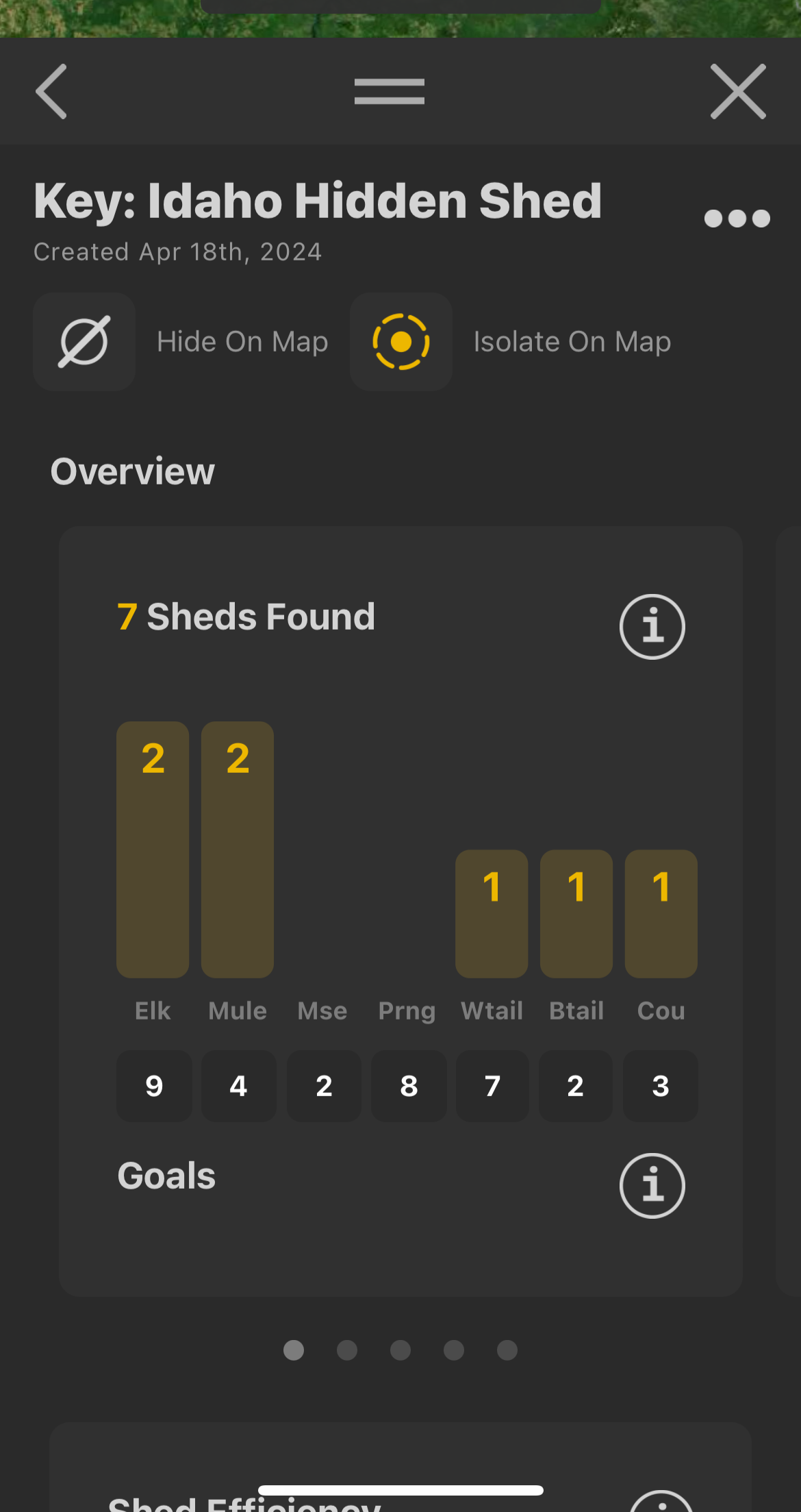
By creating a Shed Hunt for all of the provided Markers, you get a revealing key of information about where the Hidden Shed was located.
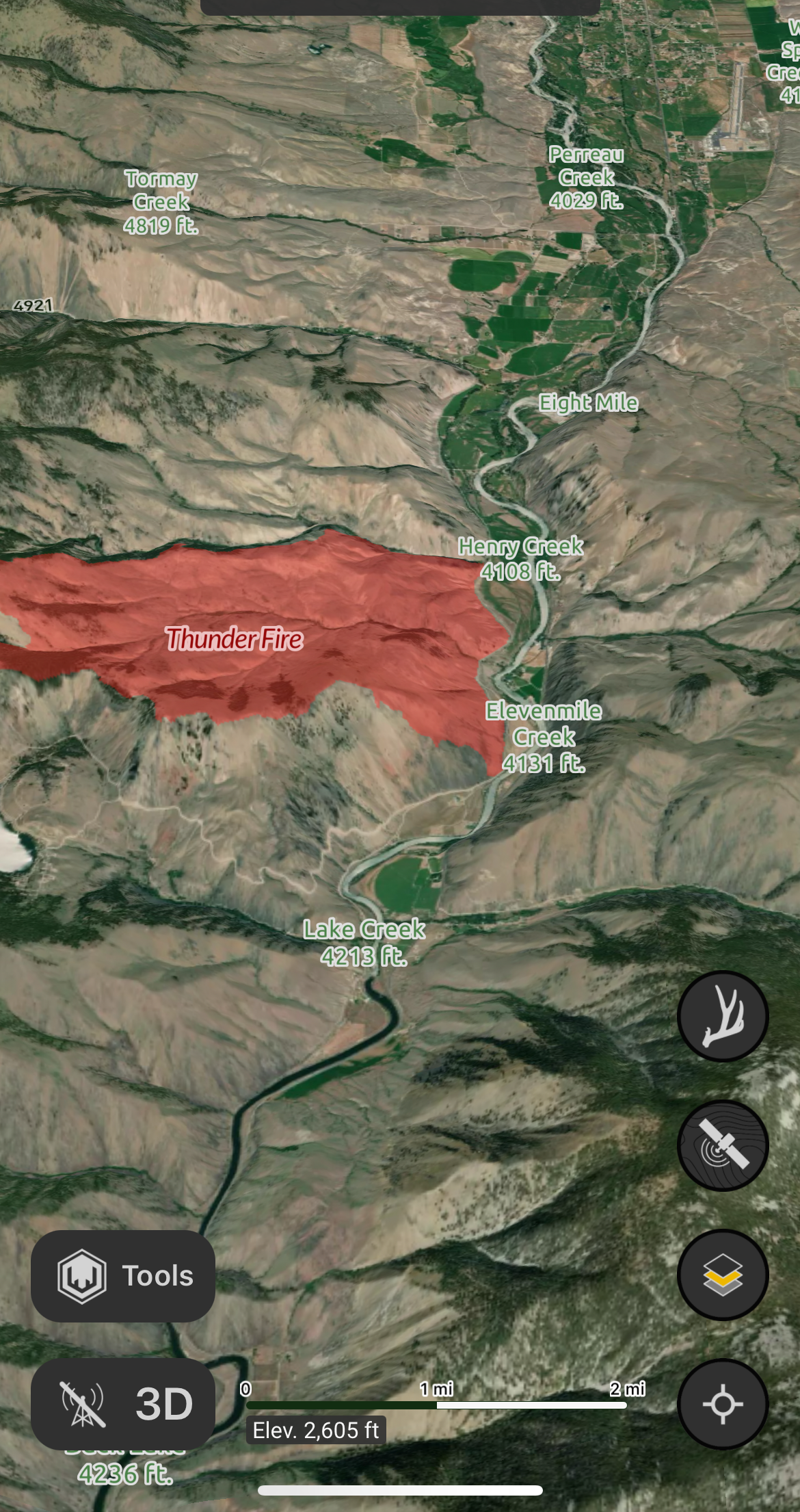
State Highway 28
The goals values without any sheds in the chart hint at State Highway 28's proximity to the Hidden Shed.
State highway 93
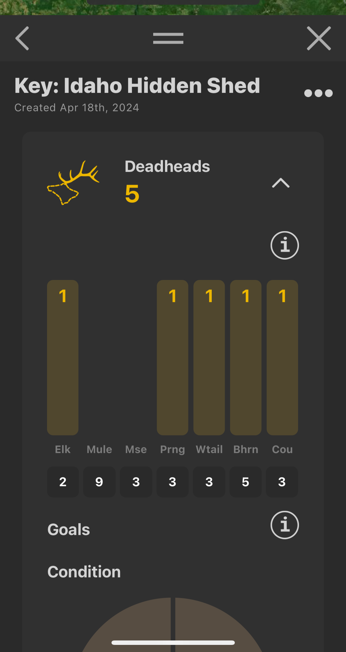
The Deadhead goals values without any deadheads in the chart hint at highway 93's proximity to the Hidden Shed.
Deadhead names:
All were lost | without each other, | connections | that discovered | and recovered
As a result of meeting and aiding Lewis and Clark, Sacajawea was able to reunite with her family from which she was taken at a young age. This timely familial connection opened the door for Lewis and Clark to pass through Lemhi Pass and receive the guidance they needed to continue their expedition.
Correct Species
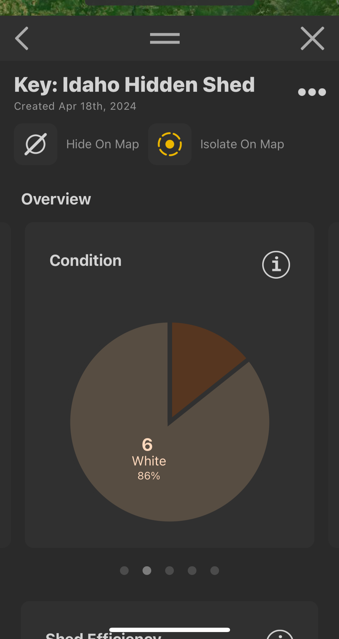
Only one Shed Marker was labeled as brown, to indicate which shed antler you should be looking for, which identifies the species that should be selected for the respective map layers.
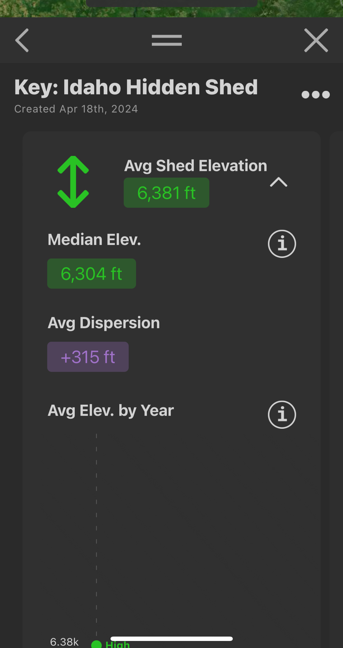
Average Shed Elevation
The Shed Hunts features conveniently figures the average elevation of all the Shed Markers you added to the Shed Hunt. This Average Elevation value matches the elevation of where the actual Hidden Shed was located.
This also reveals the correct Elevation Band color that should be used to visibly narrow down possible locations for the Hidden Shed on your map with the Elevation Bands map layer.
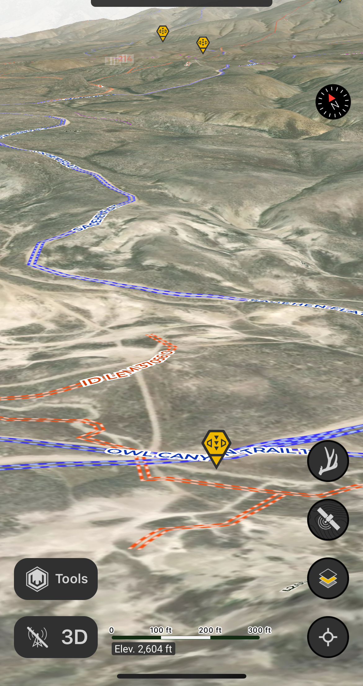
Distance from Nearest Road
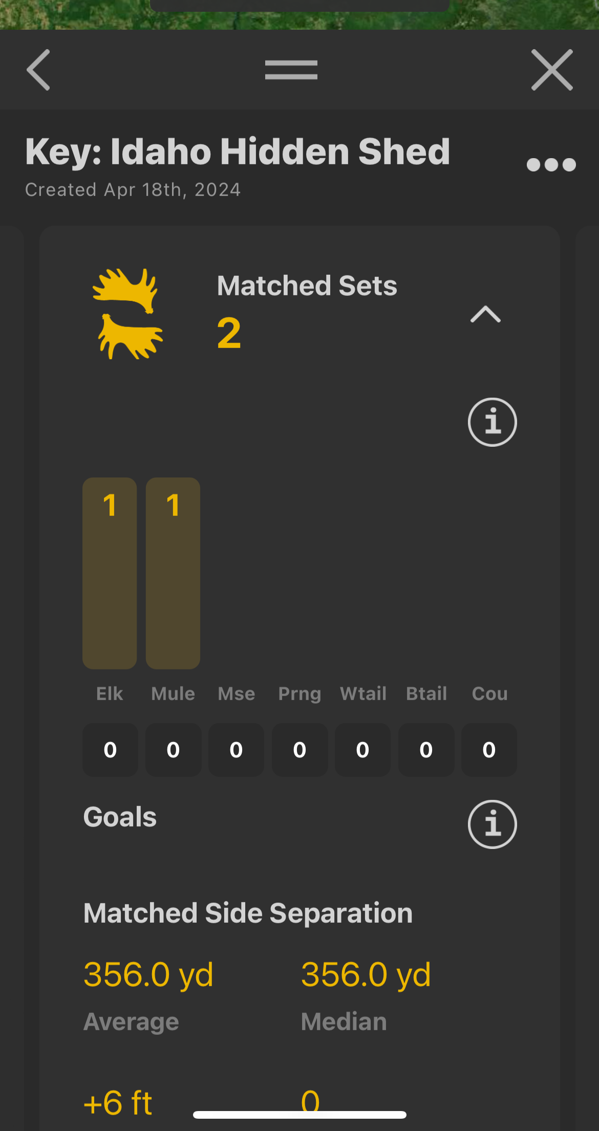
The distance value of the Matching Sets of Shed Markers indicates how far to hike from the nearest road to the location of the Hidden Shed.
County Founding Dates
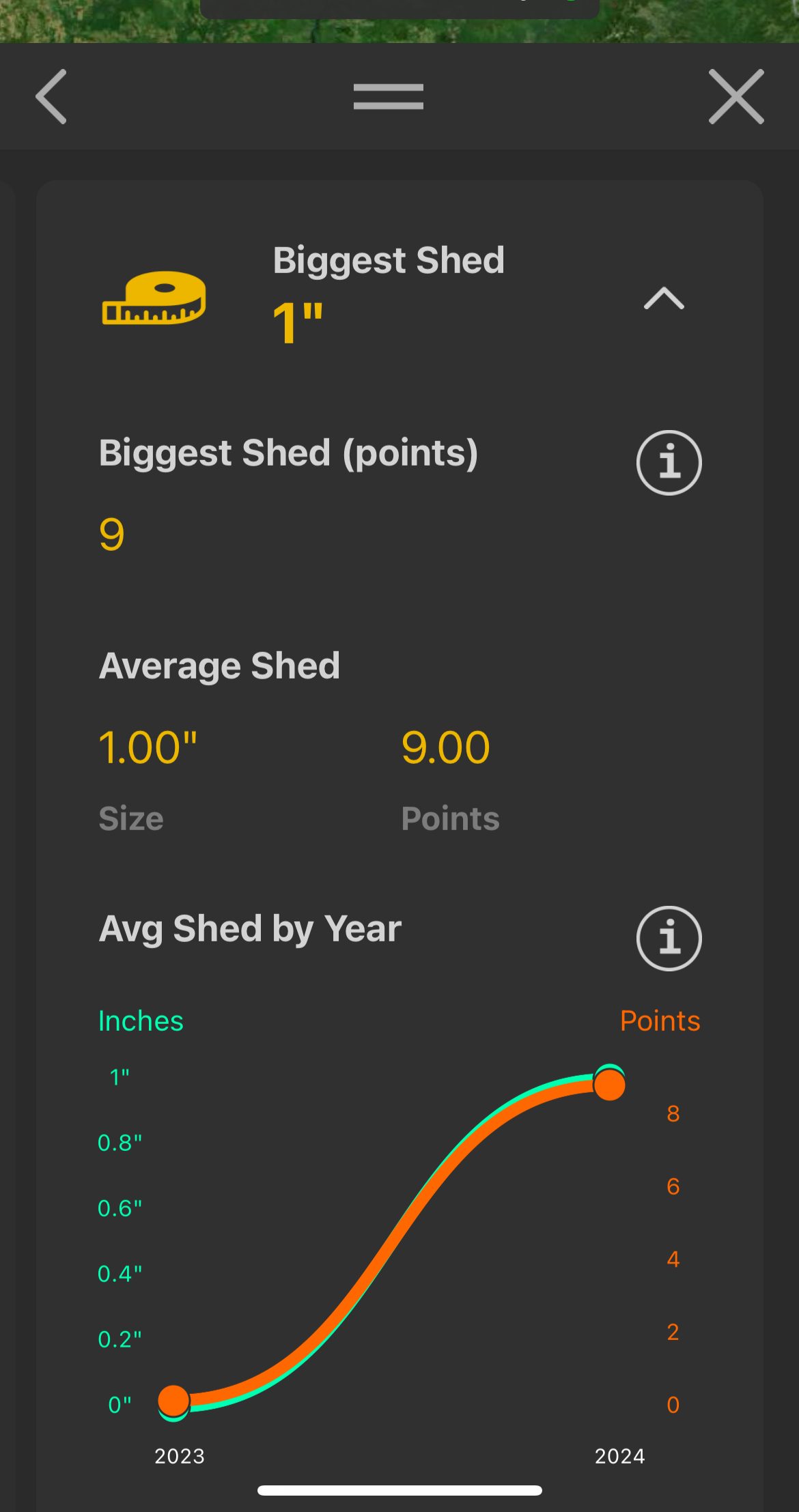
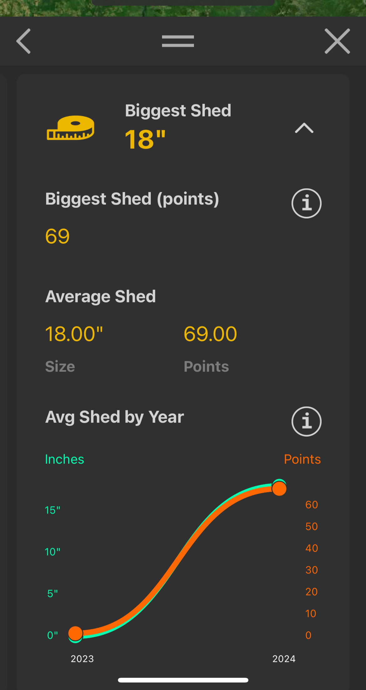
Each Matched Set of Shed Markers had additional Size and Points values. In the Shed Hunts, these are more easily read in the correct order with the Biggest Shed stats for each species that had a matching set.
Mule Deer Biggest Shed stat:
1, 9
Elk Biggest Shed stat:
18, 69
Or
1/9/1869 - Lemhi County
Hints Key: Map Layers
GMUs
The following hunt units had Shed Markers placed in them:
16
14
By adding these together you get 30, in reference to Unit 30 where the Hidden Shed was located.
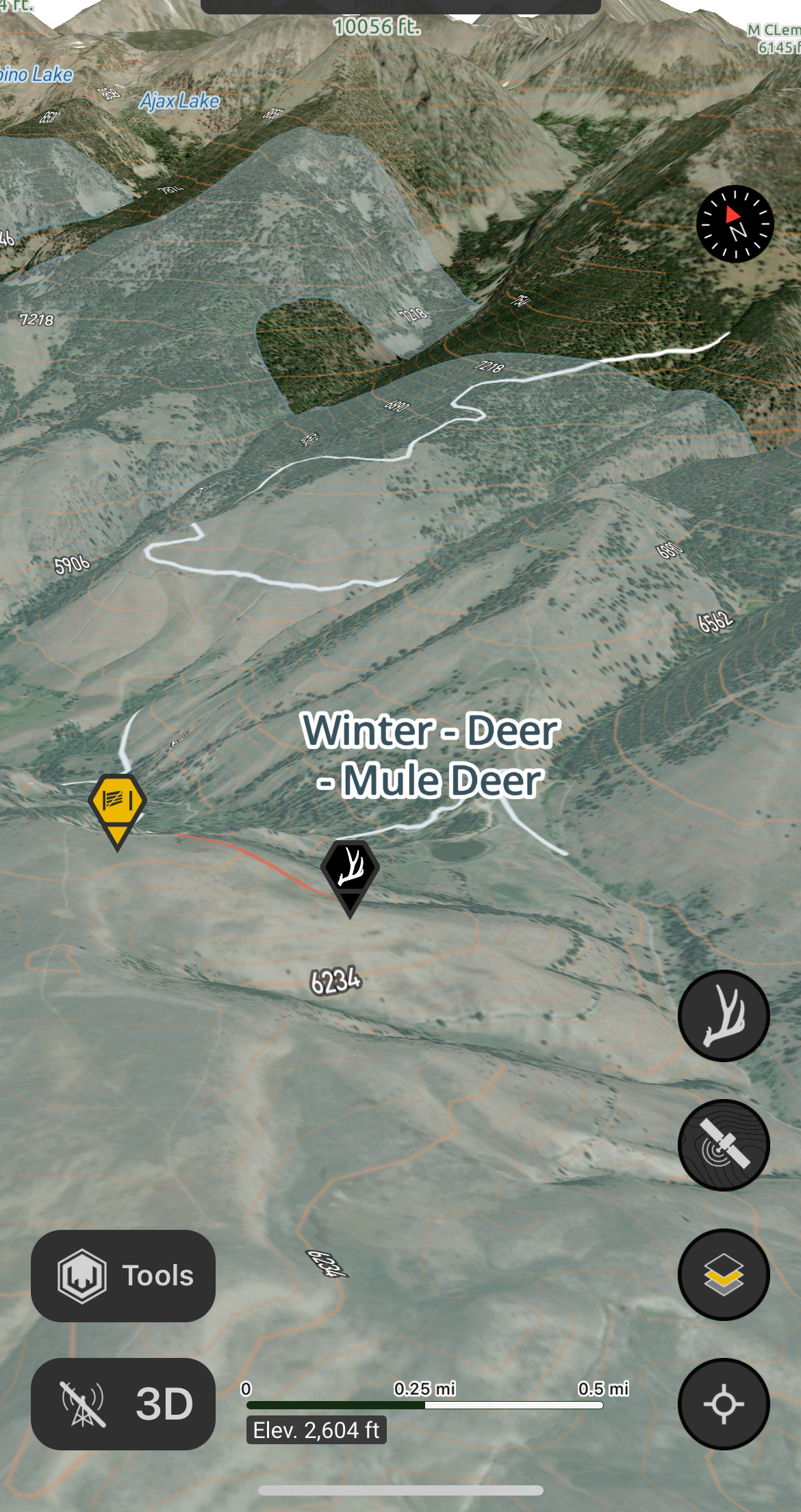
Winter Range - Mule Deer
The Hidden Shed was located in the Mule Deer Winter Rage (Game Ranges Layer). Consequently, the provided Shed Markers were all located in the Mule Deer Winter Range Layer.
East Slopes
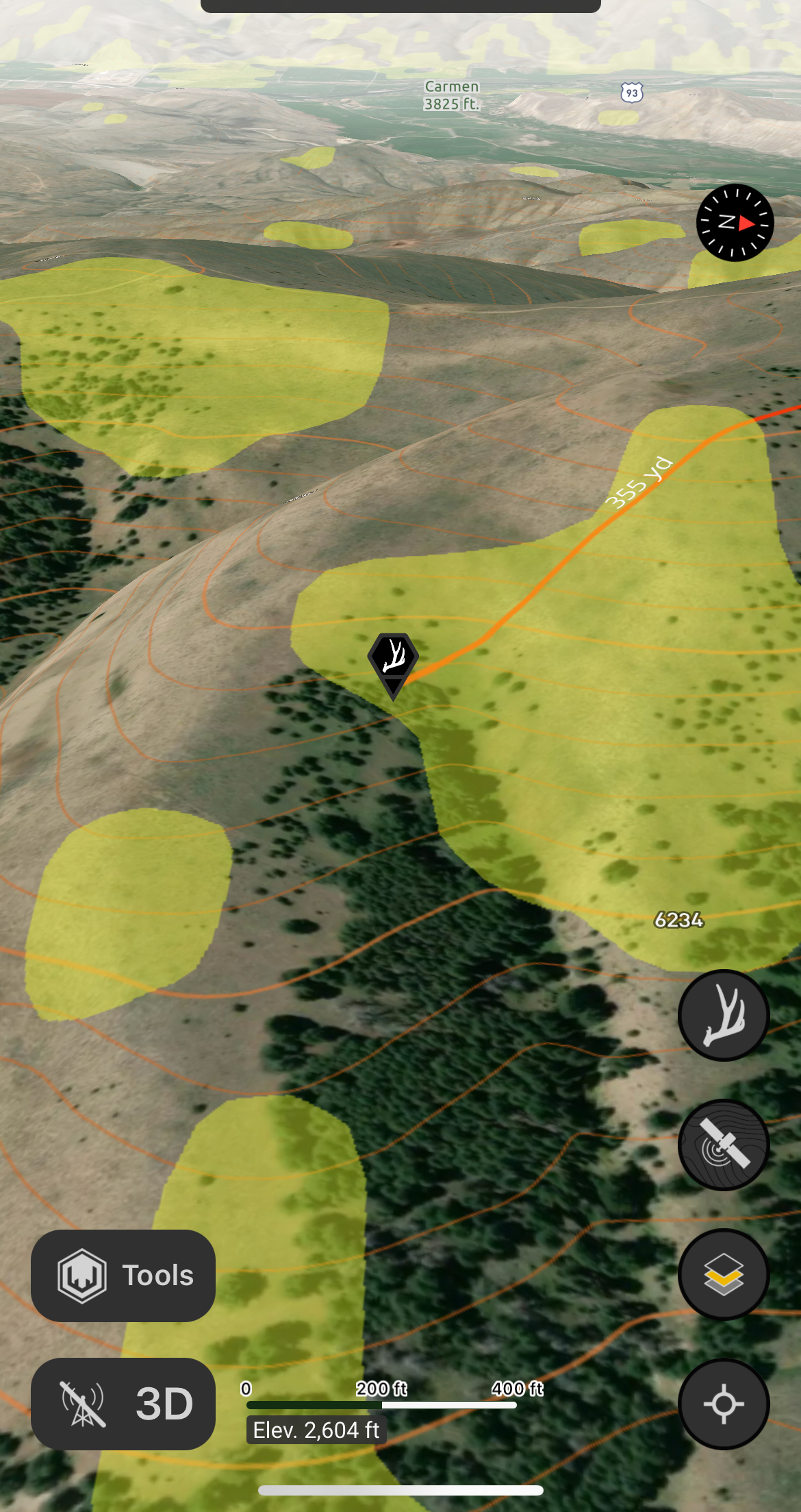
The Hidden Shed was located on a East-facing slope (Slopes Layer). Consequently, the provided Shed Markers were all located on the East Slopes layer.
Elevation Bands
In conjunction with the Average Shed Elevation value and color, the Elevation Bands layer highlights the Elevation Band the Hidden Shed was placed on.