$10K Hidden Shed Riddle Breakdown - Utah
To view the location of the Utah $10K Hidden Shed on your map tap on this link from your mobile device:
Or copy and paste the following coordinates:
Note the edge of what is contained. Stay on that side, which explains what sustains generally fails to remain.
Answer
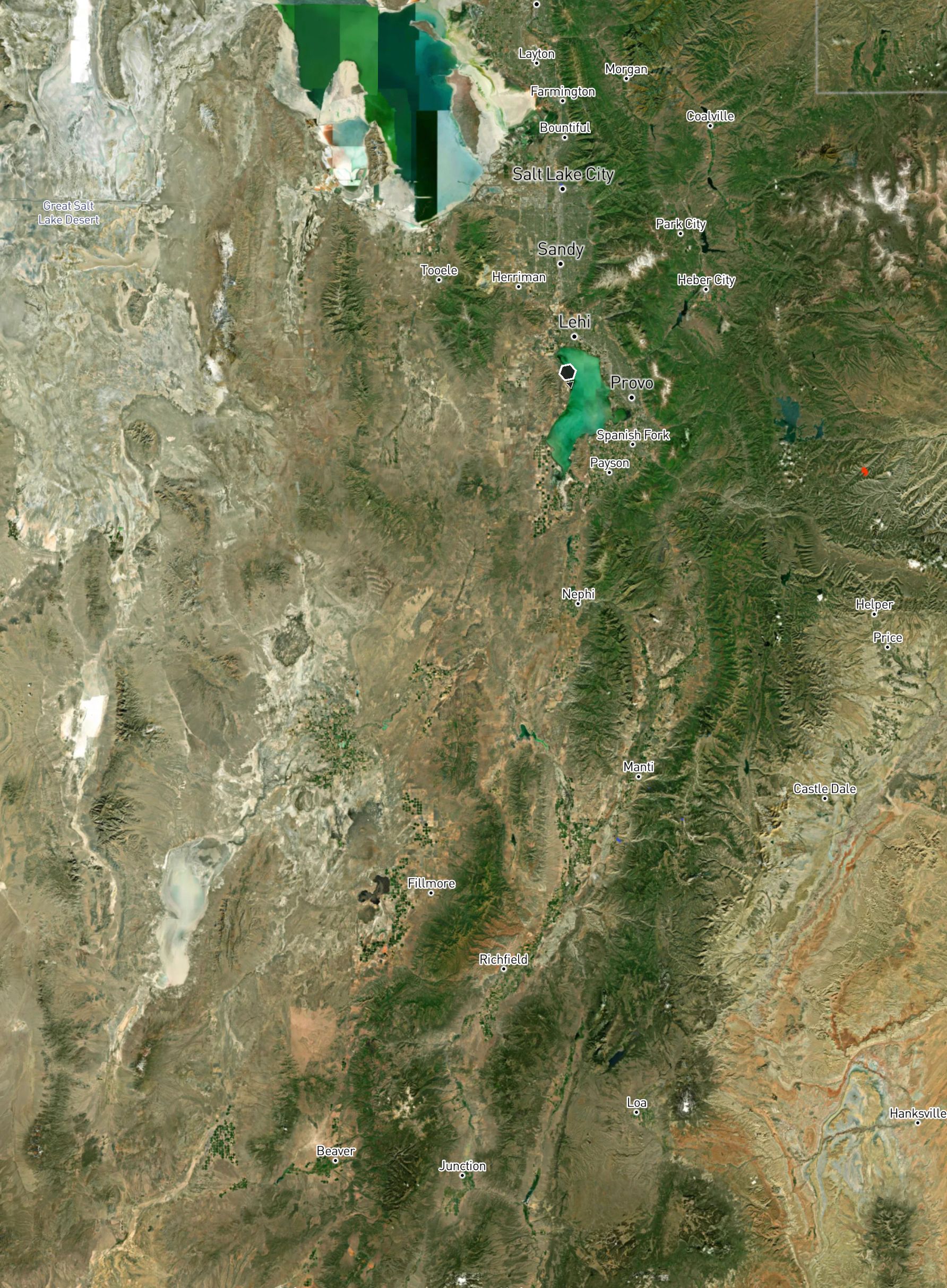
Great Basin, left of Wasatch Range
Explanation:
Water collected by the Great Basin does not flow out, it tends to evaporate or sink. The Wasatch range lines the eastern edge of the Great Basin.
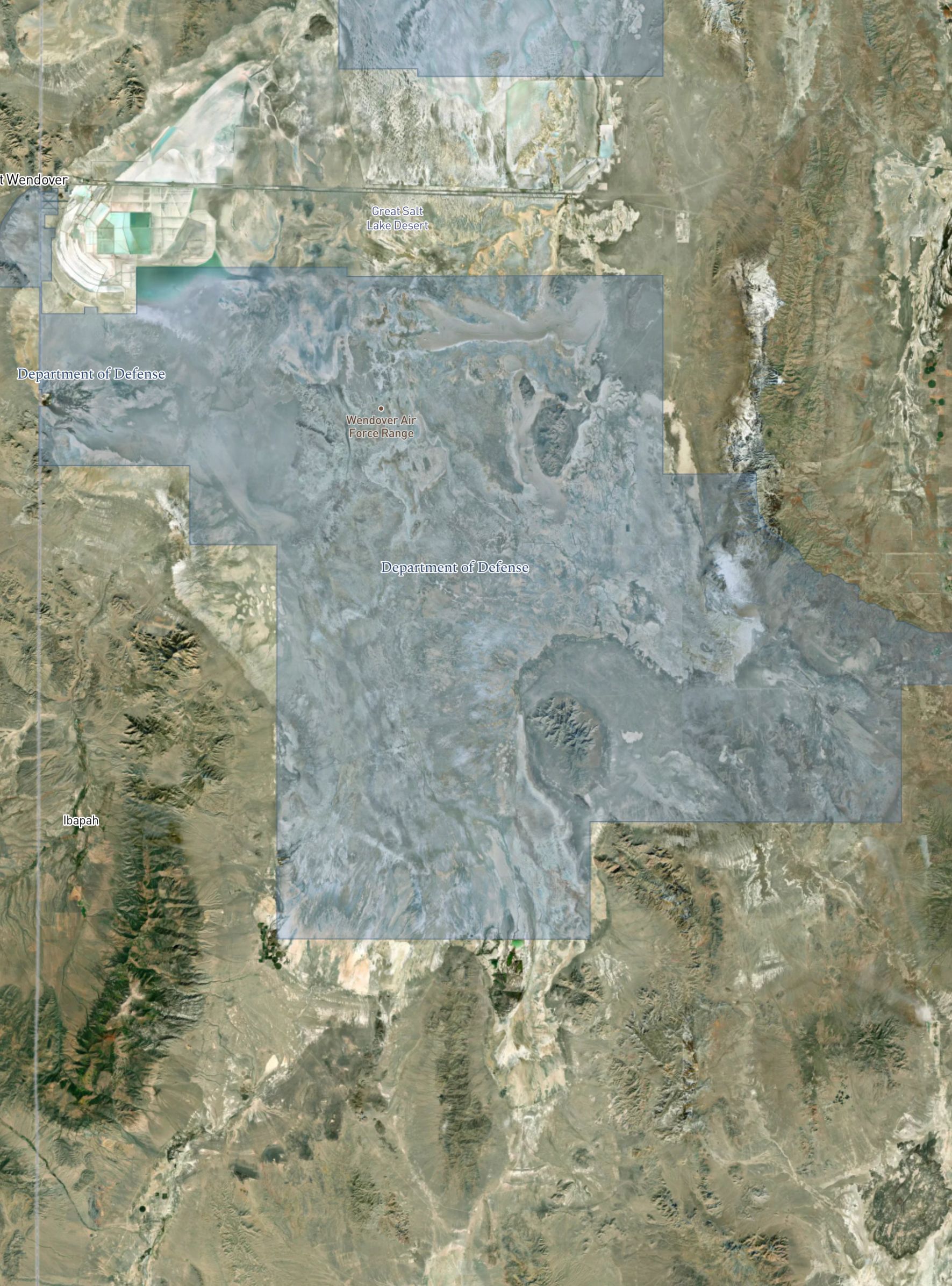
To calm your nerves, recall the herds that were observed to be disturbed.
Answer
Dugway Sheep incident or Skull Valley sheep kill around the Dugway Proving Ground.
Explanation:
In the late 1960's, Nerve Agent VX was linked to the deaths of local sheep herds around the Dugway Proving Ground from military testing in the area.
A confirmation of which side of the Wasatch range to focus your shed hunting.
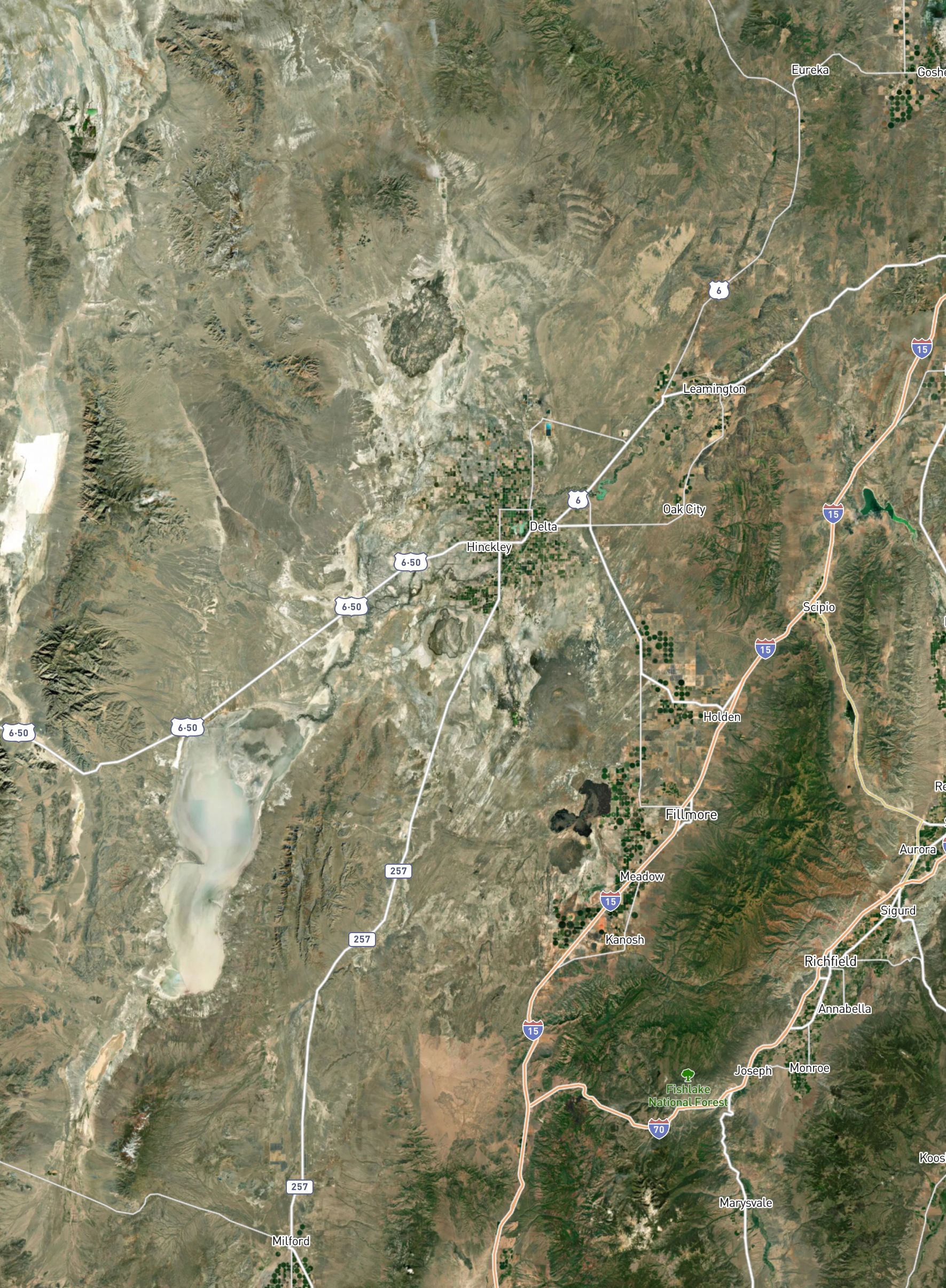
You can seek where ancient land was amassed into the vast old bath, where small waves are still seen if you are keen.
Answer
Delta, Utah
Explanation:
The town of Delta is named after its geographic relation to the delta of Lake Bonneville.
Delta is also home to the Cosmic Ray Center. Cosmic rays have short (small) wavelengths at high frequencies. You have to be really smart to "see" them. We haven't seen them.
Notice the prior proficiency in the face of deficiency, sufficiency attained by efficiency despite the stringency.
Answer
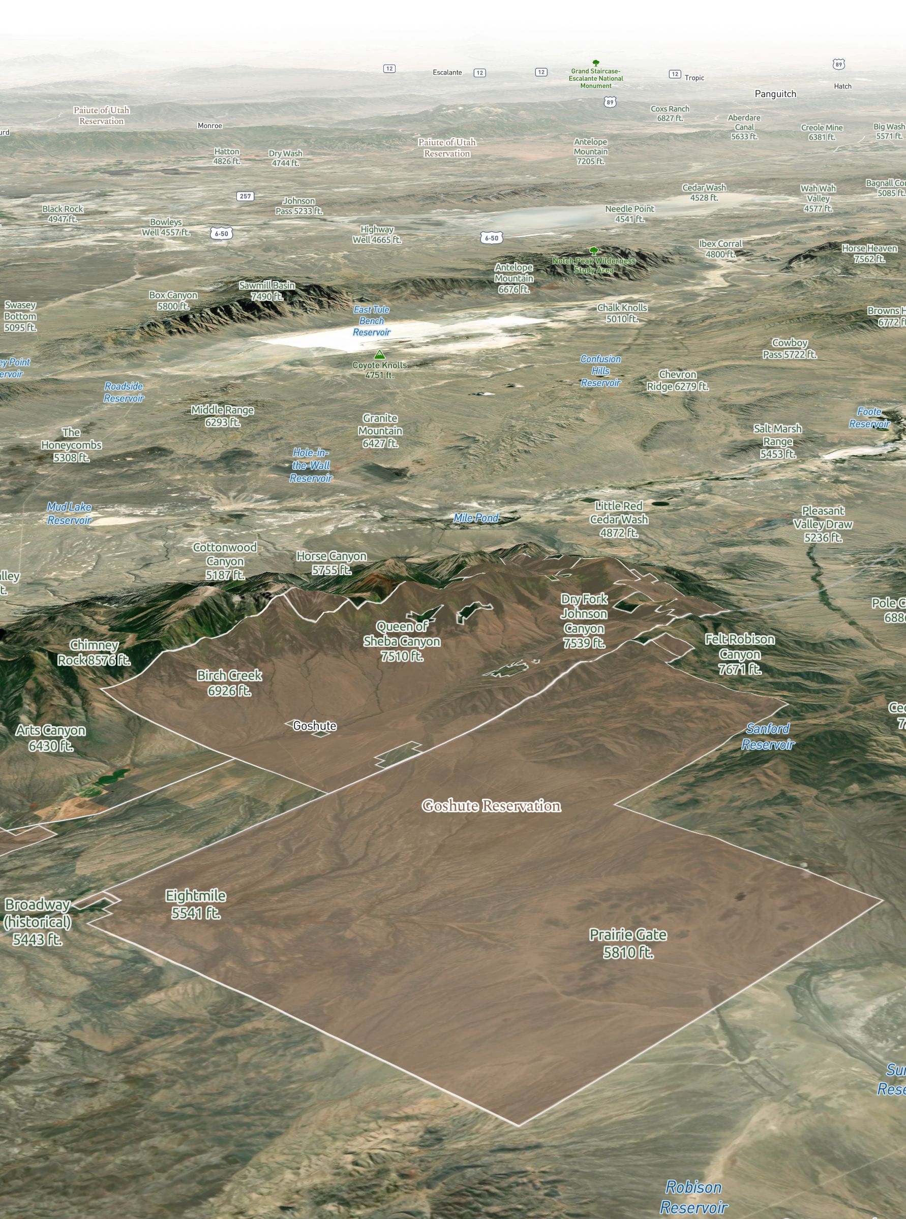
Goshute Indians
Explanation:
Their native word Kutsipiuti (Gutsipiuti) means “desert people”, or people of the dry earth. They were extremely productive and proficient in sustaining themselves in such an arid and deficient environment.
Affirmation of focusing your shed hunt in the West Desert region of the state.
Before you get heated, search for that which is usually depleted. Your spirits will be lifted when you notice earth dug and sifted.
Answer
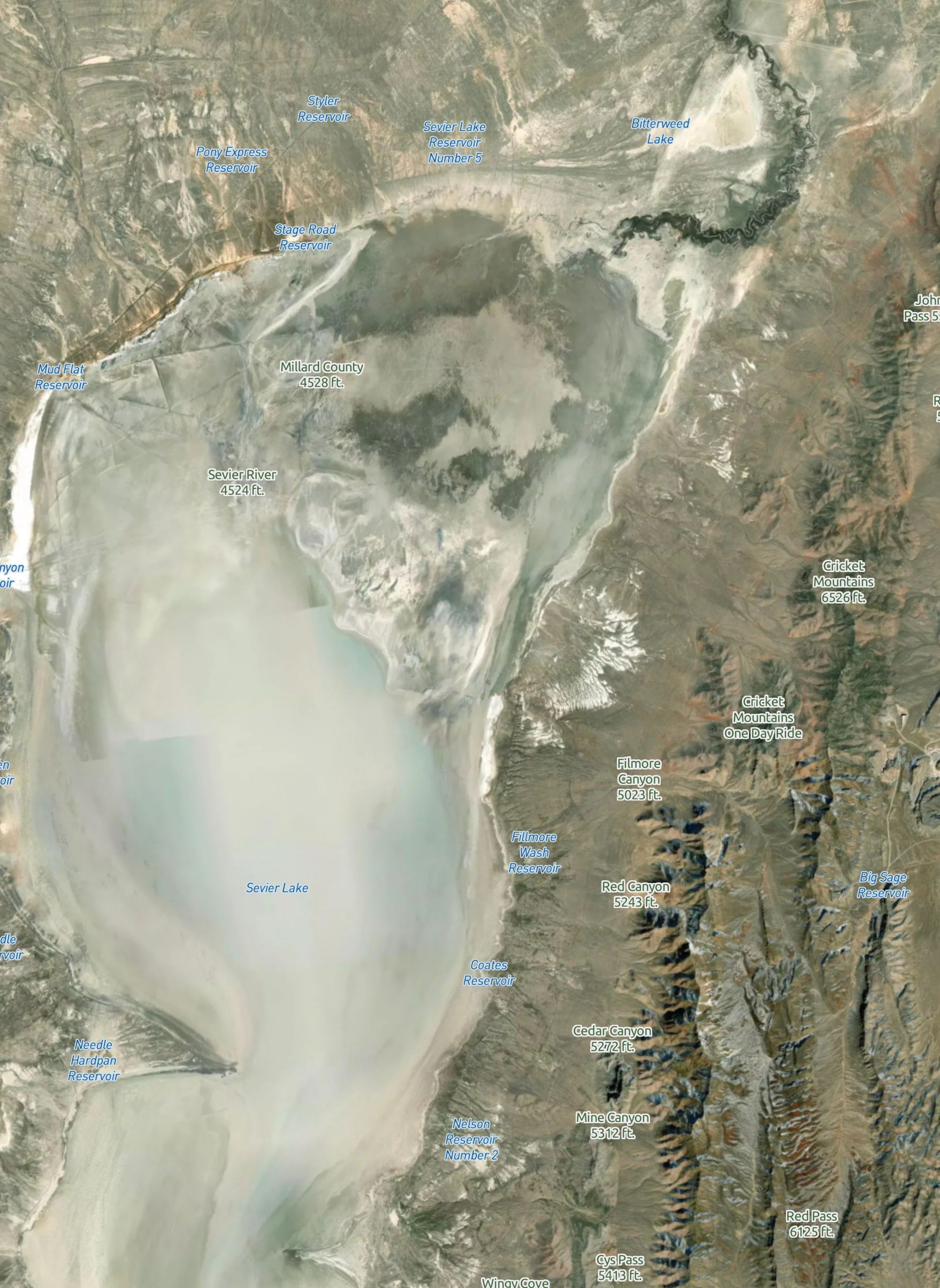
Sevier Lake and Graymont limestone plant
Explanation:
Sevier Lake is usually a dry lake bed (Great Basin, desert conditions). The Graymont plant and surrounding quarries provide additional insight as to which side of the lake to focus on.
There is a particular highway you must take. Brake and seek to elevate where you hear them approximate the degree they articulate.
Answer
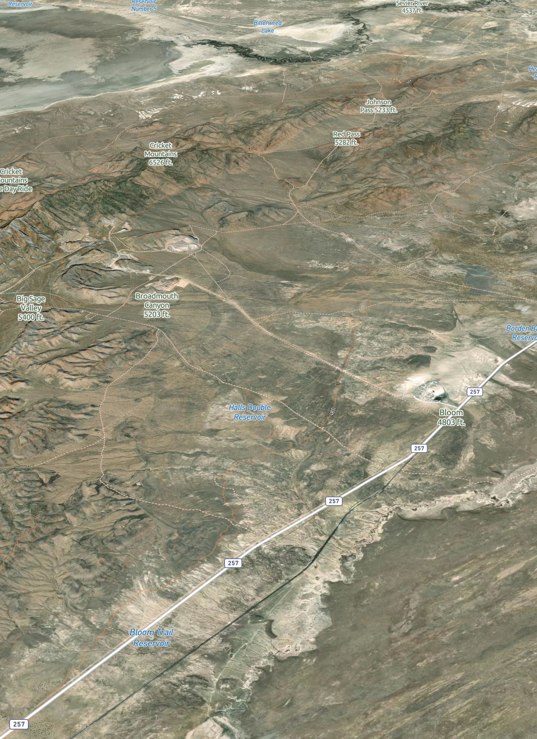
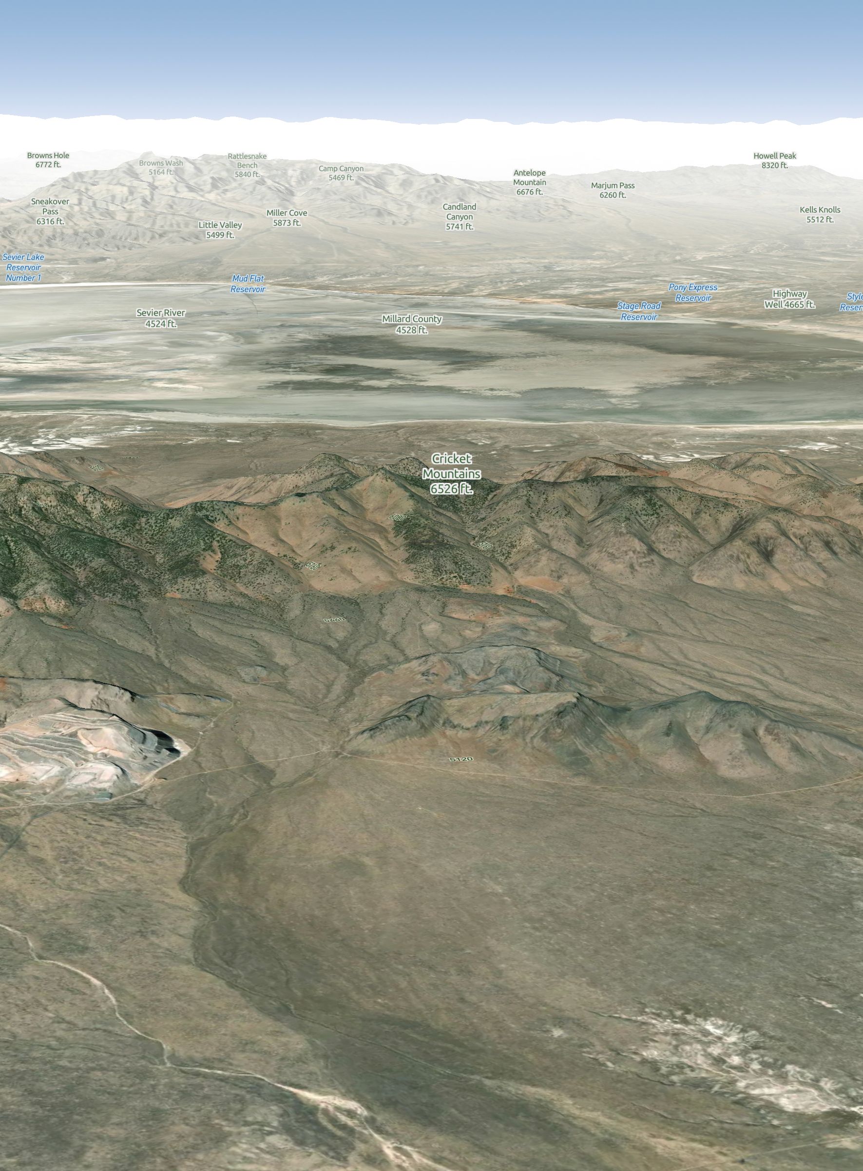
State highway 257 and Cricket Mountains
Explanation:
Highway 257 passes by the Cricket Mountains coming from the Delta area.
According to Dolbear's Law, it is understood that one can estimate the current air temperature given the rate of a cricket's chirpping. This identifies where to get off from highway 257 and head for the Cricket Mountains.
You should now be facing the remnants of this descendant, but it you cannot see until the ascendance of the range in front of thee.
Answer
Sevier Lake and Cricket Mountains
Explanation:
Sevier Lake in its remnant state as a body of water is a decendant of Lake Bonneville. Coming from the east side of the Cricket Mountains you would need to cross over the range to see Sevier Lake.
This provides additional direction as to which side of the Highway 257 you should turn to.
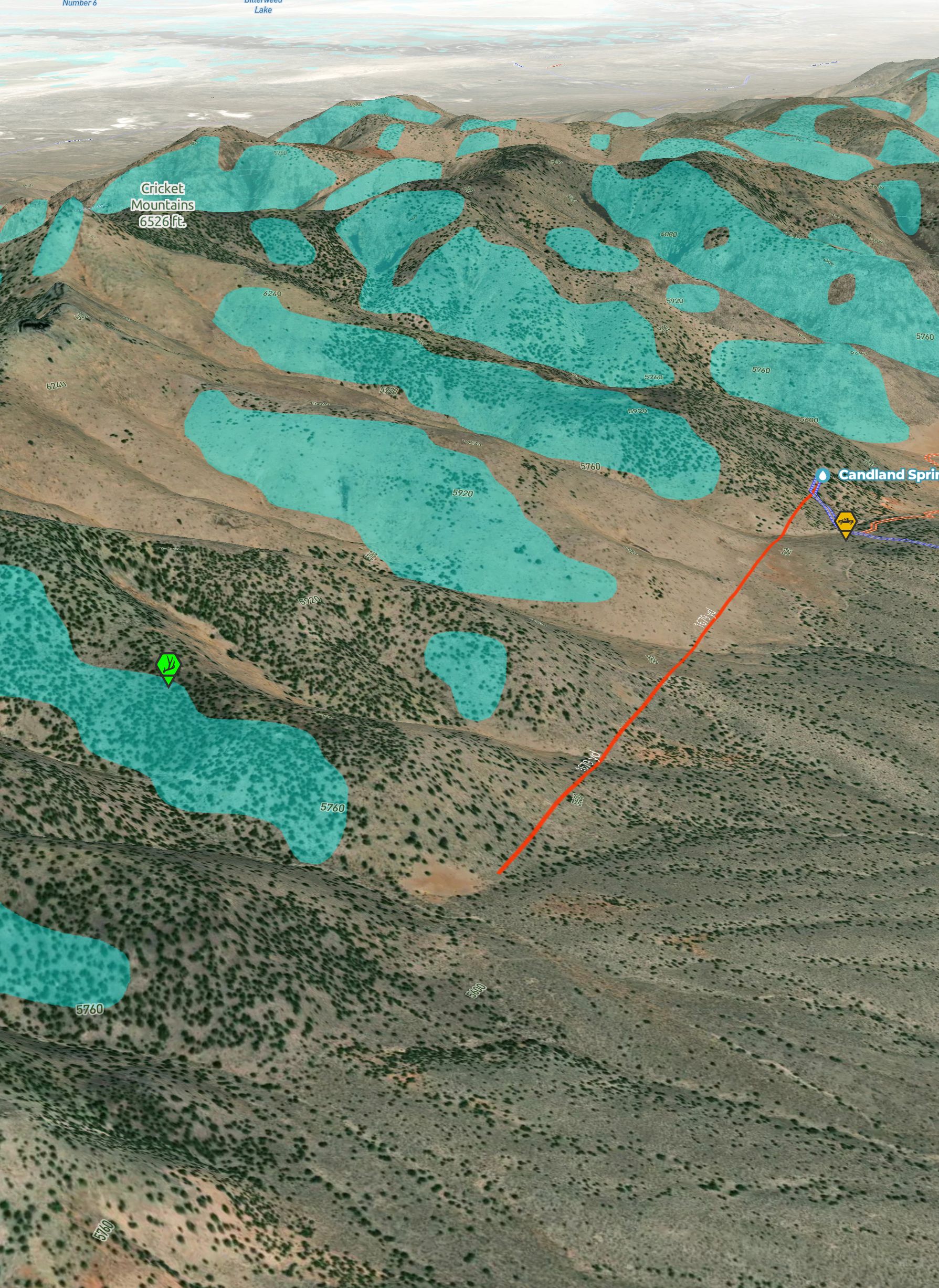
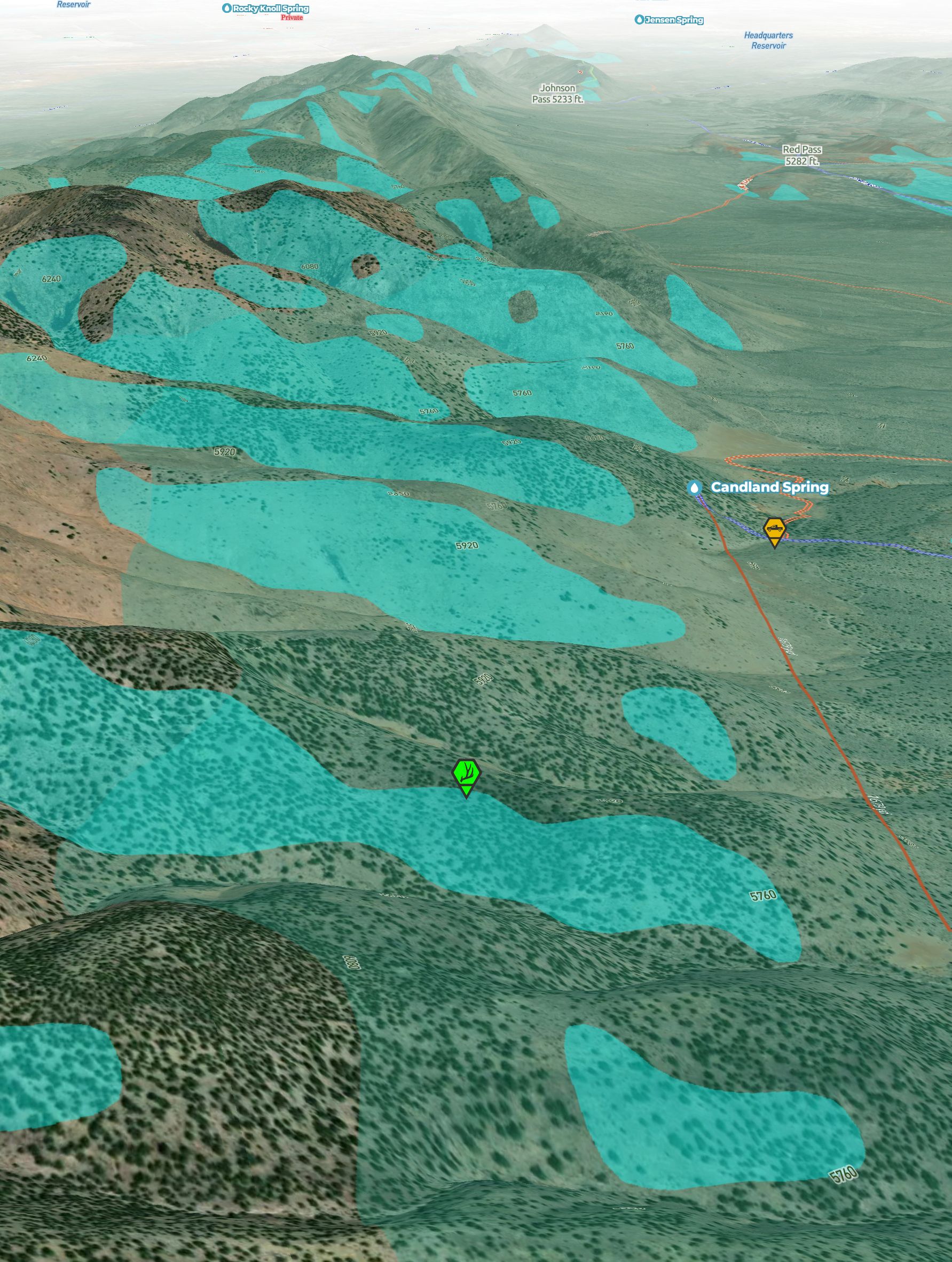
There are various roads to follow. Stay more to the north, where you'll find the correct course. Two lead to a distinct spring, but one will have you dealing with lawyers and things. The better one has the name posted and noted from the start of your off-road venturing. Follow these signs, no deterring. When you pass a decaying corral, you'll know it's almost time to start hiking.
Answer
Candland Spring
Explanation:
The north route of the two roads leads to the spring without crossing into private land.
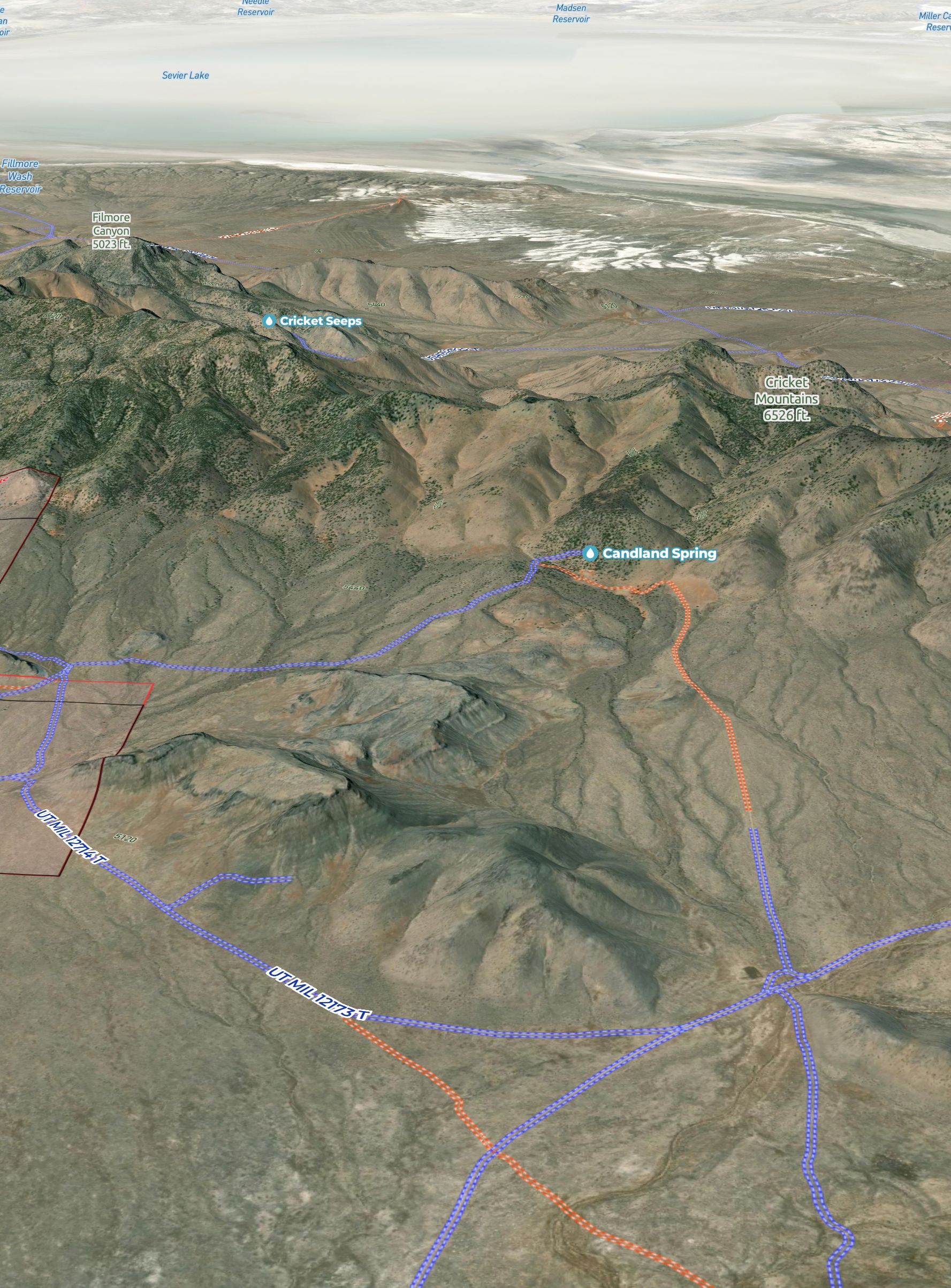
Park near the spring and begin to sing! But, if you don't have a truck, it may be wise to not test your luck on this last length, it may cost you a buck.
Answer
The last stretch of the road to Candland Spring is a bit rough (Orange/Rugged on the UnPaved™ off-roads layer).
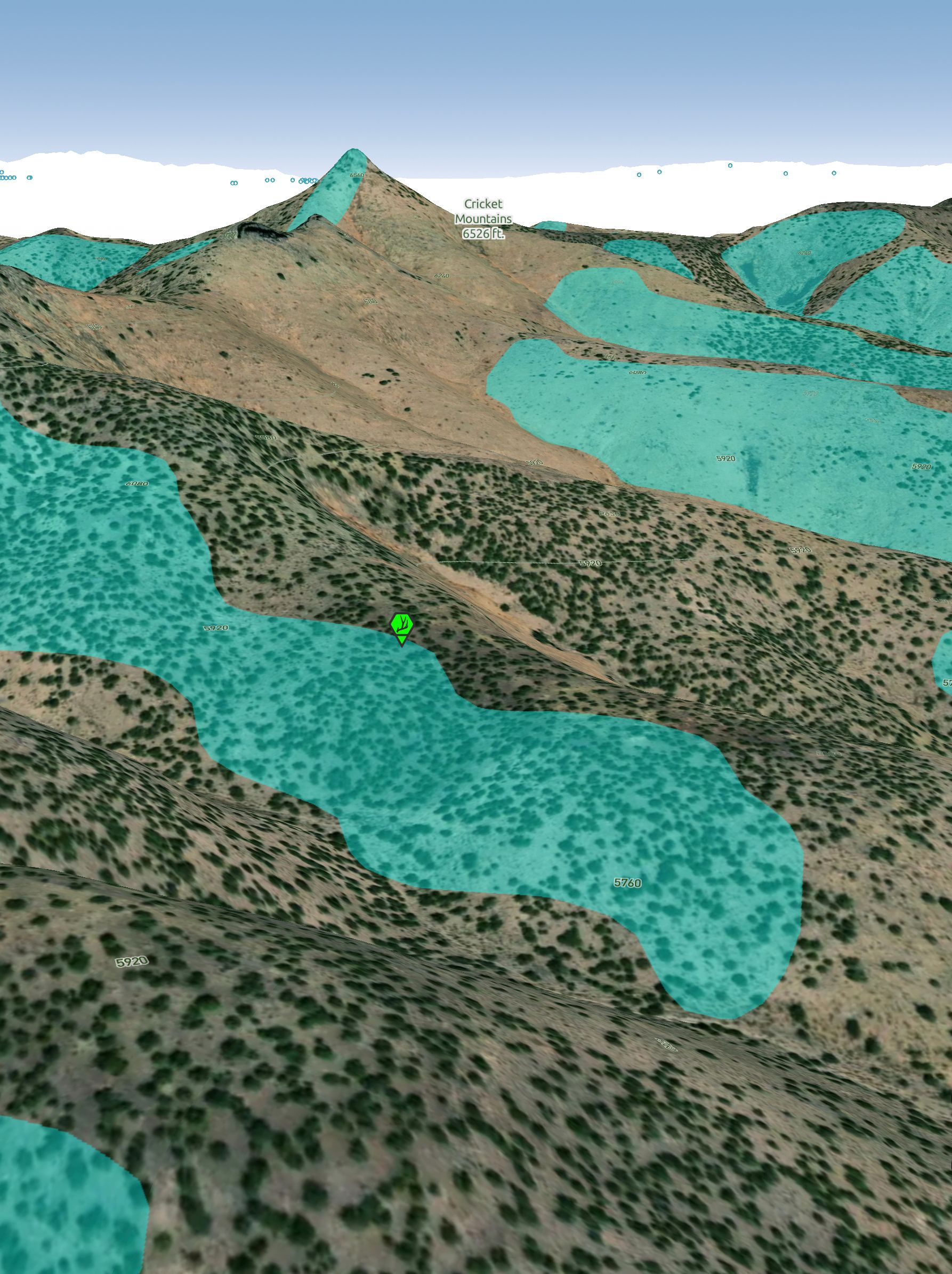
Work your way south. Bring water for your mouth. Go about a mile, out to your left you can spot a pit and a pile. But to smile, you'll need to cover the face that shed hunters embrace.
Answer
South Slopes
Explanation:
Heading south from Candland Spring by foot there are various south slopes to beging gridding for sheds on the right. To the left, in the distance there is an additional lime quarry to affirm your approximation to the Hidden Shed.
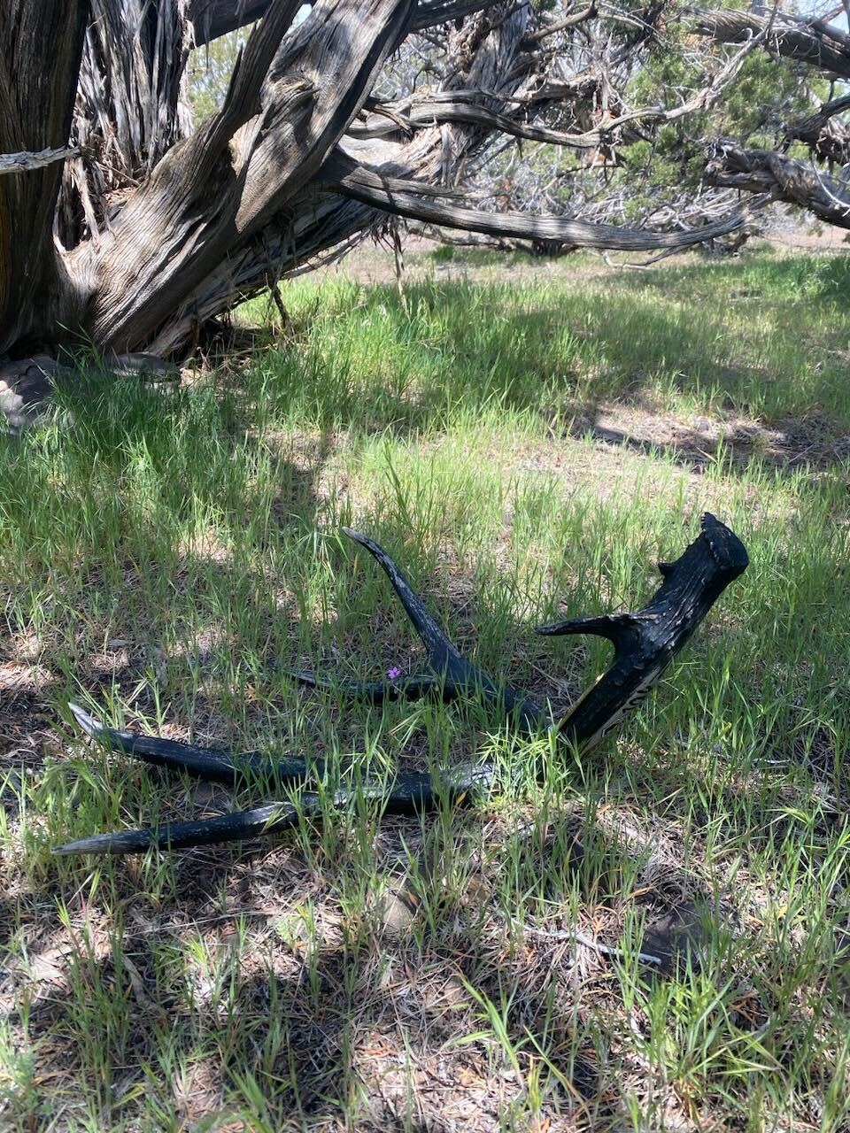
Under a canopy of pinyons, you'll find a shaded mule deer shed that will start your engines.
The question ahead, where is the next Hidden Shed(s)?